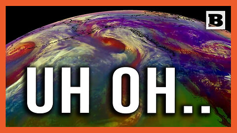
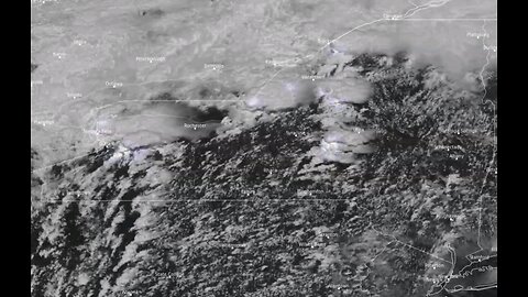
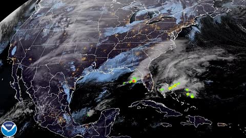
3 months agoUh Oh... Satellite Imagery Shows 3 Cyclones Heading Towards Western U.S.BreitbartVerified
1 month agoPentagon Pressed On Satellite Imagery Showing Four 'Likely' Chinese Listening Posts In CubaForbes Breaking News
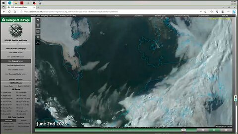
1 year agoQuebec, Canada Fires | Why Does June 2nd 2023 Satellite Imagery from College of DuPage Meteorology Department Show Dozens of Fires in Quebec Starting Up at Almost the Exact Same Time?Thrivetime Show: The ReAwakening versus The Great ResetVerified
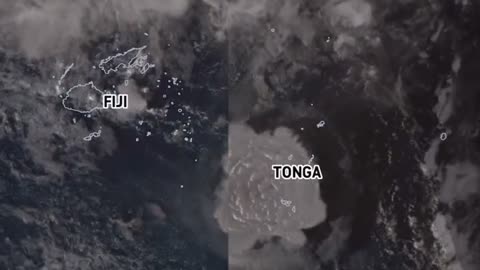
2 years agoSatellite imagery shows shockwave as Tonga's Hunga volcano erupts, causing tsunamiEarth Wind and FireVerified
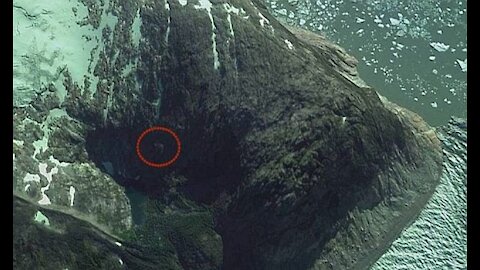
3 years agoNephilim Giant caught on satellite imagery of the Patagonian MountainsUfomania - the truth is out there
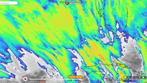
1 month agoIncredible satellite imagery showing an army of tornadic supercells moving across western New YorkGreatwhitelion21
3 months agoSatellite Imagery Exposes Potential Russian Nuclear Storage Site in BelarusFrom the Desk of Gav
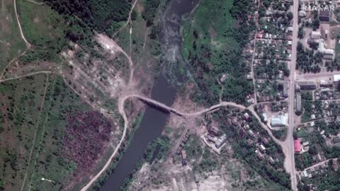
1 year agoSatellite imagery reveals damage by Sudanese military factions at airports and government buildingsJTN2020Verified
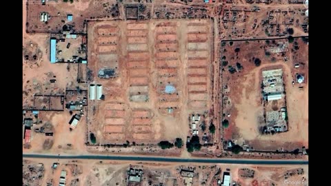
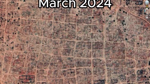
3 months agoSudan Civil War | Before & After - New Satellite Imagery Reveals Level Destruction Of DarfurGlobalDispatch
2 years agoLost American Viking Settlement Discovered By Space Archaeologists Using Satellite ImagerySeeker Land
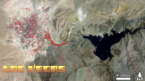
10 months agoLas Vegas & Lake Mead 1972-2021 Satellite Timelapse NASA Imagery #lasvegas #lakemead #water #droughtMOJO ADVENTURES
2 months agoZOG using satellite imagery to pinpoint target family farms in Oregon and shut them downStantonLives