Satellite imagery shows extent of flooding in regional Victoria
2 years ago
4.06K
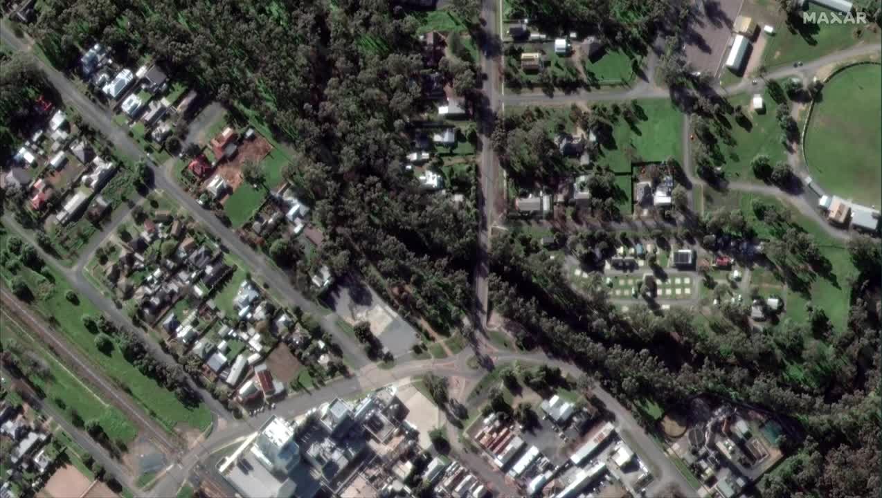
Satellite imagery shows the extent of flooding in the Australian town of Rochester, after heavy rain caused floods across the state of Victoria. This footage sent to Storyful by Maxar Technologies shows before and after images of the floods in Rochester, taken on October 15 and 16. Credit: Maxar Technologies via Storyful. BE ON IT with the latest news and lifestyle videos: www.news.com.au bit.ly/3pGT90C
Loading comments...
-
 1:50:34
Steven Crowder
3 hours ago🔴 Texas Gerrymanders for Trump & Dems Freak: Racism or Good Politics?
217K169 -
 LIVE
LIVE
Flyover Conservatives
11 hours agoTwo Stories Shaking the Internet—Sydney Sweeney’s “Offensive” Ad & Forrest Frank’s Miraculous Healing | FOC Show
411 watching -
 LIVE
LIVE
The Mel K Show
1 hour agoMORNINGS WITH MEL K -Killing Operation Mockingbird: The Truth Has No Agenda 8-4-25
1,607 watching -
 1:06:13
The Rubin Report
2 hours agoDave Tries Controversial New Medical Tech — Was It a Miracle or a Bust?
15.4K19 -
 LIVE
LIVE
The Shannon Joy Show
3 hours ago🔥🔥Trump Deploys Nuclear Submarines, JD Vance Promises To Investigate The Aliens & The Epstein Re-Brand Begins🔥🔥
287 watching -
 LIVE
LIVE
LFA TV
14 hours agoLFA TV ALL DAY STREAM - MONDAY 8/4/25
4,257 watching -
 1:00:15
VINCE
4 hours agoThe Obama Connection No One Is Talking About | Episode 95 - 08/04/25
181K237 -
 1:31:29
Caleb Hammer
19 hours agoThe Most Hated Woman In Financial Audit History
18.9K1 -
 1:09:39
The Big Mig™
5 hours agoCharlamagne Tha Crap, “A Racist Sleazbag”
12.4K11 -
 1:45:17
Dear America
4 hours agoDear GOP, Do Your Job or GET OUT!! + Trump Calls Out Chuck Schumer For DEMANDING $1 BILLION!!
144K114