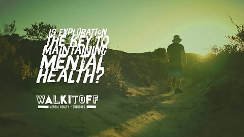
Is exploration the key to maintaining mental health?
#mentalhealth #wellbeing #exploration
Nathan riffs on the idea of exploration as a mechanism for maintaining mental health and wellbeing.
1
view

Hiking the Royston Head Trail
#hiking #mentalhealth #australia
• You’ll find Royston Head in Innes National Park, work Peninsulla, which is a hefty 309km, 4 hours drive away from the Adelaide City Centre.
• Trail Head offers has a small off-road car park which can accommodate about 5 cars.
• The trail surface is quite rocky with a section of soft sand as you get closer to the coast.
• The track will take you along the top of some large cliffs with no barrier.
4.67km (round trip)
Elevation: 12m - 51m
Incline: MAX: 16.7% AVG: 3.8%
Innes National Park, South Australia.
Map Link: https://bit.ly/3v1Tiwx
walkitoff.com.au
facebook.com/walkitoffmentalhealthoutdoors
instagram.com/walkitoffmentalhealthoutdoors
nathan.walkitoff@gmail.com
also, check out:
imageiseverything.net.au
Map Sequence Satellite Data
© Copyright 2020 Microsoft Corporation / © 2020 Maxar / © CNES (2020) Distribution Air
Music
1. Nothing Left Behind - Zac Nelson (Intro)
2. Of Good Fortunes - Glories
3. Pademnesia - Wonderland (Outro)
3
views

Mount Lofty Botanic Gardens Hike
#hiking #mentalhealth #australia
• About 30 minute drive southeast of Adelaide CBD.
• Trail Head offers a large Off road car park which is just around the corner from Mount Lofty House Estate.
• The track is going to cover ground ranging from sealed road to tight rocky tracks with some mild obstacles like large steps .
• The botanic gardens does close at 5 pm most days so night hikes are out of the question.
2.82km (round trip)
Elevation: 529m - 636m
Incline: MAX: 53% AVG: 12.5%
Crafers, South Australia.
Map Link: https://bit.ly/3mvsC4a
1
view

When is it ok not to care?
#readthis #mentalhealth #wharareyoureading
Nathan reviews mental health and self-development books and materials.
This review covers Nathan's thoughts on Mark Mansons - The Subtle art of not giving a f*@k...
Discuss in the comments below!
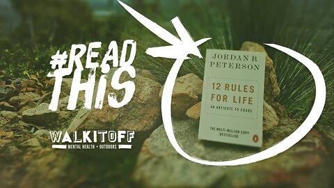
What rules do you live by?
#mentalhealth #readthis #whatareyoureading
Nathan reviews mental health and self development books and materials.
This review covers Nathan's thought on Jordan Peterson's 12 Rules for Life.
Discuss in the comments below!
1
view
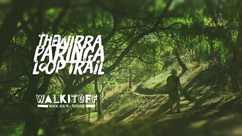
The Wirraparinga Loop Trail
#hiking #mentalhealth #australia
• Is a short 15 minutes drive Southeast of the Adelaide CBD.
• Trailhead is on Brownhill Creek rd.
• There is plenty of roadside parking just before you get to the caravan park.
• The trail's surface is easy and accessible, except, for a small section next to the creek, where there are some large steep steps.
5.13km (round trip)
Elevation: 108m - 166m
Incline: MAX: 23.2% AVG: 4.4%
Kaiserstuhl, South Australia.
Map Link: http://bit.ly/2P35r4D
walkitoff.com.au
facebook.com/walkitoffmentalhealthoutdoors
instagram.com/walkitoffmentalhealthoutdoors
nathan.walkitoff@gmail.com
Also, check out Nath's graphic design and media company:
www.imageiseverything.net.au
Map Sequence Satellite Data
© Copyright 2020 Microsoft Corporation / © 2020 Maxar / © CNES (2020) Distribution Airbus DS
Music
1. Nothing Left Behind - Zac Nelson (Intro)
2. Of Good Fortunes - Glories
3. Pademnesia - Wonderland (Outro)
6
views

Stringybark Trail - Hiking Map - Australian Hikes
#shorts #hiking #australia
• About 1 Hour and 15 minutes drive north east of Adelaide just outside of Tanunda.
• Trailhead is on Tanunda Creek rd.
• There is no offload carpark or facilities of any kind. There however a couple of roadside spots available but be careful as this road is fairly busy with large trucks.
• The trails is easy and accessible, its surface is wide save for a couple of small bottlenecks caused by fallen trees.
2.77km (round trip)
Elevation: 492m - 518m
Incline: MAX: 15.1% AVG: 3.7%
Kaiserstuhl, South Australia.
Map Link: bit.ly/3cdms3F
2
views
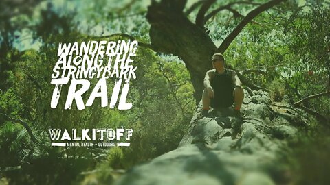
Wandering around the Stringybark Trail
#hiking #mentalhealth #australia
• About 1 Hour and 15 minutes drive northeast of Adelaide just outside of Tanunda.
• Trailhead is on Tanunda Creek rd.
• There is no offload car park or facilities of any kind. There however a couple of roadside spots available but be careful as this road is fairly busy with large trucks.
• The trail is easy and accessible. The track surface is wide, save for a couple of small bottlenecks caused by fallen trees.
2.77km (round trip)
Elevation: 492m - 518m
Incline: MAX: 15.1% AVG: 3.7%
Kaiserstuhl, South Australia.
Map Link: bit.ly/3cdms3F
3
views
Glenthorne National Park - Hiking Highlights II - Australian Hikes
#shorts #hiking #australia
• About half hours minute drive south of Adelaide CBD, in O'Halloran Hill.
• Trail Head is found on Majors rd, where there is plenty of room to park the car in the large off-road car park.
• The track is going to be wide and flat with some minor little hills near the halfway point.
• There is practically no shade at all on this walk so remember your sunscreen.
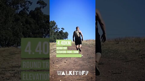
4.40km (round trip)
Elevation: 140m - 188m
Incline: MAX: 14% AVG: 3.8%
O'Halloran Hill, South Australia.
Map Link: bit.ly/3elfDQD
Glenthorne National Park - Hiking Highlights - Australian Hikes
#shorts #hiking #australia
• About half hours minute drive south of Adelaide CBD, in O'Halloran Hill.
• Trail Head is found on Majors rd, where there is plenty of room to park the car in the large off road car park.
• The track is going to be wide and flat with some minor little hills near the halfway point.
• There is practically no shade at all on this walk so remember your sunscreen.
4.40km (round trip)
Elevation: 140m - 188m
Incline: MAX: 14% AVG: 3.8%
O'Halloran Hill, South Australia.
Map Link: bit.ly/3elfDQD
2
views
Glenthorne National Park - Hiking Map - Australian Hikes
#shorts #hiking #australia
•About half hours minute drive south of Adelaide CBD, in O'Halloran Hill.
•Trail Head is found on Majors rd, where there is plenty of room to park the car in the large off-road car park.
•The track is going to be wide and flat with some minor little hills near the halfway point.
•There is practically no shade at all on this walk so remember your sunscreen.
4.40km (round trip)
Elevation: 140m - 188m
Incline: MAX: 14% AVG: 3.8%
O'Halloran Hill, South Australia.
Map Link: bit.ly/3elfDQD
1
view
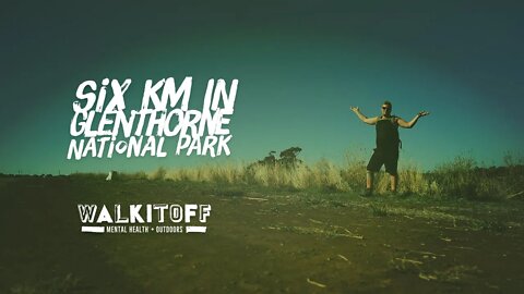
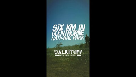
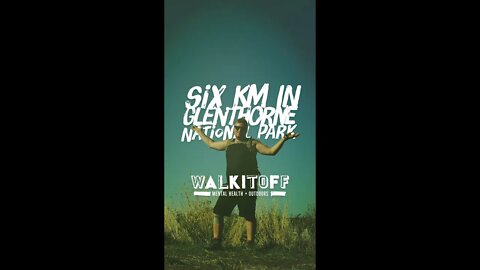
Six Kilometers in Glenthorne National Park
#hiking #mentalhealth #australia
•About half hours minute drive south of Adelaide CBD, in O'Halloran Hill.
•Trail Head is found on Majors rd, where there is plenty of room to park the car in the large off-road car park.
•The track is going to be wide and flat with some minor little hills near the halfway point.
•There is practically no shade at all on this walk so remember your sunscreen.
4.40km (round trip)
Elevation: 140m - 188m
Incline: MAX: 14% AVG: 3.8%
O'Halloran Hill, South Australia.
Map Link: bit.ly/3elfDQD
walkitoff.com.au
facebook.com/walkitoffmentalhealthoutdoors
instagram.com/walkitoffmentalhealthoutdoors
nathan.walkitoff@gmail.com
also check out:
imageiseverything.net.au
Map Sequence Satellite Data
© Copyright 2020 Microsoft Corporation / © 2020 Maxar / © CNES (2020) Distribution Airbus DS
Music
1. Leaving - Silent Partner (Intro)
2. Somnia I - Reed Mathis
3. Somnia II - Reed Mathis
4. Somnia III - Reed Mathis
4. Role Player - Au.Ra (Outro)
"There is now little question that
how one uses one’s attention,
moment to moment largely determines
what kind of person one becomes.
Our minds—and lives—are largely
shaped by how we use them."
-Sam Harris, Waking Up
Seven Hills - Hiking Highlights - Australian Hikes
#shorts #hiking #brisbane
2km (round trip)
Elevation: 21m - 72m
Incline: MAX: 42.2% AVG: 9.2%
Seven Hills, Queensland
Map Link: http://bit.ly/3dUbfrk
Seven Hills - Hiking Map - Australian Hikes
#shorts #brisbanehiker #hiking
2km (round trip)
Elevation: 21m - 72m
Incline: MAX: 42.2% AVG: 9.2%
Seven Hills, Queensland
Map Link: http://bit.ly/3dUbfrk
1
view
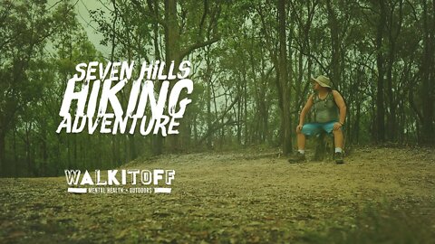
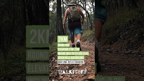
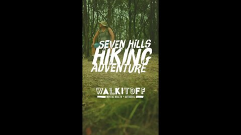
Seven Hills Hiking Adventure
#Hiking #Queensland #brisbanehiker
• you'll find the Seven Hills Bushland reserve about 20 minutes drive east of Brisbane CBD.
• Trail Head is found on Brussels Ave. There is no dedicated car park at this trailhead but there is plenty of places to park along the street.
• The trail is a wide fire-track style surface through mildly dense scrubland.
• Trail is short and very accessible.
2km (round trip)
Elevation: 21m - 72m
Incline: MAX: 42.2% AVG: 9.2%
Seven Hills, Queensland
Map Link: http://bit.ly/3dUbfrk
Slow down forget about the time
Come into the present moment Find a spot to sit
– on the grass, beside a tree or on a park bench
Notice what you can hear and see Notice what you feel"
- Qing Li, Shinrin Yoku
walkitoff.com.au
facebook.com/walkitoffmentalhealthoutdoors
instagram.com/walkitoffmentalhealthoutdoors
nathan.walkitoff@gmail.com
also, check out Nathan's Graphic Design and artwork at:
imageiseverything.net.au
Map Sequence Satellite Data
© Copyright 2020 Microsoft Corporation / © 2020 Maxar / © CNES (2020) Distribution Airbus DS
Music
1. Leaving - Silent Partner (Intro)
2. Somnia I - Reed Mathis
3. Somnia II - Reed Mathis
4. Somnia III - Reed Mathis
4. Role Player - Au.Ra (Outro)
2
views

Powerful Owl Trail, Mount Coot-Tha - Hiking Map - Australia
#shorts #hiking #australia
4.75km (round trip)
Elevation: 65m - 230m
Incline: MAX: 38.8% AVG: 10.4%
Chapel Hill, Queensland
Map Link: http://bit.ly/2OklKto
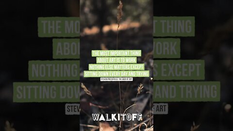
Nothing else matters except sitting down every day and trying
#shorts #mentalhealth #motivation
“The most important thing about art is to work. Nothing else matters except sitting down every day and trying.”
― Steven Pressfield, The War of Art
2
views
Honeyeater Trail - Highlights
#shorts #hiking #australia
3.1km (round trip)
Elevation: 201m - 248m
Incline: MAX: 24.6% AVG: 5.8%
Altona, South Australia.
Map Link: bit.ly/3aFBu2W
1
view

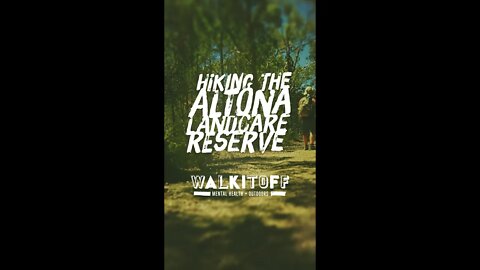
Hiking the Altona Landcare Reserve
#hiking #mentalhealth #australia
• You'll find the Altona Landcare Reserve a short drive north of Lyndoch South Australia. Which is about an hour's drive North of the Adelaide Central Business District.
• The surface is a wide fire track for the most part with some small sections where the foliage is denser.
• The trailhead has a small space to park next to the gate which can accommodate a couple of cars.
3.1km (round trip)
Elevation: 201m - 248m
Incline: MAX: 24.6% AVG: 5.8%
Altona, South Australia.
Map Link: bit.ly/3aFBu2W
walkitoff.com.au
facebook.com/walkitoffmentalhealthoutdoors
instagram.com/walkitoffmentalhealthoutdoors
nathan.walkitoff@gmail.com
also check out:
imageiseverything.net.au
Map Sequence Satellite Data
© Copyright 2020 Microsoft Corporation / © 2020 Maxar / © CNES (2020) Distribution Airbus DS
Music
1. Leaving - Silent Partner (Intro)
2. Somnia I - Reed Mathis
3. Somnia II - Reed Mathis
4. Somnia III - Reed Mathis
4. Role Player - Au.Ra (Outro)
3
views

Honeyeater Trail - Hiking Map - Australian Hikes
#shorts #hiking #australia
3.1km (round trip)
Elevation: 201m - 248m
Incline: MAX: 24.6% AVG: 5.8%
Altona, South Australia.
Map Link: bit.ly/3aFBu2W
1
view

Exploring Mount Coot-Tha
#hiking #australia #queensland #brisbanehiker
• About 20-minute drive west of Brisbane CBD Nestled in between Chapel Hill and Toowong.
• Trail Head is found on Sir Samuel Griffith Drv where you'll find plenty of car parking through a few carports off of the side of the rd.
• The track wind through some lush forest with a tight trail and open up along the ridge at the top of the hill.
• Several great views including the Simpson Falls.
4.75km (round trip)
Elevation: 65m - 230m
Incline: MAX: 38.8% AVG: 10.4%
Chapel Hill, Queensland
Map Link: http://bit.ly/2OklKto
"You can’t build
a better mind
without challenging
your own beliefs
and assumptions."
-Mark Manson
walkitoff.com.au
facebook.com/walkitoffmentalhealthoutdoors
instagram.com/walkitoffmentalhealthoutdoors
nathan.walkitoff@gmail.com
Also, check out:
imageiseverything.net.au
Map Sequence Satellite Data
© Copyright 2020 Microsoft Corporation / © 2020 Maxar / © CNES (2020) Distribution Airbus DS
Music
1. Leaving - Silent Partner (Intro)
2. Somnia I - Reed Mathis
3. Somnia II - Reed Mathis
4. Somnia III - Reed Mathis
4. Role Player - Au.Ra (Outro)
1
view

Walking the Mike Green Trail
#hiking #mentalhealth #australia
• 30 minute drive from CBD
• Trailhead across rd from The Stables Shopping Center
• Track is oneway so you'll either need to have pick or turn around
• Track is loose gravel and wide
3.16km (one way)
Elevation: 125m - 185m
Incline: MAX: 27.3% AVG: 4.1%
Golden Grove, South Australia.
Map Link: bit.ly/2YBiI5S
walkitoff.com.au
facebook.com/walkitoffmentalhealthoutdoors
instagram.com/walkitoffmentalhealthoutdoors
nathan.walkitoff@gmail.com
^also check out:
^|[imageiseverything.net.au]
Map Sequence Satellite Data
© Copyright 2020 Microsoft Corporation / © 2020 Maxar / © CNES (2020) Distribution Airbus DS
Music
1. Leaving - Silent Partner (Intro)
2. Somnia I - Reed Mathis
3. Somnia II - Reed Mathis
4. Somnia III - Reed Mathis
4. Role Player - Au.Ra (Outro)
2
views

Hiking the Bursaria Trail at Ansteys Hill
#hiking #mentalhealth #australia
• You'll find Ansteys Hill about a half hour's drive North East of the Adelaide CDB
• Trail Head is found on Range rd south and it has a decent size offload road park for those in groups.
• The track is quite rough and rocky at the start and then opens up into wide fire tracks past the 2km mark.
• Trails cross over a few downhill bike trails so be mindful of other people and bikes on the trail.
• Track features a lot of great views and ruins to explore.
4.08km (round trip)
Elevation: 313m - 426m
Incline: MAX: 30.6% AVG: 7.5%
Vista, South Australia.
Map Link: http://bit.ly/2NJTPCQ
"we must let go of the life we have planned,
so as to accept the one that is waiting for us"
Joseph Campbell
walkitoff.com.au
facebook.com/walkitoffmentalhealthoutdoors
instagram.com/walkitoffmentalhealthoutdoors
nathan.walkitoff@gmail.com
also check out:
imageiseverything.net.au
Map Sequence Satellite Data
© Copyright 2020 Microsoft Crporation / © 2020 Maxar / © CNES (2020) Distribution Airbus DS
Music
1. Leaving - Silent Partner (Intro/Map)
2. Somnia I - Reed Mathis
3. Somnia II - Reed Mathis
4. Somnia III - Reed Mathis
4. Role Player - Au.Ra (Outro)
2
views
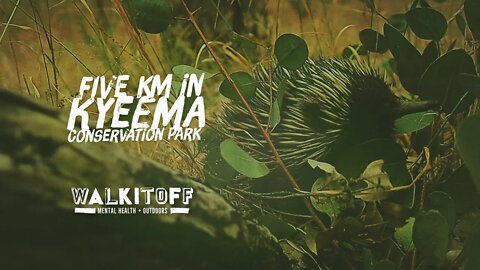
5 Kilometers in Kyeema Conservation Park
• Just over 60kms south of Adelaide CBD. Takes about an hour if you drive through Hanhdoff
• Trail Head is found on Woodgate Hill Rd and it has a decent size offload road park for those in groups.
• The track winds around some tight bush trail then opens up to a wide fire trail.
• After the half way point the track goes through a dense fern filled gully before looping around on itself as it heads back to the trail head.
5.85km (round trip)
Elevation: 309m - 382m
Incline: MAX: 54.8% AVG: 5.1%
Kyeema, South Australia.
Map Link: bit.ly/391mDPd
"maturity is the ability to put values before feelings" - Mark Manson
walkitoff.com.au
facebook.com/walkitoffmentalhealthoutdoors
instagram.com/walkitoffmentalhealthoutdoors
nathan.walkitoff@gmail.com
also check out Nathan's Graphic Design work at:
imageiseverything.net.au
Map Sequence Satellite Data
© Copyright 2020 Microsoft Corporation / © 2020 Maxar / © CNES (2020) Distribution Airbus DS
3
views
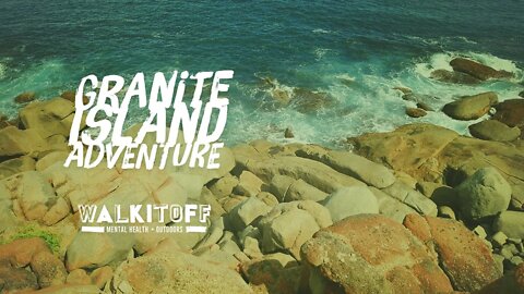
Granite Island Adventure
#hiking #mentalhealth #australia
Join Nathan as he wanders around Granite Island, Victor Harbour and chats briefly about the idea of "information diet" and "social media feedback-loops".
• Just over 1 hours drive south of Adelaide CBD.
• Trail Head is found at the start of the causeway.
• The track can start here or you can use the horse-drawn tram to get across the causeway.
• The island is a penguin habitat so be careful if you explore the rocks at the edge of the water on the northern side of the island.
3.37km (round trip)
Elevation: 2m - 27m
Incline: MAX: 19.6% AVG: 4.7%
Victor Harbour, South Australia.
Map Link: bit.ly/39zG9Sc
"routine, done for long enough and done sincerely enough, becomes more than routine. it becomes ritual—it becomes sanctified and holy."
-Ryan Holiday, Stillness is the Key.
3
views