1 year agoBREAKING! PROOF CHINA SATELLITES OVER MAUI AT FIRE STARTS! | The Prather Brief Ep. 92PATRIOT.TVVerified
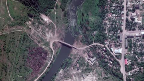
1 month agoUkraine's Kursk Collapse & Washington's Rush to Freeze Conflict Under "Minsk 3"The New Atlas
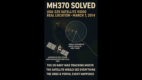
1 day agoMH370 Solved — Full Synthesis: Satellite Surveillance, ARGUS-IR & Frequency Wave TheoryFrequency Wave Theory
12 days agoTHE AMERICAN JOURNAL [1 of 3] Friday 4/18/25 • DAILY DISPATCH - News, Reports & Analysis • InfowarsRon Gibson Channel - Infowars PartnerVerified
12 days agoTHE AMERICAN JOURNAL [FULL] Friday 4/18/25 • One Step Closer To Hot War With China!Ron Gibson Channel - Infowars PartnerVerified
12 days agoTHE AMERICAN JOURNAL [2 of 3] Friday 4/18/25 • News, Calls, Reports & Analysis • InfowarsRon Gibson Channel - Infowars PartnerVerified
12 days agoTHE AMERICAN JOURNAL [3 of 3] Friday 4/18/25 • PRESTON BATES - TOMMY ROBINSON UPDATE, News, AnalysisRon Gibson Channel - Infowars PartnerVerified
5 months agoAmerican Voters: Did you know Democrats have been using satellite imagery to raid American Farms?Question EverythingVerified
1 year agoQuebec, Canada Fires | Why Does June 2nd 2023 Satellite Imagery from College of DuPage Meteorology Department Show Dozens of Fires in Quebec Starting Up at Almost the Exact Same Time?Thrivetime Show: The ReAwakening versus The Great ResetVerified
11 days agoThe Philippines and Massive Stores of Gold for all the People of the World w/ Joseph AllainSarah WestallVerified
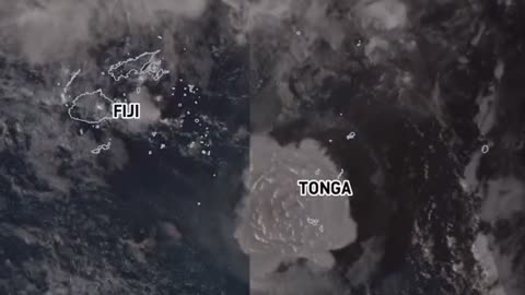
3 years agoSatellite imagery shows shockwave as Tonga's Hunga volcano erupts, causing tsunamiEarth Wind and FireVerified
4 years agoNephilim Giant caught on satellite imagery of the Patagonian MountainsUfomania - the truth is out there
2 years agoSatellite imagery reveals damage by Sudanese military factions at airports and government buildingsJTN2020Verified


![THE AMERICAN JOURNAL [1 of 3] Friday 4/18/25 • DAILY DISPATCH - News, Reports & Analysis • Infowars](https://1a-1791.com/video/fww1/8e/s8/1/n/L/b/D/nLbDy.oq1b.2-small-THE-AMERICAN-JOURNAL-1-of-3.jpg)
![THE AMERICAN JOURNAL [FULL] Friday 4/18/25 • One Step Closer To Hot War With China!](https://1a-1791.com/video/fww1/3f/s8/1/x/B/d/D/xBdDy.oq1b.2-small-THE-AMERICAN-JOURNAL-FULL-F.jpg)
![THE AMERICAN JOURNAL [2 of 3] Friday 4/18/25 • News, Calls, Reports & Analysis • Infowars](https://1a-1791.com/video/fww1/29/s8/1/b/t/c/D/btcDy.oq1b.2-small-THE-AMERICAN-JOURNAL-2-of-3.jpg)
![THE AMERICAN JOURNAL [3 of 3] Friday 4/18/25 • PRESTON BATES - TOMMY ROBINSON UPDATE, News, Analysis](https://1a-1791.com/video/fww1/43/s8/1/X/t/d/D/XtdDy.oq1b.2-small-THE-AMERICAN-JOURNAL-3-of-3.jpg)