Gino Recchia NBC26 Weather Forecast
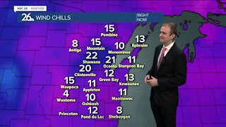
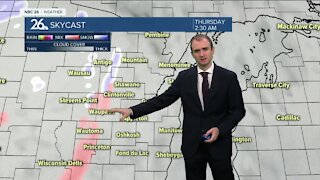
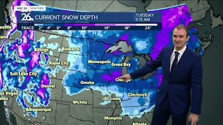
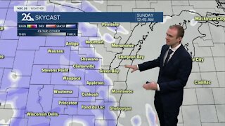
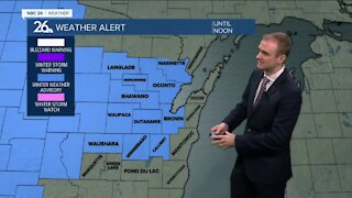
Winter storm warnings are in place for most of our area with winter weather advisories for Marquette, Green Lake, Fond du Lac, and Sheboygan counties. We are starting off as a light wintry mix this morning. As the storm evolves, the wintry mix will turn over to snowfall later in the morning. Snow will start in Central Wisconsin, and gradually move to the lakeshore by the early afternoon. With temperatures around 32-34 degrees while most of the snow is falling, it will result in a very wet and heavy compacting snow. Winds blowing out of the southeast up to 25 mph will cause issues on the roads on top of the snow falling, some blowing and drifting is expected. Snowfall totals will range a bit. Right by the immediate lakeshore, with surface water temperatures in the upper 30s on Lake Michigan, and winds blowing in from the lake for most of the storm, this will likely cut down on amounts. Around 3 inches seems to be a fair bet. Further inland for the Fox Valley, snowfall totals will mostly be between 4-7 inches. There may be some localized spots that see a tad less, or a tad more. The highest snowfall totals will be in the far Northwoods with accumulations around 7-9 inches with locally 10 inches possible. The storms wraps up late Thursday into Friday with winds shifting out of the west, around 10-20 mph with some higher gusts. A few flurries or light snow showers are possible. Temperatures will fall to the single digits Highs on Friday will be in the lower to mid teens, but with west winds around 15-25 mph, it will feel around 0 to -10 during the day. If you think that is cold, get used to it or book a flight down to somewhere warm, because we are going into the deep freeze through at least the middle to end of next week’s work week.
-
 1:45
1:45
WGBA
8 months agoFond du Lac Cardinals start the football season with a new $5.3 million nest
66 -
 3:31
3:31
WGBA
3 years agoGino Recchia NBC26 Weather Forecast
6 -
 3:44
3:44
WGBA
3 years agoGino Recchia NBC26 Weather Forecast
7 -
 3:11
3:11
WGBA
3 years agoGino Recchia NBC26 Weather Forecast
8 -
 0:02
0:02
WGBA
3 years agoGino Recchia NBC26 Weather Forecast
171 -
 3:59
3:59
WGBA
3 years agoGino Recchia NBC26 Weather Forecast
24 -
 3:24
3:24
WGBA
3 years agoGino Recchia NBC26 Weather Forecast
18 -
 3:11
3:11
WGBA
3 years agoGino Recchia NBC26 Weather Forecast
17 -
 3:15
3:15
WGBA
3 years agoGino Recchia NBC26 Weather Forecast
13 -
 3:19
3:19
WGBA
3 years agoGino Recchia NBC26 Weather Forecast
7