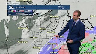
Gino Recchia NBC26 Weather Forecast
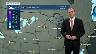
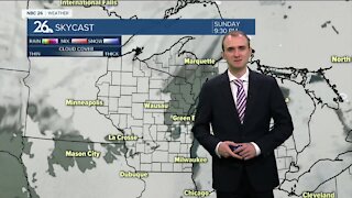
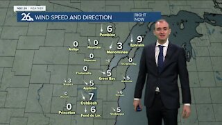
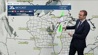
Today is going to be blustery and colder with highs only in the mid/upper teens. With steady northwest winds, it will feel near or below zero at times. High pressure sweeping through our area should keep the skies mostly clear. Temperatures fall into the single digits tonight near or below zero with mostly clear skies and lighter winds out of the west. Saturday starts off sunny, but clouds build in by the late afternoon. Temperatures will rise into the lower 20s. It looks like Saturday night into Sunday morning, we will have some accumulating snow. Right now it doesn’t look to be a big storm, but a solid 1-3 inches looks likely at this time with some areas getting totals closer to 4 inches. There are a few scenarios pinpointing some higher totals, but based on how lackluster the snowfall has been this season, it’s better to play it low-ball for now. Temperatures will get into the upper 20s on Sunday. There’s another potential snow storm that will move through the Southern Great Lakes area Monday. Right now it’s showing us missing this storm, but any change further north in its track would make a big change in that forecast.
-
 1:45
1:45
WGBA
7 months agoFond du Lac Cardinals start the football season with a new $5.3 million nest
65 -
 3:11
3:11
WGBA
3 years agoGino Recchia NBC26 Weather Forecast
17 -
 3:15
3:15
WGBA
3 years agoGino Recchia NBC26 Weather Forecast
13 -
 3:19
3:19
WGBA
3 years agoGino Recchia NBC26 Weather Forecast
7 -
 3:29
3:29
WGBA
3 years agoGino Recchia NBC26 Weather Forecast
24 -
 2:20
2:20
WGBA
3 years agoGino Recchia NBC26 Weather Forecast
18 -
 3:22
3:22
WGBA
3 years agoGino Recchia NBC26 Weather Forecast
11 -
 2:55
2:55
WGBA
3 years agoGino Recchia NBC26 Weather Forecast
17 -
 3:23
3:23
WGBA
3 years agoGino Recchia NBC26 Weather Forecast
8 -
 3:10
3:10
WGBA
3 years agoGino Recchia NBC26 Weather Forecast
5