Gino Recchia NBC26 Weather Forecast
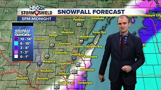
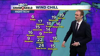
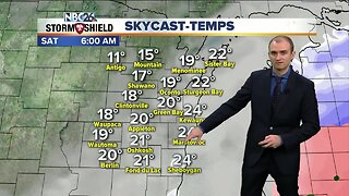
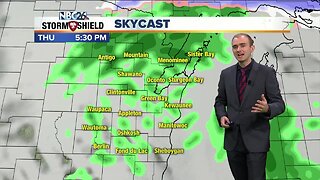
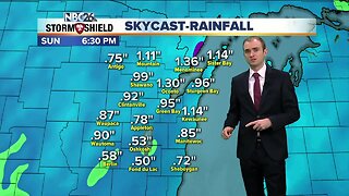
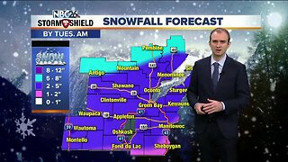
It is the calm before the storm this morning and it is also quite cold! This mornings low temperature is the coldest in Green Bay so far this winter which falls perfectly with on average being the coldest part of winter right now. Before the snow moves in tonight, skies will turn overcast with temperatures climbing into the upper 20s. Winds will pick up out of the southeast at 10-20 mph. Snow will arrive from our western counties and progress east to the lake. 4-7 pm is when the snow will arrive. Winds will pick up with gusts up to 30 mph out of the southeast. This will result in blowing and drifting snow as well as lakeshore flooding and beach erosion. Lakeshore flood advisories have been issued for lakeside counties until though Saturday. Temperatures will stay in the mid and upper 20s. Snow will begin to diminish during the first half of the afternoon Saturday. Snowfall accumulations will be 4-7 inches with some locally higher totals near 8 inches. There is the potential that some dry air will work into the storm which would result in a period of wintry mix comprising some freezing drizzle and very light snowfall. High temperatures will rise into the lower to mid 30s along and east of the I-41 corridor, upper 20s to lower 30s west of the corridor. Temperatures fall into the single digits by Sunday morning and highs in the upper teens during the afternoon. Teens remain Monday and Tuesday. We get into the upper 20s Wednesday and back above freezing potentially Thursday.
-
 3:36
3:36
WGBA
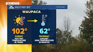
9 months agoWill it be necessary to have both the AC & the heat on during the same day??
1671 -
 3:54
3:54
WGBA
4 years agoGino Recchia NBC26 Weather Forecast
10 -
 2:36
2:36
WGBA
4 years agoGino Recchia NBC26 Weather Forecast
11 -
 4:30
4:30
WGBA
4 years agoGino Recchia NBC26 Weather Forecast
10 -
 2:52
2:52
WGBA
4 years agoGino Recchia NBC26 Weather Forecast
10 -
 4:01
4:01
WGBA
4 years agoGino Recchia NBC26 Weather Forecast
23 -
 3:37
3:37
WGBA
4 years agoGino Recchia NBC26 Weather Forecast
1 -
 3:53
3:53
WGBA
4 years agoGino Recchia NBC26 Weather Forecast
37 -
 3:45
3:45
WGBA
4 years agoGino Recchia NBC26 Weather Forecast
8 -
 5:11
5:11
WGBA
4 years agoGino Recchia NBC26 Weather Forecast
25