Premium Only Content
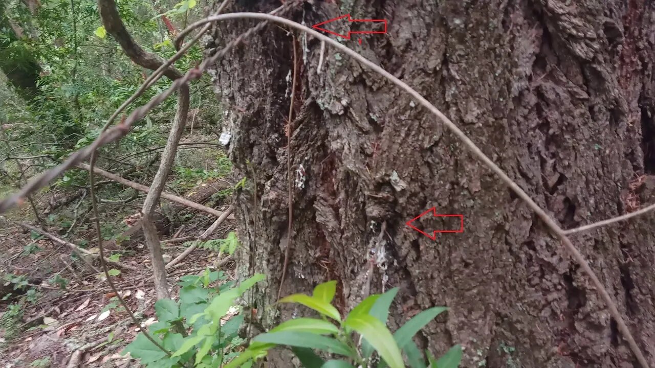
Yet More Barbed Wire Fence Along the Grizzly Flat Road
A short stop on a bike ride up the Grizzly Flat / North Trail in Upper Stevens Creek County Park and what do you know, there's more barbed wire fence.
This location is a few hundred yards below the start of what I call the middle road which also has fence along the down hill side. Judging by the depth of wood that's grown around the barbed wire where it was fastened to live trees, both fences seem to be of similar age and construction.
What do you think this road/fence was built for? I'm starting to think there was some sort of ranch on this ridge, very similar to ranches on the next two ridges to the north. In upcoming videos, I'll try exploring some other areas to see if the location of any old ranch buildings can be found.
About the USGS HTMC:
https://www.usgs.gov/programs/national-geospatial-program/historical-topographic-maps-preserving-past
View/download maps on the TopoView site:
https://ngmdb.usgs.gov/topoview/
I used the 1897 Palo Alto quadrangle or the 1900 historical topo as listed in GaiaG:
https://www.gaiagps.com/
More to come...
Subscribe for more content like this
Comment, rate, share & click the bell icon
And as always, thanks for watching
#USGS #HillShade
-
 2:15
2:15
ViralHog
3 years ago $0.01 earnedOwl Set Free From Barbed Wire Fence
3799 -
 1:07
1:07
Walk Across America
3 years ago $0.02 earnedSaving Baby Deer Trapped in Barbed Wire Fence
85 -
 4:27
4:27
4Crawler
3 years agoOld 1895 Stevens Canyon Road - Along the Grizzly Flat Trail
2 -
 8:46
8:46
4Crawler
3 years agoGrizzly Flat North Trail / Middle Road: 2nd Visit
5 -
 7:31
7:31
4Crawler
3 years agoGrizzly Flat North Trail / Middle Road: 3rd Visit
22 -
 0:26
0:26
Solitary_Seeker
3 years agolong pan along fence line
2 -
 0:33
0:33
ViralHog
3 years ago $8.38 earnedCat Awkwardly Shuffles Along Fence
4.89K2 -
 6:59
6:59
4Crawler
3 years agoGrizzly Flat North Trail / What was this Middle Road built for?
59 -
 6:39
6:39
4Crawler
3 years agoGrizzly Flat Trail, North/South Trail Junction
6 -
 29:13
29:13
Clownfish TV
1 day agoGen Z are Becoming the Boomers?! | Clownfish TV
32.8K41