
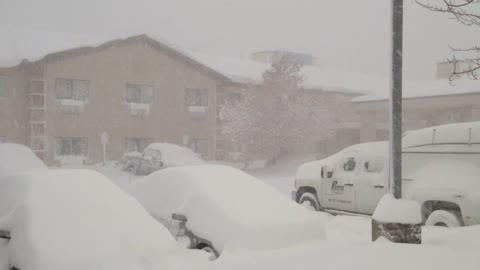
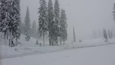
Lake-effect snowstorm pummels Western New York
A lake-effect storm dumped up to 6 feet of snow in parts of Western New York, trapping residents in their homes and stranding motorists on roadways. Live Storms Media stringer, Greg Soliday, captured footage of the historic storm in Hamburg, New York.
290K
views
1
comment
Halloween snowfall in Michigan
LiveStormsMedia.com stringer, Charles Russell shot the first snow of the season coming down in heavy fashion in the Greenville area of west-central Michigan on Oct. 31st, 2014. The snow is not expected to be much of a nuisance, but it certainly is coming down heavy in spots. Travel problems are expected to be minimal with the main impacts being the colder temperatures and windy conditions.
222K
views
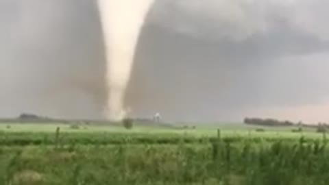
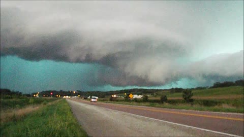
Breathtaking white cone tornado spotted in Iowa
Mike Gillespie captured stunning footage of a white cone tornado in Adams County, Iowa on August 2nd, 2015. Credit to 'LiveStormsMedia'.
188K
views
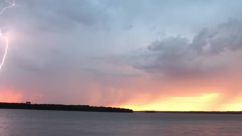
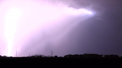
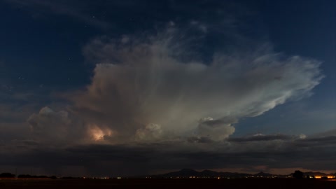
Mesmerizing time lapse of lightning show in Oklahoma
Bart Comstock captured incredible footage of a lightning show over Lake Thunderbird as it moved through the Norman, Oklahoma area on September 14th, 2015. What a stunning sight! Credit to 'LiveStormsMedia'.
170K
views
1
comment
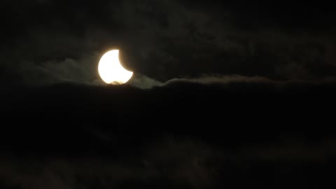
Time lapse captures partial solar eclipse
The moon passed between the Earth and the sun on Oct. 23rd, 2014, creating a partial solar eclipse. Live Storms Media stringer, Jason Weingart, captured footage of the event from a Texas location and put together this stunning time lapse. Credit to LiveStormsMedia.
97.3K
views
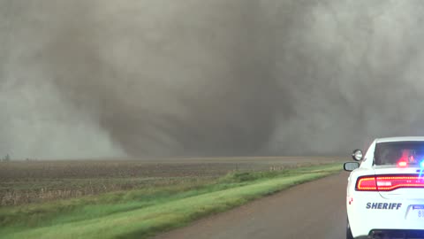
Extreme close range footage of tornadoes in Kansas
A family of tornadoes impacted Ford County around Dodge City, Kansas late last month. Watch as one of them tornado (rated EF-3) rips the roof off of a home with the inflow jet. This amazing supercell produced tornadoes for over 2 hours. Credit: Brett Adair / Live Storms Media
95.3K
views
2
comments
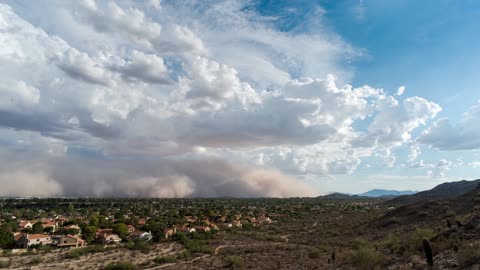
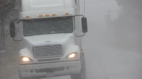
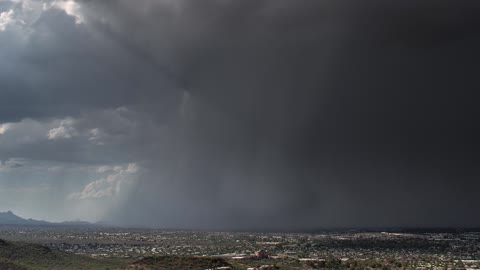
Massive Dust Storm Completely Engulfs City Of Phoenix
More familiar to the desert of Saharan Africa, the first massive dust cloud of the year has engulfed the city of Phoenix cutting off power to many homes and closing the international airport. A giant dust storm has developed across the Phoenix metro area in response to thunderstorms in the region.
Known as a haboob, which is Arabic for 'strong wind', the storm's yellowy <a href="https://rumble.com/v39xm7-dust-storm-rolls-through-zacatecas-mexico.html" target="_blank">grey dust cloud</a> was traveling pretty fast. Caused by Arizona's monsoon season which begins in early June and runs through till the end of September, haboob's only occur in Africa, the Middle East, Australia and Phoenix, Arizona. The haboob temporarily blocked out the sun and covered everything in a layer of dust.
The haboob is a rare event and is caused by loose dust being blown upwards in the absence of rain and collecting skywards where it is then propelled by another more distant thunderstorm brewing behind it. It is destructive because of the fine dust particles that manage to permeate everywhere during the storm. <a href="https://rumble.com/v32aja-dust-storm-covers-southwest.html" target="_blank">The dust gets into everything</a>, into every nook and cranny. It is one thing to see it from the ground, but when you are on top of a mountain and you still have to look up to see the top of it, you really start to grasp the size and magnitude of the haboob.
Dust storms are not naive because they carry a noxious mix of fungi, heavy metals from pollutants, chemicals and bacteria that could lead to cardiovascular and eye disease, and other illnesses.
91.8K
views
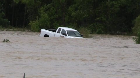
Truck swept down stream in Columbia, South Carolina
Dramatic footage of a vehicle that was swept off of Bluff Road at Gills Creek after driving around barricades into flood waters. The gentlemen who also swept down stream was eventually rescued and luckily lived to see another day. Credit: Brett Adair/Live Storms Media
83.1K
views
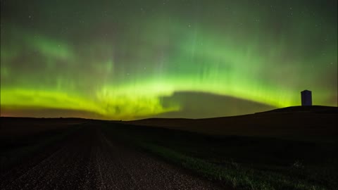
Northern Lights Shine Bright Over North Dakota
It is one of those sights that many think is only obtainable if they travel to the northern parts of the planet. An aurora, sometimes referred to as polar lights, northern lights or southern lights, is a natural light display in the Earth's sky, predominantly seen in the high-latitude regions. But in recent years the gorgeous Aurora Borealis can also be seen in some remote parts of continental US.
Zach Hargrove, from Live Storms Media, captured absolutely stunning shots of the <a href="https://rumble.com/v3zc1f-stunning-northern-lights-captured-over-lapland.html" target="_blank">nothern lights</a> over North Dakota.
Here’s a little science for you. Auroras are produced when the magnetosphere is sufficiently disturbed by the solar wind that the trajectories of charged particles in both solar wind and magnetospheric plasma, mainly in the form of electrons and protons, precipitate them into the upper atmosphere due to Earth's magnetic field, where their energy is lost. The resulting ionization and excitation of atmospheric constituents emits light of varying color and complexity.
That is why the Aurora shows different colors in different parts of the world. In the northern countries, it may show varying shades of blue, purple and green. Lower, it shows only the green spectrum.
In northern latitudes, the effect is known as the aurora borealis or the northern lights. The southern counterpart, the aurora australis or the <a href="https://rumble.com/v38idj-stunning-timelapse-of-southern-lights-captured-over-scenic-lake.html" target="_blank">southern lights</a>, has features almost identical to the aurora borealis and changes simultaneously with changes in the northern auroral zone. The Aurora Australis is visible from high southern latitudes in Antarctica, Chile, Argentina, New Zealand, and Australia.
Credit: Zachary Hargrove/Live Storms Media.
75.1K
views
Incredible cloud-to-ground lightning storm
Bryan Snider, from Live Storms Media, captures these stunning cloud-to-ground lightning strikes near Phoenix, Arizona. It's amazing how beautiful an intense a storm can be.
53.7K
views
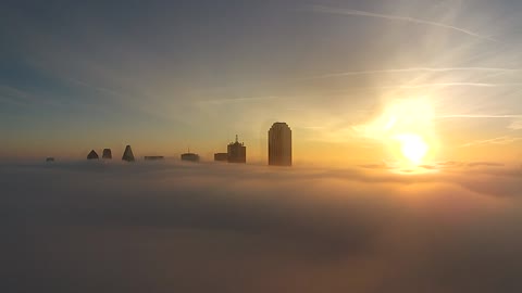
Drone captures Dallas skyline above fog bank
Live Storms Media's Mike Prendergast captured a stunning view of the Dallas, Texas skyline after flying his drone above a morning fog bank. It's an incredible sight!
50.7K
views
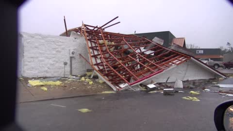
Damage from Columbia, Mississippi tornado
Severe damage occurred along HWY-98 in Columbia, Mississippi from a strong tornado that roared through the region on December 23rd, 2014. Brandon Clement of Live Storms Media shot the first damage images after the tornado passed.
41.1K
views

Plane crashes into home in Maryland
A private executive plane crashed into a Gaithersburg, Maryland home at approximately 10:45 a.m. on December 8th, 2014, killing all three people aboard the aircraft and a mother and two children inside the house. The Embraer EMB-500/Phenom 100 twin-engine jet was on approach to Montgomery County Airpark, which is just under a mile from the site. Mark Ellinwood captured footage of the scene.
31.4K
views
Storm chaser struck by lightning!
August 31st 2014 will be a day that Live Storms Media storm chaser Danny Murphy will never forget. He encountered a tornadic thunderstorm that was filled with electricity with lightning strikes taking place nearly every second. Unfortunately, while documenting the storm, Danny was struck by what is referred to as a 'Step Leader' from the main lightning bolt seen just feet away. Luckily he survived the experience, but did suffer neurological and physical injuries from the lightning interaction, which left him in a Sioux City, Iowa hospital for 10 days.
29.4K
views

Have you ever seen a corn stalk tornado?
Shae Cohan, from Live Storms Media, captures a 'mini tornado' tearing across a freshly plucked field of corn in Shelbyville, Illinois. Dry stalks are lofted into this rather wide dust devil, which eventually pelted his windshield and vehicle. Crazy!
28.1K
views
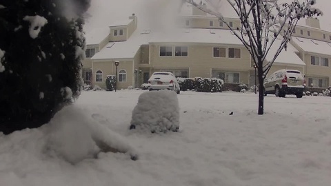
Lake-effect snow pummels New York State
Parts of Western New York could expect to receive up to 6 feet of snow from a massive lake-effect storm hitting the area on November 18th, 2014. Video by Greg Soliday of Live Storms Media.
26.7K
views
1
comment
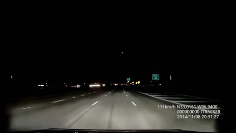
Dash-cam captures fireball over Texas
Live Storms Media stringer, Stephen Denney, captured incredible footage of a meteor burning in the sky while driving in Carollton, Texas on November 8th, 2014.
21K
views
Time lapse: Stunning microburst thunderstorm in Arizona
Bryan Snider of 'LiveStormsMedia' managed to capture this amazing microburst near the Tuscon area. A microburst is a small-scale downburst caused by a small and intense downdraft within a thunderstorm. This timelapse displays the potential danger of a common thunderstorm, especially to those in the aviation industry.
18.6K
views

Hotel in Dallas lights up in support of France
The Omni Hotel in Dallas, Texas, lights up over the weekend in the colors of the French flag. This is a symbol of unity spread across the world following the deadly Paris terrorist attacks the took over 100 lives on Friday. Credit: Nick Busby / Live Storms Media
18.2K
views
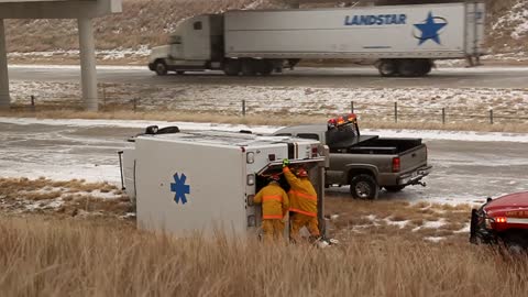
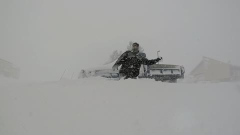
Texas snow leads to dangerous road conditions
Snowfall in the Texas Panhandle region on November 16th, 2014 created dangerous road conditions for drivers. The aftermath unfortunately included emergency personnel where an ambulance flipped on I-40 near McLean. Trevor Leeper of Live Storms Media was on scene.
15K
views
1
comment

Fall in Iowa delivers stunning beauty
Fall colors come around across portions of eastern Iowa. These shots were taken east of Des Moines in mid October. Beautiful! Credit: Danny Murphy / Live Storms Media
11.8K
views
Stunning time lapse: Arizona monsoon storms
The Arizona monsoon continues to be quite strong with loads of moisture pouring into Arizona this season. Storms continue to be a daily occurrence with deadly lightning strikes and localized flash flooding. This piece demonstrates the power in time lapse from Live Storm Media's Bryan Snider.
11.4K
views
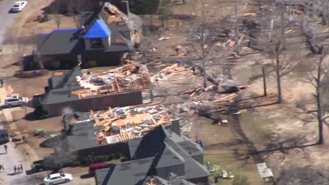
Aerial footage captures magnitude of Alabama tornado damage
Live Storms Media Meteorologist Brett Adair flew over the EF-2 tornado damage path in Bessemer just one day after the tornado tore a path through town. The aerial views are just south of I-459 where the Bentbrook Golf Course is located. The heaviest damage was noted on Pocahontas Road, Dickey Springs Road, and Pine Valley Drive where the roof of some homes were completely removed. The tornado was rated an EF-2 by the National Weather Service with 125 mph winds. Credit: Brett Adair / Live Storms Media
10.4K
views
Major west coast storm brings flooding and snow
David Plank of Live Storms Media shows just how elevation is affecting areas in California with a large storm system moving on shore. Down in the valleys near Mount Shasta, rain and flooding are causing many issues. Over 5 inches of rain has fell in the last 24 hours in the region. Above 6,000 feet, 8 inches of snow has fallen on Mount Shasta with more expected tonight.
9.11K
views
1
comment
Time lapse video captures Northeast snowfall
Live Storms Media stringer, Dave Lewison, captured an amazing timelapse video of the snow piling up at his location in Poughkeepsie, New York during this week's snowfall.
9K
views