

Chanterelle Mushroom Foraging Near Boone, North Carolina
Chanterelle hunting in the forest near Boone, North Carolina.
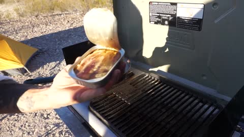
I make a simple recipe using butter, thyme, heavy cream and salt. White wine or lemon juice would also be a great addition, however the mushrooms have wonderful flavor and aroma so keep it simple.
Use caution when harvesting wild mushrooms, there are many toxic species.
Mushrooms contain water which will start to release during the saute process. Cook on high heat to evaporate most of the water or you wont get a good brown on the mushrooms and your sauce wont be creamy.
Serve as a side, on toast, or with steak.
Buy Me A Coffee
https://www.buymeacoffee.com/ashtrooutdoors
Music
What We Do by Boulevard X-Audi
34
views
1
comment
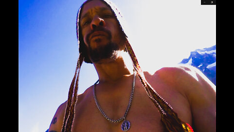
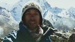
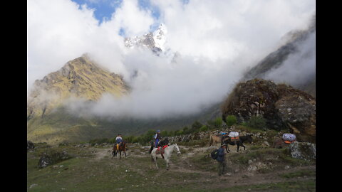
42 Mile Solo Reverse Salkantay Trek - Day 5 "The Mountain" - Peru
Day 5 begins after a long cold night spent in the barn of a local family. Though they did not operate a formal hostel or hotel they were willing to offer the barn and a home-cooked meal which was greatly appreciated. There is no opportunity for resupply in the surrounding area so you will have to ask random villagers if they are willing to sell you food, lodging, or supplies.
This section I gain approx 2,400ft (730m) over the course of 3.5 miles then descend around 2,000ft over another 4 miles.
The altitude (approx 13,000ft) combined with the freezing cold and physical bodily pain to make for a sleepless night. It did not help that the 5 or so dogs living on the property stayed up howling at the moon and barking at various times. It was at one of these bark sessions that I left the hammock to use the bathroom and noticed that I was standing in a bowl surrounded by glacier capped Andean mountains. Up to that point the entire valley had been encased in a dense fog that left no clue as to geography of the region. I knew it was alpine, the plants, temperature, and altitude gave that away, but the mountains were a sight to behold, especially in the middle of the night bathed in the glow of a colossal full moon.
Eventually I managed to fall asleep but was no sooner awakened by horse trains ferrying supplies up the mountain trail well before any hint of dawn.
This climb was absolutely brutal. I must have stopped to rest over a dozen times. By this point I had no food, very little water, almost no sleep. My legs were in terrible pain. The trail had been reduced to large randomly scattered unstable stones which made movement slow and precarious. I could feel my knees and ankles grinding away. And of course the altitude was not helping.
This section probably took me 6 hours though most locals told me it would take 3. I would have to walk a few kilometers past the village or Soraypampa to find transportation back to Cusco. I dont believe there is a bus system or taxis available to take you back and Cusco is several hours away. I relied on a store keeper asking his friend who operated a tour group if I could hitch back with them. It cost about $30 US and we even stopped at a hotel in the mountains for a buffet style lunch which was part of their tour. The bus was packed and I must have smelled terrible after having walked 5 days through the jungle and sleeping in barns, but everyone was very kind.
This was a trek to remember and although quite difficult I would absolutely do it again though with less weight and a better tripod, and I might even bring Bella along.
The 42 mile long Salkantay Trek is an adventurous alternative to the more popular, and thus more crowded, Inca Trail which many hikers use as a gateway to the renowned UNESCO archeological site of Machu Picchu in Peru.
The standard protocol is to begin this trip in the foothills of Salkantay Mountain at approximately 15,000 ft (4,600m) and work your way down over several days to approx. 8,000 ft (2,400m) with the trek culminating in the ruins of Machu Picchu.
I do this trek solo and in reverse, starting in Machu Picchu Village and walking to Soraypampa gaining altitude the entire way while carrying a 25kg pack.
As an added challenge I take the jungle route between the villages of Playa Sahuayaco and Collpapampa. Most trekking guides will avoid this route and ferry their group via bus along a dirt road as the trail is remote, narrow, and potentially non-existent due to mudslides. ***This route is dangerous. Proceed with caution or with a guide.
AllTrails
https://www.alltrails.com/explore/trail/peru/cusco/salkantay-trek?mobileMap=false&ref=sidebar-static-map&u=i
Buy Me A Coffee
https://www.buymeacoffee.com/ashtrooutdoors
Music
Lush Valley by High Proof
65
views
42 Mile Solo Reverse Salkantay Trek - Day 4 "The Highlands" - Peru
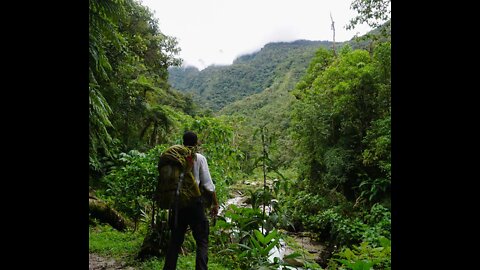
On day 4 I begin the arduous trek from Chaullay Village (9,500ft) to Wayramachay (12,900ft). This is the point at which the tropical cloud forest transitions into misty alpine meadows and the first snow capped 6,000 meter peaks begin to dominate the landscape. There is little opportunity to resupply but water is abundant via creeks and mountain runoff. Due to an inadequate breakfast I chanced knocking on a random house and asking if someone would sell me lunch, fortunately there was a woman who agreed and I gave her 10 soles ($2.60) for some eggs, rice, and tomatoes. As there are no jobs or regular source of cash income out here this is a pretty good trade. I hesitate to film people without their permission or if they seem less than enthusiastic. People in this region are poor and live in conditions that have been virtually extinguished in Western countries e.g. dirt floors, wood for fuel, cohabitating with livestock, etc. Also, they are quite aware of the economic disparity between the tourists/trekkers and themselves. Westerners wear expensive clothes, carry expensive backpacks and cameras, and even the idea of flying halfway across the globe to walk in the mountains is an extravagant display of wealth. I never want to make people feel like an oddity or an object of pity, and certainly not feel self conscious about their circumstances. That said, I usually put the camera away and try to experience the moment and connect on a human level.
Once I arrived in Wayramachay I asked a family if they had lodging and they said I could camp in their barn for the night and they would cook me dinner. Trekkers and guides will tell you that there are no kiosks, resupply opportunities, or lodging past Chaullay Village, but what they mean is there is no formal tourist infrastructure past Chaullay. You will pass several family homes (huts) and the locals will probably welcome the opportunity to make some cash so don't be shy. Also, they are not going to quote you a price, if anything they will say it's free so just give fair compensation.
This was the first night that I was really cold, my light sleeping bag did not provide much comfort and the altitude probably didn't help. I maybe got 2 hours of actual sleep before rising early and beginning the final section of my trek.
The 42 mile long Salkantay Trek is an adventurous alternative to the more popular, and thus more crowded, Inca Trail which many hikers use as a gateway to the renowned UNESCO archeological site of Machu Picchu in Peru.
The standard protocol is to begin this trip in the foothills of Salkantay Mountain at approximately 15,000 ft (4,600m) and work your way down over several days to approx. 8,000 ft (2,400m) with the trek culminating in the ruins of Machu Picchu.
I do this trek solo and in reverse, starting in Machu Picchu Village and walking to Soraypampa gaining altitude the entire way while carrying a 25kg pack.
As an added challenge I take the jungle route between the villages of Playa Sahuayaco and Collpapampa. Most trekking guides will avoid this route and ferry their group via bus along a dirt road as the trail is remote, narrow, and potentially non-existent due to mudslides. ***This route is dangerous. Proceed with caution or with a guide.
AllTrails
https://www.alltrails.com/explore/trail/peru/cusco/salkantay-trek?mobileMap=false&ref=sidebar-static-map&u=i
Buy Me A Coffee
https://www.buymeacoffee.com/ashtrooutdoors
Music
Solo Flute by SaReGaMa
109
views
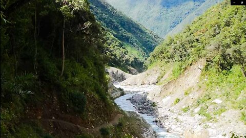
42 Mile Solo Reverse Salkantay Trek - Day 3 "The Canyon" - Peru
On Day 3 I travel from Playa Sahuayaco to Chaullay (9,500ft) gaining about 2,700 ft (800m) in elevation over the course of 9 miles (14k)
This section of the trail is the optional "Jungle Route" from Playa Sahuayaco to Collpapampa. Most guide services take their groups on the dirt road on the opposite side of the canyon, hiking or via vehicle. In fact, most guides or villagers I spoke with informed me the trail was inaccessible and I had no choice but to walk the road, and most recommended I hire a vehicle.
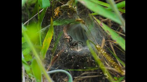
I chose to hike through the jungle. Please understand that while my video is only 5 minutes long, this trail involves several hours of navigating through very dense, overgrown forest/jungle with very few habitations spread out over several kilometers. There is little to no opportunity for supplies or assistance should you need it. There is plenty of water along the route so take a portable water filter or iodine tablets. Also, there are very narrow, exposed sections of trail that have steep drop-offs into the canyon. A fall along one of these sections would be life ending, use caution, hug the wall, be wary of rock slides/mud slides especially if there has been several days of rainy weather. It is very possible that a mud slide could completely wash out the trail requiring you to turn around or the trail conditions are so wet and muddy that traversing along the steep canyon would be too risky. Once you are on this side of the canyon there is no crossing the river to reach the road on the other side, the canyon is deep, wide, and the river is a torrent, if you take this trail you are either committed to it or you have to turn around.
Also, keep in mind that the jungle has anacondas, vipers, tarantulas, giant centipedes, bears, pumas, and mosquitos. This trail is isolated, sparsely traveled, and dense/overgrown. If something happens to you there is no help available. Bring a well stocked first aid kid and know how to use it.
I was very fortunate with the weather, but it is high mountain jungle and heavy rains can occur without warning. There is no shelter along this route, prepare for the worst, hope for the best. I don't want to discourage people from doing this trail, experienced back-country hikers can complete this with ease, eps if travelling alpine style or with a friend. I will discourage anyone who is not completely comfortable with rugged, isolated conditions or who is not in strong physical conditioning.
On a different note, the butterflies and wildflowers along this trail were absolutely magical, I've never seen so many butterflies, it was like walking through a fairytale and although this section was difficult it was absolutely worth it. The family I met were incredibly kind and I believe genuinely excited/curious to see me. I doubt they receive many visitors. Their modest home was truly a Garden of Eden with a bounty of fruits, vegetables, and flowers which they were certainly proud of and eager to display. Their skill in cultivation was readily apparent. It reminded me that there is a different way of being in the world and I am truly grateful for the experience.
The 42 mile long Salkantay Trek is an adventurous alternative to the more popular, and thus more crowded, Inca Trail which many hikers use as a gateway to the renowned UNESCO archeological site of Machu Picchu in Peru.
The standard protocol is to begin this trip in the foothills of Salkantay Mountain at approximately 15,000 ft (4,600m) and work your way down over several days to approx. 8,000 ft (2,400m) with the trek culminating in the ruins of Machu Picchu.
I do this trek solo and in reverse, starting in Machu Picchu Village and walking to Soraypampa gaining altitude the entire way while carrying a 25kg pack.
As an added challenge I take the jungle route between the villages of Playa Sahuayaco and Collpapampa. Most trekking guides will avoid this route and ferry their group via bus along a dirt road as the trail is remote, narrow, and potentially non-existent due to mudslides. ***This route is dangerous. Proceed with caution or with a guide.
AllTrails
https://www.alltrails.com/explore/trail/peru/cusco/salkantay-trek?mobileMap=false&ref=sidebar-static-map&u=i
Buy Me A Coffee
https://www.buymeacoffee.com/ashtrooutdoors
Music
Echoes of the Canyon by SaReGaMa
91
views
42 Mile Solo Reverse Salkantay Trek - Day 2 "Bugs and Botany" - Peru
On Day 2 I travel from Llaqtapata Lodge to Playa Sahuayaco losing about 1,600 ft (480m) in elevation over the course of 6 miles (9k)
This section will have you initially climb approx 800 ft (240m) passing through the small ruins of Llacatapata before descending through a wide jungle path where you will encounter multiple small farms and villages where you can resupply or rest. This area is teeming with wildflowers, lush tropical vegetation, and panoramic views of the surrounding mountains. Bring a small, portable water filter such as the MSR MiniWorks as there are several waterfalls and streams along the path, this way you don't have to carry multiple bottles or purchase plastic ones in villages, enabling you to travel light and save money. Heavy rainfall creates muddy conditions and possible encounters with landslides or washed-out sections of the trail so use caution.
The 42 mile long Salkantay Trek is an adventurous alternative to the more popular, and thus more crowded, Inca Trail which many hikers use as a gateway to the renowned UNESCO archeological site of Machu Picchu in Peru.
The standard protocol is to begin this trip in the foothills of Salkantay Mountain at approximately 15,000 ft (4,600m) and work your way down over several days to approx. 8,000 ft (2,400m) with the trek culminating in the ruins of Machu Picchu.
I do this trek solo and in reverse, starting in Machu Picchu Village and walking to Soraypampa gaining altitude the entire way while carrying a 25kg pack.
As an added challenge I take the jungle route between the villages of Playa Sahuayaco and Collpapampa. Most trekking guides will avoid this route and ferry their group via bus along a dirt road as the trail is remote, narrow, and potentially non-existent due to mudslides. ***This route is dangerous. Proceed with caution or with a guide.
AllTrails
https://www.alltrails.com/explore/trail/peru/cusco/salkantay-trek?mobileMap=false&ref=sidebar-static-map&u=i
Buy Me A Coffee
https://www.buymeacoffee.com/ashtrooutdoors
Music
Echoes of the Canyon by SaReGaMa
50
views
42 Mile Solo Reverse Salkantay Trek - Day 1 "The River" - Peru
The 42 mile long Salkantay Trek is an adventurous alternative to the more popular, and thus more crowded, Inca Trail which many hikers use as a gateway to the renowned UNESCO archeological site of Machu Picchu in Peru.
The standard protocol is to begin this trip in the foothills of Salkantay Mountain at approximately 15,000 ft (4,600m) and work your way down over the course of several days to approx. 8,000 ft (2,400m) with the trek culminating in the ruins of Machu Picchu.
I do this trek solo and in reverse, starting in Machu Picchu Village and walking to Soraypampa gaining altitude the entire way while carrying a 25kg pack.
As an added challenge I take the jungle route between the villages of Playa Sahuayaco and Collpapampa. Most trekking guides will avoid this route and ferry their group via bus along a dirt road as the trail is remote, narrow, and potentially non-existent due to mudslides. ***This route is dangerous proceed with caution or with a guide.
On Day 1 I travel from Machu Picchu Village to Llaqtapata Lodge gaining about 2,200 ft (670m) in elevation over the course of 8 miles (13k)
AllTrails
https://www.alltrails.com/explore/trail/peru/cusco/salkantay-trek?mobileMap=false&ref=sidebar-static-map&u=i
Buy Me A Coffee
https://www.buymeacoffee.com/ashtrooutdoors
Music
Moon Chasm by Looking Glass
Air by SaReGaMa
78
views
1
comment
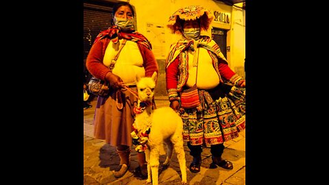
Inca Pan Flute and Drum Jam Downtown Cusco Peru
Dozens gather for an Inca drum and pan flute jam in downtown Cusco, Peru. A local Peruvian told me this style of traditional music was native to Bolivia (Collasuyu) one of the four historic regions (Tawantinsuyu's) of the Inca Empire.
28
views

World Sport Climbing Mecca El Potrero Chico, Nuevo Leon, Mexico
We have an incredible adventure in one of the worlds premiere sport climbing destinations, El Potrero Chico, Mexico.
Although famous globally for its over 500+ single and multi pitch routes on limestone cliffs, there's a lot more to offer. Hiking, highlining, 4x4 desert adventures, and even BASE jumping can be had within the park and surrounding mountains.
The small community of Hidalgo has excellent and affordable cuisine, open air markets, and amenities such as groceries and auto repair.
If you are into sport climbing or trad, put Potrero on your bucket list.
Music
Snow by Tomas Gomez
Buy me a coffee
https://www.buymeacoffee.com/ashtrooutdoors
17
views
1
comment
BASE Jumping and Wingsuit in Mexico, La Popa (Cliff) Nuevo Leon
I film a group of BASE Jumpers and Wingsuit Pilots over the course of several days outside of a remote desert village called San Jose de la Popa in Nuevo Leon, Mexico.
BASE Jumpers in this video
Leo Turco Instagram @leoturco
Ben Dicko - Instagram @bendicko101
Joshua G - Instagram @joshua_wild_skies
Antonio - Instagram @dr.toggles
Filming
Instagram @ashtrooutdoors
Motocross Riders
Stephie Schinkel - Instagram @stephieschinkel
Jose Perea - Instagram @jose_perea_motors
Music
Chilly Day by Bopper Beats
Buy Me a Coffee
https://www.buymeacoffee.com/ashtrooutdoors
38
views

Fork In The Road - Afghani Biryani (Vegetarian)
Biryani is a popular rice dish that originated in India but is popular throughout southeast and central Asia. In this variation I use Quinoa instead of rice. Quinoa is a non fussy grain that cooks faster than rice and is less prone to being overcooked or even under cooked, it also contains protein, fiber, and carbohydrates so is a great staple to keep in your overland pantry.
Afghan Biryani, or "Biryan", typically contains goat meat, dried fruits, and a fragrant blend of Afghan spices, which are featured in this recipe (sans goat).
Cashews, ghee, and quinoa create a nutritionally balanced dish with plenty of protein, fiber, and healthy fats making this dish a regular feature in my back country culinary line-up.
Recipe Includes
Harmony House Foods Dehydrated
Lentils, Leeks, Carrots, Onions, Spinach
Dried fruit blend of raisins, apricots, cherries, and peaches
Organic white quinoa
Ghee
Chicken stock powder
Paprika, Cinnamon, Afghan Curry Powder (Rumi)
Fried Garlic
Cashews
Dried Pequin Chilis (use any dried spicy red chili)
Location - Organ Mountains Desert Peaks National Monument, New Mexico
Buy Me A Coffee
https://www.buymeacoffee.com/ashtrooutdoors
Music
Kora Explorations by Splice Originals
46
views
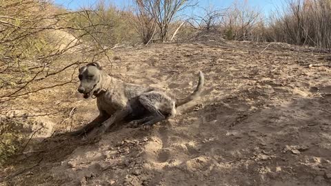
Beautiful Bella Rolls Around in the Dirt
My beautiful German Shorthaired Pointer, Bella, decides to roll around in the dirt on the bank of the Rio Grande River.
44
views
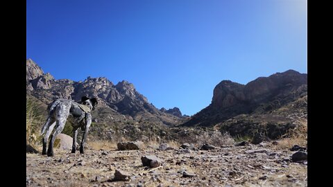
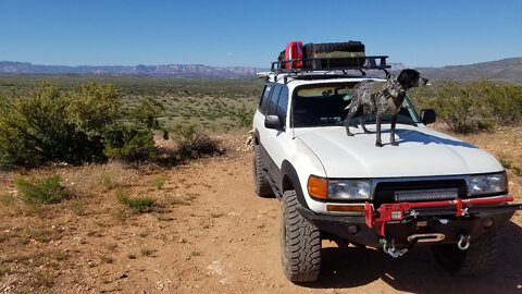
6 Mile Solo(ish) Hike in Organ Mountains - Desert Peaks National Monument, New Mexico
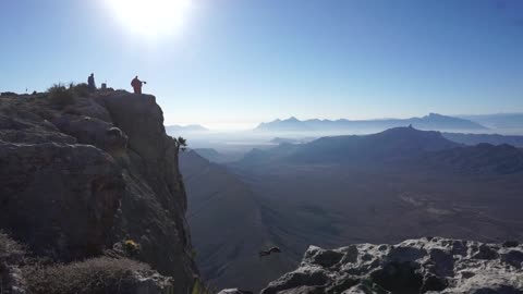
After visiting White Sands National Park Bella and I stumble upon a lesser known yet equally majestic area known as Organ Mountains - Desert Peaks National Monument near Las Cruces, New Mexico, which was only recently given conservation status in 2014. At nearly 500,000 acres this park features several remote hiking trails and dispersed camping outside of the park via BLM lands.
We opted for the challenging 6 mile vertical hike up the Organ Needles Trail which involves quite a bit of zig zagging thru poorly marked high desert brush and scree scrambling at the base of a steep climb toward the summit. Once up top you are treated to panoramic views of the valley below as well as the sheer walls of surrounding mountains. Geocachers will discover a metal ammo box on the summit filled with interesting items.
Be sure to download a map from AllTrails as the local Ranger Office does not provide maps of the areas remote trail system.
Music
MatFix - Heartbeat
Link to Buy Me a Coffee
https://www.buymeacoffee.com/ashtrooutdoors
87
views
Cold Night Hot Spring, Chisos Basin Campground, Big Bend National Park, Texas
After a frigid February night we make our way towards a luxury spa on the banks of the Rio Grande to melt off the chill.
https://www.buymeacoffee.com/ashtrooutdoors
Music
Neo Soul Sunshine - Splice Originals
38
views

Boquillas Del Carmen, Mexico - Big Bend National Park, Texas
While exploring Big Bend National Park I take a quick detour across the border to the sleepy village of Boquillas Del Carmen, Mexico. Visitors to Big Bend are able to cross into this quaint village via a US Border Checkpoint located on the southern end of the park near the Rio Grande Village Campground. Expect to pay around $5 to be ferried across the river, then an additional $8 for a ride up to the village. The locals in Boquillas only accept US currency. There are 2 restaurants in Boquillas with small limited menus that serve cold beer and liquor. I did not see a grocery store while there, however, it may help to ask a local as groceries within Big Bend are limited and very expensive, the nearest US option outside the park is approximately 50 miles one way.
https://www.buymeacoffee.com/ashtrooutdoors
70
views
1
comment
Dispersed Camping in Lincoln National Forest, Sitting Bull Falls New Mexico
Bella and I look for camping options in the Lincoln National Forest near Carlsbad, New Mexico. Most National Forests in the United States have a "dispersed camping" option for people who don't want to camp in an established campground. These areas are typically free and on a first come basis where guests can stay up to 14 days. These areas are easily identified by graded pullouts on the sides of roads and some may have pre-built campfire rings or other markings. Never create a new camping area in National Forest lands. You can locate these areas using park maps or apps such s iOverlander or Alltrails. The Bureau of Land Management (BLM) also maintains similar dispersed camping areas and are a great resource for overlanders or those looking to camp in remote areas away from the crowd.
https://www.buymeacoffee.com/ashtrooutdoors
62
views
2
comments

Fork In The Road - Paneer Spinach Curry (Vegetarian)
Paneer is a soft, unaged cheese common in India. In the Southwestern United States and Mexico it goes by the name Queso Blanco or Queso Fresco. Since the process for making Paneer and Queso Blanco is virtually the same, feel free to use either in this dish.
As always, I am using Harmony House dried and freeze dried vegetables for this dish. Another staple in my pantry is powdered coconut milk which is great for its versatility and subtle sweetness.
Ingredients:
Harmony House Freeze Dried Peas, White Onion, Spinach
Fried Garlic
Afghan Curry Blend (Rumi) but use whatever blend you prefer
Dried red chiles to taste
Powdered Coconut Milk
Cashews roasted or plain
Ghee (clarified butter)
Paneer or Queso Blanco cut into cubes
Good salt
Tortillas or Indian Flatbread (Roti) for serving
https://www.buymeacoffee.com/ashtrooutdoors
16
views
1
comment

Lincoln National Forest New Mexico, 6 mile Solo(ish) Hike Sitting Bull Falls Trail T68
We go off the beaten path and attempt to navigate the poorly marked yet uniquely stunning trail named T68 in Sitting Bull Falls Recreation Area, New Mexico. You will encounter numerous crystal clear spring pools while traversing this approximately 6 mile trail. Open range cattle roam the area as we soon find out, and sweeping views of the surrounding canyon make for stunning panoramic photo opportunities. Be sure to pack a water filter, trail map (downloaded from Alltrails), and compass.
Music
Taranta by Fatima Mhedden
https://www.buymeacoffee.com/ashtrooutdoors
23
views
1
comment

Fork In The Road - Ghee (Clarified Butter)
Don't waste money buying overpriced ghee in the store when you can make it yourself. Ghee or clarified butter is simply butter that has gone through a heating process that removes the milk solids and water, resulting in a rich, golden brown butterfat which when melted resembles oil but tastes like melted butter (because it is). I keep ghee in my overland pantry because of its luxurious flavor, high smoke temperature (which makes it great for sautéing), and because it does not require refrigeration, which leaves room for other items in the cooler.
In this recipe I use 1 pound of salted butter but make as much or as little as you need
https://www.buymeacoffee.com/ashtrooutdoors
27
views

Best Kept Secret! Sitting Bull Falls Recreation Area, Lincoln National Forest, New Mexico
Spectacular swimming hole in the New Mexico desert with crystal clear spring water. Dispersed wilderness camping right outside the park entrance. Active duty military and veterans get in free!
https://www.buymeacoffee.com/ashtrooutdoors
43
views

Big Bend National Park "Cross Canyon Trail" 14 mile Solo(ish) Hike
Bella and I take on a grueling 14 mile round trip hike to a lush desert oasis on the banks of the Rio Grande River which serves as the boundary line of the US/Mexico border in Big Bend National Park. This trail is extremely isolated and rugged. Take plenty of food, water, and be prepared to possibly spend the night. Actually, you will definitely want to spend the night at the river, it's that beautiful!
Protips - Bring a portable water filter like the MSR Miniworks so you can refill at the river, wear snake gaiters, start early before the heat sets in, leave a note in your car windshield telling park rangers where you went and what time you expect to return
Music
Azul by Andres Cantu
https://www.buymeacoffee.com/ashtrooutdoors
Alltrails
https://www.alltrails.com/explore/trail/us/texas/cross-canyon-trail--3
21
views
Fork in the Road : Sardine Stew
I made a delicious and satisfying Sardine Stew in the back country.
For my overland pantry I carry only Harmony House freeze dried or dehydrated fruits and vegetables, they are the best tasting and highest quality product I have found and the price is reasonable.
For this recipe you will need
2 tins of Sardines in Olive Oil
Freeze Dried or Dehydrated
Corn, Carrots, Celery, Onion, Garlic, Potatoes, Bell Pepper, Jalapeno, Leeks
Salt, Cumin, Paprika, Chipotle Powder
Enjoy!
https://www.buymeacoffee.com/ashtrooutdoors
40
views
Fork in the Road - Roasted Green Chile Quesadilla
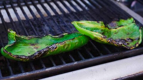
Quick and satisfying, Roasted Green Chile Quesadillas
Use a mild green pepper like poblano or anaheim. Cut them in half and discard the seeds and white membrane.
I use Yellow Bird Serrano Pepper Sauce in this recipe, it's an amazing product, all natural ingredients, organic, made in Texas, and most important tastes fantastic. Best sauce you can buy in a store.
https://www.buymeacoffee.com/ashtrooutdoors
50
views
1
comment
McKinney Springs Campsite - Big Bend National Park, Texas
Bella and I spend a few nights at the beautiful backcountry camp site of McKinney Springs off of the Old Ore Road OHV Trail in Big Bend National Park. While here we restock our water supply at one of the gently bubbling spring pools using the MSR Miniworks hand pump water filter. McKinney Springs campsite is one of the few areas on the trail that features an active spring and shade from a grove of cottonwood trees, making it a real gem especially during the summer months when temperatures soar.
https://www.buymeacoffee.com/ashtrooutdoors
Alltrails
https://www.alltrails.com/explore/trail/us/texas/old-ore-road
92
views
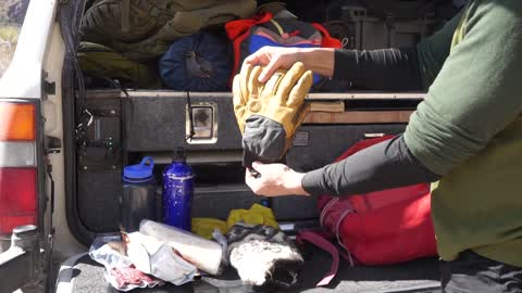
Pine Canyon Trail Pack Review
A review of the items I packed on the 4.5 mile Pine Canyon Trail. Although this is a relatively short trail, it is remote, not well traveled, and cell service is non-existent. In the several hours I was on the trail I only ran into one other group, this is partly because access to the trail is via 4x4 road and a backcountry camping permit ($15) is required if staying overnight in camp sites near the trail head. Hikers should be prepared to stay overnight on the trail if necessary and provide themselves or their group first aid.
https://www.buymeacoffee.com/ashtrooutdoors
63
views
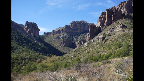
Pine Canyon Trail Big Bend National Park Texas 4.5 Mile Hike
Bella and I tackle the 4.5 mile out-and-back Pine Canyon Trail in Big Bend National Park Texas. A lush desert plateau gives way to an alpine forest as we descend a narrow canyon where seasonal rains eventually breathe life into a now dormant waterfall. This is a fairly easy trail within a remote northern section of the park backcountry
https://www.buymeacoffee.com/ashtrooutdoors
Alltrails
https://www.alltrails.com/explore/trail/us/texas/pine-canyon-trail?mobileMap=false&ref=sidebar-static-map
93
views
1
comment