Gino Recchia NBC26 Weather Forecast
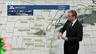
Temperatures will fall into the lower 20s tonight with mostly clear skies and steady northeast wounds at 5-15 mph. Monday will be sunny for most of the day but clouds will quickly increase later in the evening. Temperatures will be in the upper 30s and lower 40s with east winds at 10-20 mph. Light snow or a wintry mix will pass through our area Monday night. There will probably be some very minor accumulation under an inch with grass and elevated surfaces with the best chance of a light dusting. Temperatures will fall into the upper 20s. Cloudy to mostly cloudy skies will stick around Tuesday with highs in the upper 30s to the lower 40s. We should see more sunshine on Wednesday with highs back in the upper 40s to the lower 50s. A storm system will pass south of Wisconsin Thursday but winds will pick up out of the east because of it. That will drive temperatures down into the lower to mid 40s. High pressure moves in on Friday from Canada dropping our highs into the lower 40s with mostly sunny skies. We rise up into the lower to mid 50s during the weekend with more sunshine as the high pressure shifts east and we get in the warmer air return flow. Long range temperature forecasts are keeping highs general slightly above average through the end of March. The average high temperature by the end of the month is 46.
-
 0:30
0:30
WGBA
7 months agoThree Degree Guarantee
61 -
 3:23
3:23
WGBA
3 years agoGino Recchia NBC26 Weather Forecast
7 -
 3:25
3:25
WGBA
3 years agoGino Recchia NBC26 Weather Forecast
13 -
 3:14
3:14
WGBA
3 years agoGino Recchia NBC26 Weather Forecast
3 -
 3:22
3:22
WGBA
3 years agoGino Recchia NBC26 Weather Forecast
11 -
 3:32
3:32
WGBA
3 years agoGino Recchia NBC26 Weather Forecast
7 -
 4:44
4:44
WGBA
3 years agoGino Recchia NBC26 Weather Forecast
7 -
 3:52
3:52
WGBA
3 years agoGino Recchia NBC26 Weather Forecast
8 -
 3:28
3:28
WGBA
3 years agoGino Recchia NBC26 Weather Forecast
8 -
 3:38
3:38
WGBA
3 years agoGino Recchia NBC26 Weather Forecast
3