Gino Recchia NBC26 Weather Forecast
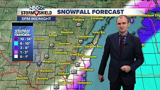
The headlines for the next couple of days include bitterly cold wind chills tonight, lake effect snow potential tomorrow night, and gradually warming temperatures this week. Wind chills advisories and a wind chill warning are back tonight for the whole area. Temperatures are going to fall well below zero into the negative teens with wind chills between -20 to -35. We don't warm up much on Monday with highs in the single digits under mostly sunny skies. A storm system will pass south of the area Monday night, however with northeast winds picking up, this will create an opportunity for lake effect snow along the immediate shorelines of southern Kewaunee county through Manitowoc, and down into Sheboygan County. The band of snow looks to just scrape the shoreline, so inland areas will probably see just flurries or a dusting at most. How much snow along the shore will all be dependent on how far onshore this band sets up. Totals could range from as little as 1-2 inches to as over a half foot. Lake effect snow showers will taper off by Tuesday evening. For the rest of the area on Tuesday, temperatures will climb into the mid teens with partly cloudy skies. The 20s are back on Wednesday, the first time since the 5th of the month (12 days of temperatures below 20). Another winter storm appears to develop across the southern Midwest and Great Lakes on Thursday with a track south of our area mainly, but some light snow showers are possible. Highs will be in the mid 20s. Highs rise to 30 degrees by Sunday with a slight chance of snowfall.
-
 4:30
4:30
WGBA
4 years agoGino Recchia NBC26 Weather Forecast
10 -
 3:08
3:08
WGBA
3 years agoGino Recchia NBC26 Weather Forecast
24 -
 14:17
14:17
Great Lakes Weather
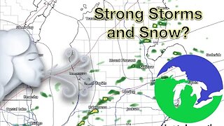
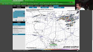
8 months agoStrong Thunderstorms Possible in Michigan Tomorrow; Snow In the Forecast -Great Lakes Weather
18 -
 12:19
12:19
Great Lakes Weather
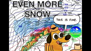
2 years agoMore Active Weather Ahead, Thunderstorms AND Snow in One Week -Great Lakes Weather
4 -
 17:25
17:25
Great Lakes Weather
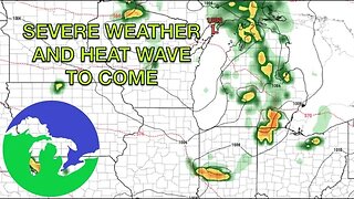
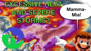
10 months agoSevere Weather Potential Next Week with a Possible Heat Wave To Come -Great Lakes Weather
34 -
 29:49
29:49
Great Lakes Weather
1 year agoLive Update on Supercell Sunday Severe Weather Potential in Indiana and Ohio
1 -
 18:00
18:00
Great Lakes Weather
10 months agoHEAT WAVE and Possible Severe Thunderstorms Through the Week -Great Lakes Weather
32 -
 15:40
15:40
Great Lakes Weather
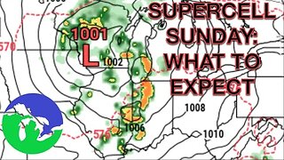
11 months agoSupercell Sunday: Severe Weather Potential for Michigan and Indiana -Great Lakes Weather
14 -
 13:25
13:25
Great Lakes Weather
7 months agoNarrow Band of Heavy Snow Possible In Michigan Friday Morning -Great Lakes Weather
38 -
 18:33
18:33
Great Lakes Weather
1 year agoRED ALERT: Dangerous Blizzard Likely in Michigan, Indiana -Great Lakes Weather
10