Gino Recchia NBC26 Weather Forecast
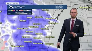
Snowfall totals from yesterdays storm ranged mostly from 2 to as much as 10 inches. The highest totals occurred west of the Fox Valley and in the Northwoods. The lowest amounts were along the shoreline. Today begins day one of a long stretch of well below normal temperatures. The high temperature technically was at midnight, but afternoon highs will struggle to get into the lower teens. Coupled with gusty west winds, wind chills will be down in the negative teens. Some blowing and drifting snow is possible, especially in open areas. Temperatures tonight will fall just below 0 with wind chills in the negative teens to negative twenties under mostly cloudy to partly cloudy skies. The weekend will be a cold one. Highs will be in the single digits with wind chills below zero. There’s a chance of some light snow either Monday night or Tuesday. Right now south of Highway 29 has the best chance of seeing minor accumulation. The southern part of the state has a better opportunity than us. The chilly pattern will continue into the majority of the work week with no big warm-ups in sight.
-
 3:34
3:34
WGBA
2 years agoGino Recchia NBC26 Weather Forecast
-
 3:31
3:31
WGBA
2 years agoGino Recchia NBC26 Weather Forecast
4 -
 8:36
8:36
TiffanysContent
5 months agoDaily Weather Update: Snowstorm, Tornadoes, Thunderstorms, LIGHTNING, Heavy Rainfall, Black Ice, FOG
38 -
 15:40
15:40
Great Lakes Weather
11 months agoSupercell Sunday: Severe Weather Potential for Michigan and Indiana -Great Lakes Weather
14 -
 12:19
12:19
Great Lakes Weather
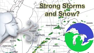
2 years agoMore Active Weather Ahead, Thunderstorms AND Snow in One Week -Great Lakes Weather
4 -
 9:13
9:13
TiffanysContent
5 months agoChicago Fog, Gulf Coast Flood, ThunderStorms, Freezing Rain, Snow, Atmospheric River
41 -
 6:46
6:46
The Siouxland StormTrack Weather Channel
1 year agoSioux City Weather Forecast
7.06K -
 14:17
14:17
Great Lakes Weather
8 months agoStrong Thunderstorms Possible in Michigan Tomorrow; Snow In the Forecast -Great Lakes Weather
18 -
 5:18
5:18
NCTV45
1 year agoNCTV45’S LAWRENCE COUNTY 45 WEATHER 2022 THUR FEB 16 2023 PLEASE SHARE
2 -
 14:13
14:13
NCTV45
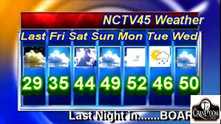
1 year agoNCTV45’S LAWRENCE COUNTY 45 WEATHER FRI FEB 24 2023 PLEASE SHARE
1