Gino Recchia NBC26 Weather Forecast
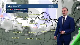
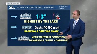
Get the shovels out because while it was a sunny start to the day, snow is on the way. It looks like tonight into Sunday morning, we will have some accumulating snow. Right now it doesn’t look to be a big storm, but a solid 1-3 inches looks likely at this time with some areas getting totals closer to 4 inches. Right along the immediate lakeshore, there are some signs that towards the end of the snowfall tomorrow morning, some embedded lake enhancement may add some locally higher totals close to 4 inches or even slightly higher depending on how this plays out. The best shot of see this enhancement and locally higher totals will be across the Door Peninsula. Temperatures will get into the upper 20s to lower 30s on Sunday with cloudy skies and winds shifting to the south to southeast direction in the morning to the west/northwest direction by the evening. There’s a snow storm that will move through the Southern Great Lakes area Monday. Right now it’s showing us missing the brunt of the storm, but maybe some lake effect or light snow could work its way up to the far southern Fox Valley. Anyone planning to drive south towards Illinois should monitor the forecast. Afterwords, it'll be back to a quiet stretch of weather for most of the work week. I don't see any concerning changes in the weather pattern. Temperatures will remain in the mid 20s for most of the work week. By the weekend however, we will be getting above average with temperatures back in the 30s. That will start melting our snow pack
-
 3:43
3:43
WGBA
2 years agoGino Recchia NBC26 Weather Forecast
6 -
 5:08
5:08
WGBA
1 year agoGino Recchia NBC26 Weather Forecast
14 -
 12:19
12:19
Great Lakes Weather
2 years agoMore Active Weather Ahead, Thunderstorms AND Snow in One Week -Great Lakes Weather
4 -
 15:40
15:40
Great Lakes Weather
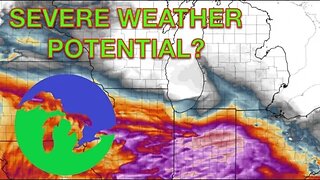
9 months agoSupercell Sunday: Severe Weather Potential for Michigan and Indiana -Great Lakes Weather
14 -
 14:17
14:17
Great Lakes Weather
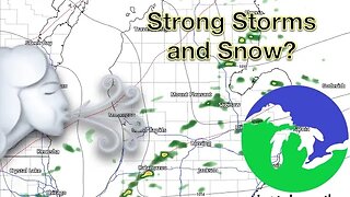
6 months agoStrong Thunderstorms Possible in Michigan Tomorrow; Snow In the Forecast -Great Lakes Weather
18 -
 18:00
18:00
Great Lakes Weather
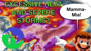
8 months agoHEAT WAVE and Possible Severe Thunderstorms Through the Week -Great Lakes Weather
32 -
 17:25
17:25
Great Lakes Weather
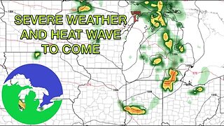
9 months agoSevere Weather Potential Next Week with a Possible Heat Wave To Come -Great Lakes Weather
34 -
 15:19
15:19
Great Lakes Weather
1 year agoSevere Weather Potential Returns to the Great Lakes Region -Great Lakes Weather
4 -
 18:33
18:33
Great Lakes Weather
1 year agoRED ALERT: Dangerous Blizzard Likely in Michigan, Indiana -Great Lakes Weather
10 -
 15:00
15:00
Great Lakes Weather
5 months agoWidespread Snowfall Event Expected in Michigan Starting this Weekend -Great Lakes Weather
27