Gino Recchia NBC26 Weather Forecast
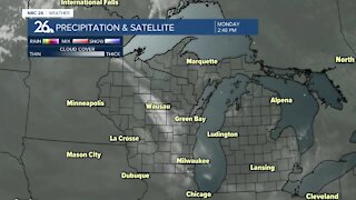
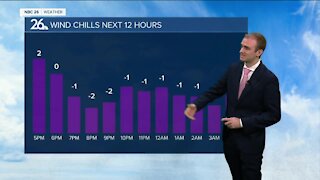
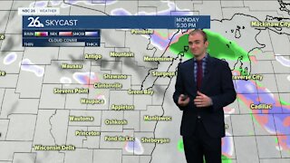
Dry air is getting sucked into the snow storm tonight which will cut down on totals across most of the area. 2-4 inches will fall across most of Northeast Wisconsin tonight with 4-6 inches near the shore from Manitowoc County and southward. The dry air will return in a mixture of light snow and freezing drizzle to last into parts of the overnight. Any remaining moisture will end from this storm by the early morning. Temperatures will remain in the upper 20s to lower 30s overnight. Winds will turn out of the west later in the morning and start to drop our temperatures slowly throughout the day. Wind chills by late Wednesday evening will probably be in the lower teens or single digits. We will have sunny skies Thursday between storm systems. Highs will be in the lower to mid 20s with light southwest winds. There will be another chance of snow on Friday, but with the low pressure developing in Texas, the track may shift very easily putting us out of any additional accumulation. Right now if we do see snowfall from this storm, it's looking like a few inches with the potential for also some sleet or freezing rain depending on how much warm air gets brought in. Saturday and Sunday will see highs in the upper 20s to lower 30s with partly cloudy to mostly sunny skies.
-
 1:45
1:45
WGBA
10 months agoFond du Lac Cardinals start the football season with a new $5.3 million nest
158 -
 3:25
3:25
WGBA
3 years agoGino Recchia NBC26 Weather Forecast
7 -
 4:15
4:15
WGBA
3 years agoGino Recchia NBC26 Weather Forecast
3 -
 3:21
3:21
WGBA
3 years agoGino Recchia NBC26 Weather Forecast
3 -
 3:26
3:26
WGBA
3 years agoGino Recchia NBC26 Weather Forecast
1 -
 3:11
3:11
WGBA
3 years agoGino Recchia NBC26 Weather Forecast
10 -
 3:28
3:28
WGBA
3 years agoGino Recchia NBC26 Weather Forecast
13 -
 3:15
3:15
WGBA
3 years agoGino Recchia NBC26 Weather Forecast
4 -
 3:22
3:22
WGBA
3 years agoGino Recchia NBC26 Weather Forecast
12 -
 2:44
2:44
WGBA
3 years agoGino Recchia NBC26 Weather Forecast
2