Gino Recchia NBC26 Weather Forecast
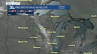
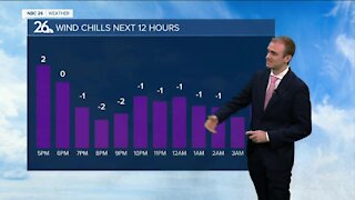
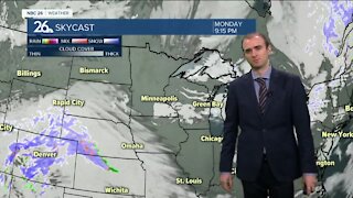
Snow is on the way tonight. It will be kind of a quick-hitter as it develops through the evening, then starts to taper off into early Wednesday morning. 3-6" will be likely for most areas in NE Wisconsin, with a little less in the far Northwoods. There may be a little more snow along or south of Highway 23. Temperatures will actually rise into the 30s through the night. Most of the snow should be out, or moving out Wednesday morning. It could even mix in with some drizzle or freezing drizzle. Salt should work fine though with highs in the lower 30s. We will have sunny skies Thursday between storm systems. Highs will be in the lower to mid 20s with light southwest winds. There will be another chance of snow on Friday, but with the low pressure developing in Texas, the track may shift very easily putting us out of any additional accumulation. Right now if we do see snowfall from this storm, it's looking like a few inches with the potential for also some sleet or freezing rain depending on how much warm air gets brought in. Saturday and Sunday will see highs in the upper 20s to lower 30s with partly cloudy to mostly sunny skies.
-
 1:45
1:45
WGBA
8 months agoFond du Lac Cardinals start the football season with a new $5.3 million nest
66 -
 3:25
3:25
WGBA
3 years agoGino Recchia NBC26 Weather Forecast
7 -
 3:21
3:21
WGBA
3 years agoGino Recchia NBC26 Weather Forecast
3 -
 3:26
3:26
WGBA
3 years agoGino Recchia NBC26 Weather Forecast
1 -
 3:11
3:11
WGBA
3 years agoGino Recchia NBC26 Weather Forecast
10 -
 3:28
3:28
WGBA
3 years agoGino Recchia NBC26 Weather Forecast
13 -
 3:15
3:15
WGBA
3 years agoGino Recchia NBC26 Weather Forecast
4 -
 3:22
3:22
WGBA
3 years agoGino Recchia NBC26 Weather Forecast
12 -
 2:44
2:44
WGBA
3 years agoGino Recchia NBC26 Weather Forecast
2 -
 5:56
5:56
WGBA
3 years agoGino Recchia NBC26 Weather Forecast
4