Gino Recchia NBC26 Weather Forecast
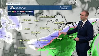
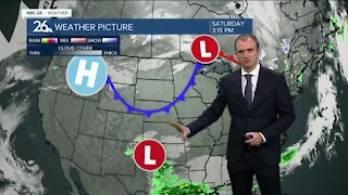
Cloudy skies are back today with highs in the upper 30s. We will also see gusty NE winds up to 25 mph. Some Lakeshore flooding is possible but there will be a better chance tonight and tomorrow for it. Tonight, we will have cloudy skies and gusty northeast winds up to 30-35 mph with temperatures falling just below freezing. Snowfall will start to move in from the south. Saturday will be a day of different weather depending where you live. Fond du Lac, Sheboygan, Manitowoc, and southeastern Calumet Counties will likely pick up several inches of snow. there may be some locally higher totals if the lake enhancement gets going. Along the immediate lakeshore, snowfall totals will likely be minimal to none do to the relatively warm lake and onshore wind. North and west of these counties, snowfall accumulations will drop off drastically because of dry air intruding on the western side of this storm. If you were to draw a line from Wautoma through Green Bay and up to Sturgeon Bay, that looks to be the farthest possible extent of seeing any snow, but accumulations will probably be a dusting at best. There is still the possibility of this forecast changing. We saw some new data last night that shifted the storm north about 50 miles, but now have shifted it further south again to its original track. It will be a gusty day as well with northeast winds up to 35-40 mph. After this storm, the weather turns quiet Sunday with subsiding winds and temperatures in the lower 30s. The sun should be back Monday and Tuesday with some cloud cover mixing in at times. Right now the temperature outlook through Christmas Eve is showing near to above average temperatures which isn’t something you would want if you’re hoping for a White Christmas.
-
 1:57
1:57
WGBA
7 months agoHow the City of Green Bay is hoping a $1.6M investment will make the community safer for pedestrians
921 -
 3:25
3:25
WGBA
3 years agoGino Recchia NBC26 Weather Forecast
7 -
 3:20
3:20
WGBA
3 years agoGino Recchia NBC26 Weather Forecast
4 -
 2:45
2:45
WGBA
3 years agoGino Recchia NBC26 Weather Forecast
4 -
 4:06
4:06
WGBA
3 years agoGino Recchia NBC26 Weather Forecast
12 -
 2:27
2:27
WGBA
3 years agoGino Recchia NBC26 Weather Forecast
7 -
 3:10
3:10
WGBA
3 years agoGino Recchia NBC26 Weather Forecast
5 -
 3:07
3:07
WGBA
3 years agoGino Recchia NBC26 Weather Forecast
2 -
 2:44
2:44
WGBA
3 years agoGino Recchia NBC26 Weather Forecast
3 -
 3:10
3:10
WGBA
3 years agoGino Recchia NBC26 Weather Forecast
20