Gino Recchia NBC26 Weather Forecast
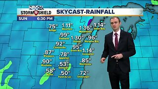
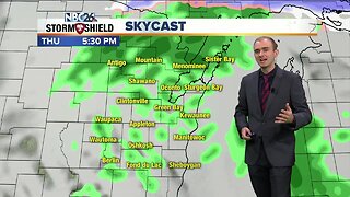
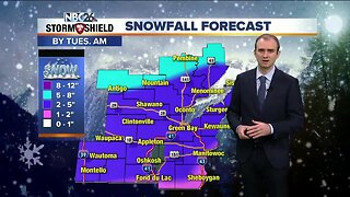
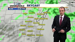
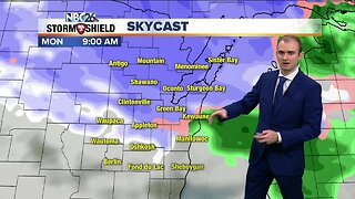
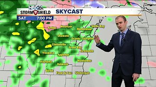
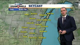
Later tonight, a light round of snow will impact parts of the area with minimal accumulations of up to 1-2", but less NW of the Fox Valley. Temperatures will fall to around 20 by Saturday morning and winds will be picking up rapidly out of the northeast with gusts approaching 30 mph. There is sill some uncertainty with the snow over the weekend, but the main round would move through on Saturday night. The farther you live to the SE, the more snow you will see. Green Bay and the Fox Cities looks like the potential of a moderate snow of 3-6", towards Sheboygan, 6-10", and lesser amounts NW. If you move this storm NW, all of our totals are going to go up. If the trend of this going SE and weakening continues, we're going to have to lower these totals even further. There will be a lot of wind with this system though and some lake enhancement will be likely for shoreline areas. Snowfall will be ending by 3-5 am. The Tundra will be frozen at kickoff on Sunday, but it won't be that cold with temps in the lower to mid 20s. Late Sunday night into Monday morning there is a weak disturbance that will bring a dusting to two inches of snow through our area. We're also watching the for the chance some snow as a couple of systems move across the Great Lakes next week.
-
 1:45
1:45
WGBA
9 months agoFond du Lac Cardinals start the football season with a new $5.3 million nest
108 -
 2:52
2:52
WGBA
4 years agoGino Recchia NBC26 Weather Forecast
10 -
 3:53
3:53
WGBA
4 years agoGino Recchia NBC26 Weather Forecast
37 -
 3:37
3:37
WGBA
4 years agoGino Recchia NBC26 Weather Forecast
1 -
 3:45
3:45
WGBA
4 years agoGino Recchia NBC26 Weather Forecast
8 -
 5:11
5:11
WGBA
4 years agoGino Recchia NBC26 Weather Forecast
25 -
 4:00
4:00
WGBA
4 years agoGino Recchia NBC26 Weather Forecast
9 -
 4:33
4:33
WGBA
4 years agoGino Recchia NBC26 Weather Forecast
21 -
 3:53
3:53
WGBA
4 years agoGino Recchia NBC26 Weather Forecast
12 -
 3:14
3:14
WGBA
4 years agoGino Recchia NBC26 Weather Forecast
20