NBC26 Storm Shield Forecast
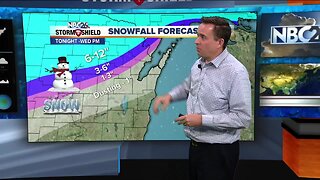
Today looks cool, but dry with highs in the upper 30s to lower 40s. Cloudiness will be increasing throughout the day. There is a system approaching the area which will increase our chances of precipitation later tonight with a wintry mix changing to some snow. There may be a little accumulation by morning. The winds will be picking up with lows around 30. As of the latest data, this is going to be close for Halloween. It still looks like some snow will be moving through that will accumulate in most places. Green Bay and the Fox Cities are in the 1-3" range where farther SE toward Sheboygan and SE Fond du Lac County, they may see 3-4". Farther NW, you may only see a trace-1". There still is some uncertainty with this system. Either way.....parts of the area could once again see accumulating snow, especially the farther southeast you live. It will be blustery and cold with highs only in the upper-30s. This will be moving out through Halloween evening, but it will still be blustery and cold with trick or treaters dealing with temps in the mid-30s. There will be a slight chance of a light shower Friday afternoon with highs struggling to make it to 40. Temps will be COLD as we head into November!!
-
 1:48
1:48
WGBA
4 years agoNBC26 Storm Shield Forecast
10 -
 1:01
1:01
WGBA
4 years agoNBC26 Storm Shield Forecast
16 -
 2:16
2:16
Mohibbanchannels
3 months agoThundersnow Storm
251 -
 9:45
9:45
Great Lakes Weather
9 months agoIsolated Severe Storms Possible Tomorrow, Cooler Weather Ahead -Great Lakes Weather
4 -
 7:19
7:19
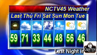
NCTV45
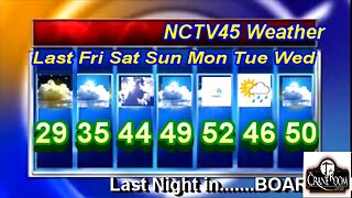
1 year agoNCTV45’S LAWRENCE COUNTY 45 WEATHER WED FEB 22 2023 PLEASE SHARE
1 -
 10:34
10:34
Great Lakes Weather
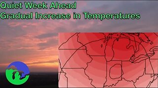
9 months agoThunderstorms Tuesday; Quiet Pattern Ahead with Gradual Warming Trend -Great Lakes Weather
4 -
 12:19
12:19
Great Lakes Weather
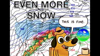
2 years agoMore Active Weather Ahead, Thunderstorms AND Snow in One Week -Great Lakes Weather
4 -
 14:13
14:13
NCTV45
1 year agoNCTV45’S LAWRENCE COUNTY 45 WEATHER FRI FEB 24 2023 PLEASE SHARE
1 -
 0:14
0:14
Shelisa45
3 years ago $0.09 earnedSnow Storm Coming
575 -
 7:03
7:03
NCTV45
1 year agoNCTV45’S LAWRENCE COUNTY 45 WEATHER THU FEB 23 2023 PLEASE SHARE
1