NBC26 Storm Shield Forecast
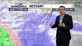
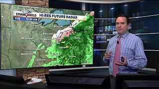
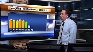
Mainly sunny skies are back today, though it will be a bit windy at times with highs in the lower/mid 40s. There will be a slight chance of a wintry mix late tonight with lows in the upper-20s. Wednesday will be cloudy with a few rain/snow showers. If there is any snow accumulation it would be very minor. Highs will be around 40. Heading into Thursday and Friday, the forecast gets more active. As of right now, most of NE Wisconsin looks to see more of the precipitation as rain starting on Thursday and going into Thursday night. That may start to change to a little snow as we head into Friday morning. This could be a decent rain- and wind-maker kicking up the rivers and moving ice around on Lake Winnebago and the Bay into Friday. However this storm tracks, after it exits the region, temperatures will fall into the teens by Saturday Morning with highs possibly not breaking the freezing mark for daytime highs. This should be short lived as more seasonable temperatures returning Sunday.
-
 0:30
0:30
WGBA
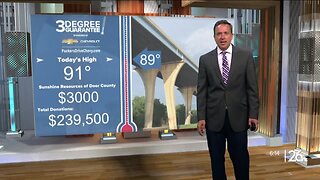
9 months agoThree Degree Guarantee
123 -
 3:20
3:20
WGBA
4 years agoNBC26 Storm Shield Forecast
5 -
 3:22
3:22
WGBA
4 years agoNBC26 Storm Shield Forecast
7 -
 3:02
3:02
WGBA
4 years agoNBC26 Storm Shield Forecast
7 -
 3:09
3:09
WGBA
4 years agoNBC26 Storm Shield Forecast
12 -
 1:40
1:40
WGBA
4 years agoNBC26 Storm Shield Forecast
12 -
 3:46
3:46
WGBA
4 years agoNBC26 Storm Shield Forecast
24 -
 3:46
3:46
WGBA
4 years agoNBC26 Storm Shield Forecast
22 -
 4:38
4:38
WGBA
4 years agoNBC26 Storm Shield Forecast
15 -
 2:04
2:04
WGBA
4 years agoNBC26 Storm Shield Forecast
11