Gino Recchia NBC26 Storm Shield Weather Forecast
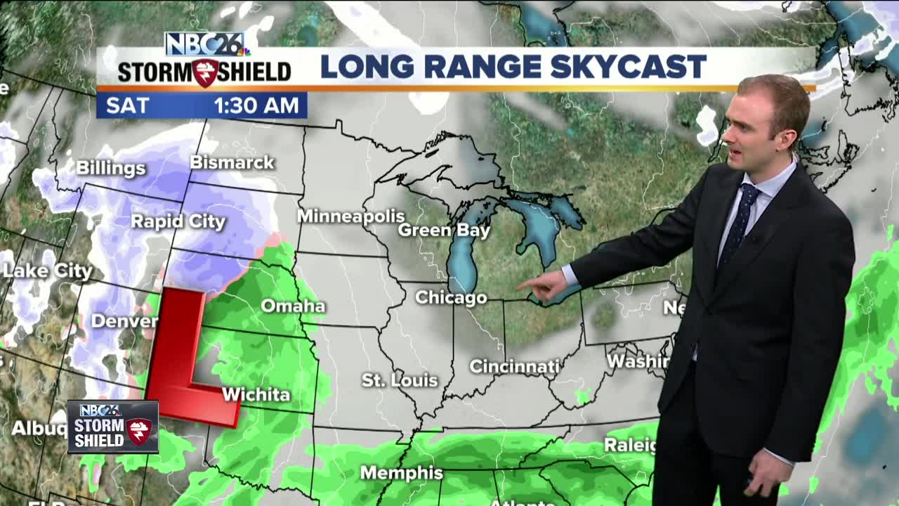
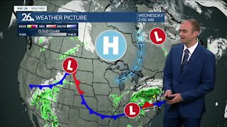
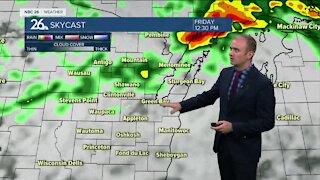
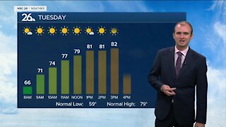
Tonight, clouds will be on the increase, but still kind of cold with lows in the single digits. Winds will be light out of the southwest around 3 to 5 mph. Friday won't be as cold with highs in the low-30s in the afternoon. Winds will be out of the southwest around 4 to 8 mph with mostly cloudy skies. Average highs tomorrow run in the mid 30s so we will still be slightly below normal. A messy storm system moves in during the weekend. Right now it looks like areas along and north of Highway 29 will have the better chance of seeing several inches of accumulating snowfall. Areas to the south will see more of a wintry mix with some snow followed by a transition over to rainfall as this low pressure moves through Wisconsin Saturday evening into Sunday. High temperatures will be in the lower to mid 30s As this storm moves out of the area, cooler air will wrap behind it and cause any wintry mix to transition over to snowfall. High temperatures on Sunday will also be in the lower to mid 30s so while s now will be falling, some locations will see little to no accumulation. The sun comes back out Monday with highs around 30. Then we gradually warm up into the lower 40s by Wednesday but it does come with a risk of some light rainfall.
-
 1:57
1:57
WGBA
1 year agoHow the City of Green Bay is hoping a $1.6M investment will make the community safer for pedestrians
4742 -
 3:24
3:24
WGBA
4 years agoGino Recchia NBC26 Weather Forecast
2 -
 3:54
3:54
WGBA
4 years agoGino Recchia NBC26 Weather Forecast
2 -
 2:46
2:46
WGBA
4 years agoGino Recchia NBC26 Weather Forecast
2 -
 3:14
3:14
WGBA
3 years agoGino Recchia NBC26 Weather Forecast
9 -
 2:52
2:52
WGBA
3 years agoGino Recchia NBC26 Weather Forecast
5 -
 3:01
3:01
WGBA
4 years agoGino Recchia NBC26 Weather Forecast
5 -
 2:54
2:54
WGBA
4 years agoGino Recchia NBC26 Weather Forecast
3 -
 2:41
2:41
WGBA
4 years agoGino Recchia NBC26 Weather Forecast
2 -
 3:33
3:33
WGBA
4 years agoGino Recchia NBC26 Weather Forecast
6