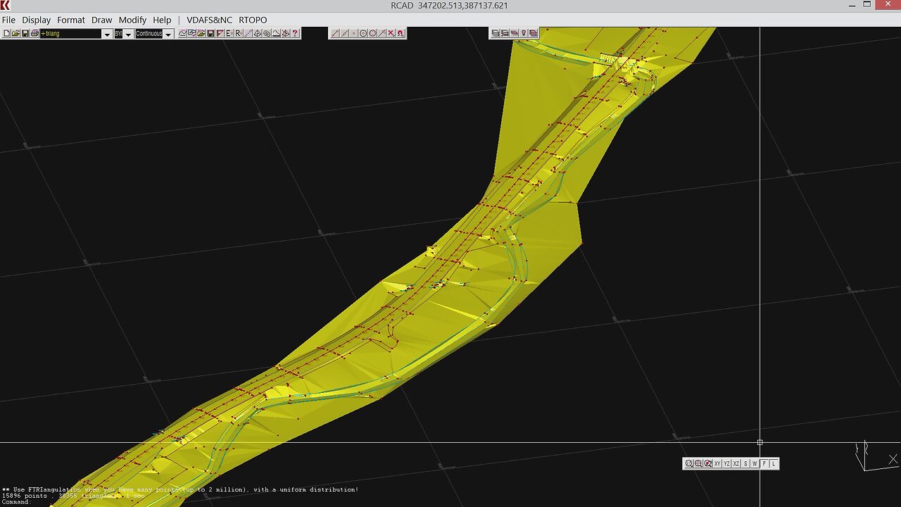
RTOPO Hydrology, Simulating rainwater runoff
1 year ago
25
RTOPO is a CAD software for topography, editing XYZ files, triangulation, contour lines, sections and simulation of rainwater flow.
You can identify the watershed, the direction and meaning of the water flow, the flooded areas, the speed and level of the water.
You can set: the amounts of precipitation and infiltration into the soil, the roughness of the land, the calculation time increment, the duration of the precipitation, the total duration greater than or equal to the duration of the precipitation and drawing the water level at every moment.
https://rcad.eu/rtopo/
See also https://rumble.com/v3v3xdg-rtopo-hydrology-cad-for-topography-editing-xyz-point-files.html
Loading comments...
-
 1:34:24
Redacted News
2 hours agoLIVE: Minnesota School Shooter’s Shocking Motive Revealed – Plus Trump Targets Soros w AG Ken Paxton
122K109 -
 4:55:15
StoneMountain64
5 hours agoHUNTING FOR THE FIRST WIN BACK ON WARZONE
45.5K2 -
 1:09:06
The Officer Tatum
3 hours agoBREAKING: Shooter IDENTIFIED TR*NS , Cracker Barrel CAVES To Pressure + MORE | EP 162
37K47 -
 53:47
53:47
Matt Kohrs
3 hours agoLIVE! Nvidia Earnings Call || NVDA Stock Reaction
18K1 -
 32:25
32:25
Tudor Dixon
1 hour agoKarol Markowicz on Freedom, Immigration, and Saving the American Dream | The Tudor Dixon Podcast
51 -
 2:03:25
The Quartering
5 hours agoFlag Burning, Free Speech, Church Attack & More With Andrew Wilson
187K297 -

The Robert Scott Bell Show
20 hours agoDr. Peter McCullough, Vaccines: Mythology, Ideology, and Reality, Dr. Dan Sullivan, Chiropractic - The RSB Show 8-27-25
18K -
 1:21:03
Darkhorse Podcast
5 hours agoFreedom, Tyranny, and Childhood Lost: The 291st Evolutionary Lens w/ Bret Weinstein & Heather Heying
34.2K17 -
 LIVE
LIVE
LFA TV
11 hours agoLFA TV ALL DAY STREAM - WEDNESDAY 8/27/25
1,322 watching -
 2:34:01
Steven Crowder
5 hours agoBREAKING: Minnesota Catholic School Shooting Update - Shooter & Manifesto
319K494