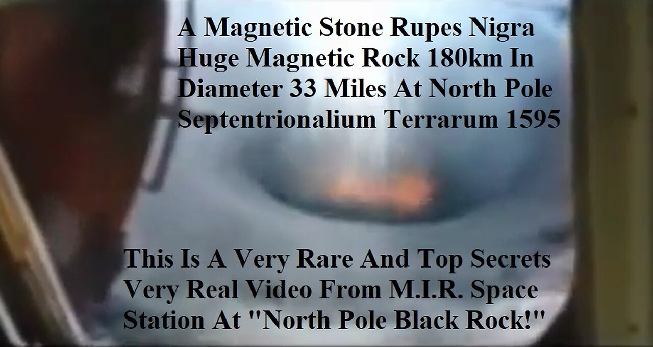
Magnetic Stone Rupes Nigra Huge Magnetic Rock 180km In Diameter At North Pole
This Is A Very Rare And Top Secrets Real Video From M.I.R. Space Station of the North Pole Septentrionalium Terrarum descriptio - Magnetic Stone The Rupes Nigra ("Black Rock") 1595 First Edition Mercator Map of the Arctic (1st Map of the North Pole) Hello my friends. this is an ancient map of the north pole. The North Pole as a magnetic mountain goes back at least to Roman times. the North Pole as a magnetic mountain surrounded by a circular continent divided by four powerful rivers from maps Martin Behaim's 1492 globe shows, at the arctic pole there is a high magnetic rock, thirty-three German miles in circumference. A surging sea surrounds this rock, as if the water were discharged downward from a vase through an opening. Around it are islands, two of which are inhabited."
Mercator's map from 1595 showing the Arctic continent, with the "Rupes nigra et altissima" ('black and highest rock') at its centre. The Rock is the site of the North Pole, captioned as the POLVS ARCTICVS. Gerardus Mercator's world map of 1569 reflects his reading of Cnoyen's Itinerarium. It also features a marginal note alluding to the Franciscan's "discovery",
"we have taken [the Arctic geography] from the Itinerium of Jacobus Cnoyen of the Hague, who makes some citations from the Gesta of Arthur of Britain; however, the greater and most important part he learned from a certain priest at the court of the king of Norway in 1364. He was descended in the fifth generation from those whom Arthur had sent to inhabit these lands, and he related that in the year 1360 a certain Minorite, an Englishman from Oxford, a mathematician, went to those islands; leaving them, advanced still farther by magic arts and mapped out all and measured them by an astrolabe in practically the subjoined figure, as we have learned from Jacobus.The four canals there pictured he said flow with such current to the inner whirlpool, that if vessels once enter they cannot be driven back by wind."
The Arctic map inset on Mercator's 1569 world map was the prototype for the influential and widely circulated Septentrionalium Terrarum of 1595, posthumously published by his son, and the maps in Ortelius's Theatrum Orbis Terrarum of 1570. Both show the same configuration of the arctic regions as the 1569 map.
In his letter to Dee, Mercator further quotes Cnoyen's description of the Northern regions:
"...In the midst of the four countries is a Whirlpool into which there empty these four Indrawing Seas which divides the North. And the water rushes round and descends into the earth just as if one were pouring it through a filter funnel. It is 4 degrees wide on every side of the Pole, that is to say eight degrees altogether. Except that right under the Pole there lies a bare rock in the midst of the Sea. Its circumference is almost 33 French miles, and it is all of magnetic stone. And is as high as the clouds, so the Priest said, who had received the astrolabe from this Minorite in exchange for a Testament. And the Minorite himself had heard that one can see all round it from the Sea, and that it is black and glistening. And nothing grows thereon, for there is not so much as a handful of soil on it."
More interesting to modern researchers are the people the friar encountered, "pygmies" who may well be identical with the Skrælings referred to in old Norse texts about Greenland, predecessors of the modern Inuit.
The John Day letter
In 1956 a letter referring to the existence of the book was found in the Archivo General de Simancas (Spain) from the English merchant John Day to "The Most Magnificent And Most Worthy Lord - The Lord Grand Admiral" (presumably Christopher Columbus).
written in either December 1497 or January 1498, John Day says,
"Your Lordship's servant brought me your letter. I have seen its contents and I would be most desirous and most happy to serve you. I do not find the book Inventio Fortunata, and I thought that I (or he) was bringing it with my things, and I am very sorry not [to] find it because I wanted very much to serve you. I am sending the other book of Marco Polo and a copy of the land which has been found [by John Cabot]… The Rupes Nigra ("Black Rock"), a phantom island, is believed to be a 33-mile-wide black rock (Mercator actually describes the rock's circumference as 33 "French" miles) located at the Magnetic North Pole or at the North Pole itself.It purportedly explains why all compasses point to this location.comes from a lost work titled Inventio Fortunata, and the island features on maps from the sixteenth and seventeenth centuries, including those of Gerardus Mercator and his successors.Mercator describes the island in a 1577 letter to John Dee:
In the midst of the four countries is a Whirl-pool, into which there are empty these four indrawing Seas which divide the North. And the water rushes round and descends into the Earth just as if one were pouring it through a filter funnel. It is four degrees wide on every side of the Pole, that is to say eight degrees altogether. Except that right under the Pole there lies a bare Rock in the midst of the Sea. Its circumference is almost 33 French miles, and it is all of magnetic Stone [Jacobus Cnoyen] years ago.
Gerard Mercator (March 5, 1512 - December 2, 1594) is a seminal figure in the history of cartography. Mercator was born near Antwerp as Gerard de Cremere in Rupelmonde. He studied Latin, mathematics, and religion in Rupelmonde before his Uncle, Gisbert, a priest, arranged for him to be sent to Hertogenbosch to study under the Brothers of the Common Life. There he was taught by the celebrated Dutch humanist Georgius Macropedius (Joris van Lanckvelt; April 1487 - July 1558). It was there that he changed him name, adapting the Latin term for 'Merchant', that is 'Mercator'. He went on to study at the University of Louvain. After some time, he left Louvain to travel extensively, but returned in 1534 to study mathematics under Gemma Frisius (1508 - 1555).
He produced his first world map in 1538 - notable as being the first to represent North America stretching from the Arctic to the southern polar regions. This impressive work earned him the patronage of the Emperor Charles V, for whom along with Van der Heyden and Gemma Frisius, he constructed a terrestrial globe. He then produced an important 1541 globe - the first to offer rhumb lines. Despite growing fame and imperial patronage, Mercator was accused of heresy and in 1552.
His accusations were partially due to his Protestant faith, and partly due to his travels, which aroused suspicion. After being released from prison with the support of the University of Louvain, he resumed his cartographic work. It was during this period that he became a close fried to English polymath John Dee (1527 - 1609), who arrived in Louvain in 1548, and with whom Mercator maintained a lifelong correspondence. In 1552, Mercator set himself up as a cartographer in Duisburg and began work on his revised edition of Ptolemy's Geographia. He also taught mathematics in Duisburg from 1559 to 1562. In 1564, he became the Court Cosmographer to Duke Wilhelm of Cleve. During this period, he began to perfect the novel projection for which he is best remembered.
The 'Mercator Projection' was first used in 1569 for a massive world map on 18 sheets. On May 5, 1590 Mercator had a stroke which left him paralyzed on his left side. He slowly recovered but suffered frustration at his inability to continue making maps. By 1592, he recovered enough that he was able to work again but by that time he was losing his vision. He had a second stroke near the end of 1593, after which he briefly lost speech. He recovered some power of speech before a third stroke marked his end. Following Mercator's death his descendants, particularly his youngest son Rumold (1541 - December 31, 1599) completed many of his maps and in 1595, published his Atlas. Nonetheless, lacking their father's drive and genius, the firm but languished under heavy competition from Abraham Ortelius. It was not until Mercator's plates were purchased and republished (Mercator / Hondius) by Henricus Hondius II (1597 - 1651) and Jan Jansson (1588 - 1664) that his position as the preeminent cartographer of the age was re-established.
Jodocus Hondius (October, 14 1563 - February 12, 1612) was an important Dutch cartographer active in the late 16th and early 17th centuries. His common name, Jodocus Hondius is actually a Latinized version of his Dutch name, Joost de Hondt. He is also sometimes referred to as Jodocus Hondius the Elder to distinguish him from his sons. Hondius was a Flemish artist, engraver, and cartographer. He is best known for his early maps of the New World and Europe, for re-establishing the reputation of the work of Gerard Mercator, and for his portraits of Francis Drake. Hondius was born and raised in Ghent. In his early years he established himself as an engraver, instrument maker and globe maker.
In 1584 he moved to London to escape religious difficulties in Flanders. During his stay in England, Hondius was instrumental in publicizing the work of Francis Drake, who had made a circumnavigation of the world in the late 1570s. In particular, in 1589 Hondius produced a now famous map of the cove of New Albion, where Drake briefly established a settlement on the west coast of North America. Hondius' map was based on journal and eyewitness accounts of the trip and has long fueled speculation about the precise location of Drake's landing, which has not yet been firmly established by historians.
Hondius is also thought to be the artist of several well-known portraits of Drake that are now in the National Portrait Gallery in London. In 1593, Hondius returned to Amsterdam, where he remained until the end of his life. In 1604, he purchased the plates of Gerard Mercator's Atlas from Mercator's grandson. Mercator's work had languished in comparison to the rival atlas, Theatrum Orbis Terrarum by Ortelius. Hondius republished Mercator's work with 36 additional maps, including several which he himself produced. Despite the addition of his own contributions, Hondius recognizing the prestige of Mercator's name, gave Mercator full credit as the author of the work, listing himself as the publisher. Hondius' new edition of Mercator revived the great cartographer's reputation and was a great success, selling out after a year. Hondius later published a second edition, as well as a pocket version called the Atlas Minor.
The maps have since become known as the "Mercator/Hondius series". Between 1605 and 1610 Hondius was employed by John Speed to engrave the plates for Speed's The Theatre of the Empire of Great Britaine. Following Hondius' death in 1612, his publishing work in Amsterdam was continued by his widow and two sons, Jodocus II and Henricus. Later his family formed a partnership with Jan Jansson, whose name appears on the Atlasas co-publisher after 1633. Eventually, starting with the first 1606 edition in Latin, about 50 editions of the Atlas were released in the main European languages. In the Islamic world, the atlas was partially translated by the Turkish scholar Katip Çelebi. The series is sometimes called the 'Mercator/Hondius/Jansson' series because of Jansson's later contributions. Hondius' is also credited with a number of important cartographic innovations including the introduction of decorative map borders and contributions to the evolution of 17th century Dutch wall maps. The work of Hondius was essential to the establishment Amsterdam as the center of cartography in Europe in the 17th century.
This is the first edition, first state of Gerard Mercator's seminal 1595 map of the Arctic, the great cartographer's most interesting and important atlas map. In this first edition, it is the scarcest of Mercator's atlas maps and a holy grail for any Arctic collector. For all its flaws and inaccuracies, it is a schematized interpretation of factual voyages between Norway, England, Iceland, Greenland, and Labrador (Markland).
Context of this Polar Projection
Mercator's Arctic projection has its roots in a magnificent 1569 wall map of the world in which Mercator first introduces his revolutionary projection. The difficulty with the Mercator Projection is that it dramatically inflates the appearance of size it draws near to the poles: its application to the polar regions themselves would result in an infinitely tall map. Mercator therefore included a polar projection, very similar to the map shown here, in the lower-left corner of his wall map. Mercator produced the present map, expanded and updated from his wall map, for inclusion in the first edition of his Atlas, published posthumously in 1595. As such, it is the first specific separate map of the Arctic.
At the North Pole, Mercator depicts a large black rock, the Rupes Nigra, surrounded by a great whirlpool fed by four powerful rivers - 'the Indrawing Seas'. These divide a massive continent-sized landmass into four distinct islands. When the English polymath John Dee wrote to Mercator asking about his sources for this map, Mercator returned the following letter which survives in his own hand (April 20, 1577, British Library):
In the midst of the four countries is a Whirl-pool, into which there empty these four indrawing Seas which divide the North. And the water rushes round and descends into the Earth just as if one were pouring it through a filter funnel. It is four degrees wide on every side of the Pole, that is to say eight degrees altogether. Except that right under the Pole there lies a bare Rock in the midst of the Sea. Its circumference is almost 33 French miles, and it is all of magnetic Stone (…) This is word for word everything that I copied out of this author years ago.
The author to which Mercator referred is the Dutch traveler Jacobus Cnoyen van Tsertoghenbosche, whose report combined firsthand encounters with interpretations of an enigmatic lost work, the Inventio Fortunata (Fortunate Discoveries). This 14th century work, now largely forgotten, was a well-known resource for cartographers of the 15th and 16th centuries. The mysterious author may have been Nicholas of Lynn, Thomas Kingsbury, or Hugh of Ireland. The work told of a Minorite monk from Oxford who traveled extensively in northern lands, including Iceland, Greenland, Norway, and possibly even Labrador. The Inventio also cited far older lost works, the Principio Gestorum Arturi and the Leges Anglorum Londoniis Collectae, which contributed a chapter to the legend of King Arthur, casting him as a 6th century Arctic explorer, and describing Arthurian conquests of Iceland, Greenland, the Faeroes, parts of Norway, and even the North Pole.
King Arthur - Arctic Explorer
The Inventio described Arthur's invading Arctic army as consisting of some 4000 men on 12 ships. He sent the army into one of these 'indrawing seas', apparently the only way to bypass the 'Encircling Arctic Mountains'. According to John Dee, in Arthur's time there were cities lying beyond those mountains. Perhaps unsurprisingly, no further report of this momentous invasion appears in Arthurian record.
In the fourteenth century, at the court of King Håkan Magnusson (1340 - 1380) in Norway, Cnoyen met and interviewed eight travelers from northern regions. One, a priest, even carried an astrolabe. Historian E. G. Taylor ('A letter dated 1577 from Mercator to John Dee.' Imago Mundi 13:56–68) believed Cnoyen's voyagers were Norse settlers from 'Greenland, or even . . . a group from Markland (Labrador).' The combination of concrete voyager's reports with the tantalizing, remote voyages of a legendary king helped cement Mercator's formulation of the Arctic as he presented here.
The Magnetic North
The black rock at the pole, the Rupes Nigra, also came to Mercator from Cnoyen, who reported that it was made of magnetic stone (an explanation the wonders of the compass). Mercator, however, did not ascribe to Rupes Negra the magnetic properties claimed by Cnoyen. Instead, Mercator placed a different magnetic rock to the north of the Strait of Anian, and it was this that he identified as the magnetic pole: an attempt to explain the correct observation that the geographic pole and the magnetic pole were not the same.
Perilous Waters
The placement, both by medieval scholars and Mercator, of violent currents and whirlpools in the northern waters was neither isolated nor fanciful. The Lofoten Maelstrom on the coast of Norway inspired many early legends, for example. The explorers John Davis and Martin Frobisher both believed the strong currents that they encountered corresponded to Mercator's polar rivers and their descriptions reflected such:
This place seemeth to have a marvellous great indrafte, and draweth in to it most of the drift ice and other things which doe flote in the sea (George Best - Martin Frobisher's Lieutenant)
which inlet or gulfe this afternoone and in the night we passed over: where to our great admiration we saw the sea falling down into the gulfe with a mighty overfal and roaring, and with divers circular motions like whirle-pooles. (James Davis)
It is hard to know exactly what these navigators witnessed, but there can be no doubt that Arctic currents in Davis's Strait are powerful and erratic. Mercator was not in doubt: at the southern opening of Davis Strait, he noted in English, 'a furious over fall.'
Indigenous Peoples
Throughout the map are references to remote Indigenous populations. These include the Samoyed people of Siberia (described here as cannibals), and the Zolotaya Baba or 'Golden Woman,' an idol worshipped by indigenes on the Ob River. This probably derives from Sigismund von Herberstein's (1486 - 1566) 1557 map of Muscovy which included the idol. Ir is very likely that Herberstein's book informed Mercator's geography for Siberia, as did the small map of Maciej Miechowita (1457 - 1523). Further north, the Latin text on the island north of Norway notes 'Here live pygmies, at most 4 feet tall, who are like those in Greenland called Scraelings.' This may derive again from Cnoyen, but from his report of Norse travelers: the name 'Scraeling,' referring to the Inuit of Greenland, was a Viking term. It also appeared in the Sagas referring to abortive Viking efforts to colonize Vinland. Placing the Inuit on that particular Arctic island, neighboring Greenland, would be a reasonable assumption; after all, Mercator notes the presence of Scraelings in Greenland as well.
Zeno anf Frisland
The difficulty Mercator confronted in presenting a map of such remote regions is not just that the sources available to him were few, but that they could not be confirmed - resulting in the perpetuation of geographical information that was arguably concocted deceptively. Hence, his inclusion of the imaginary island of Frisland, which appears between Greenland and Iceland. Mercator's delineation of this region is drawn from the 1558 map of Nicolo Zeno the younger, informed by the purported explorations of his ancestors Nicolo and Antonio Zeno. The brothers Zeno allegedly explored the coasts of Greenland and Labrador in the 14th century, and as such were held forth as a Venetian discovery of America. Modern historical consensus has been that Nicolo the Younger's map was a hoax, with a minority of dissenters considering it a confused re-telling of a legitimate voyage. Some archival evidence places the Zeno brothers in Venice at the time they were supposedly at sea; it is possible that they never voyaged at all. Nevertheless, in the 16th century Zeno's map was accepted as legitimate. Warts and all, it represented the first attempt at mapping the remote north Atlantic, and so its many phantom islands - notably Frisland - would be included on the maps of Mercator and other cartographers well into the 17th century. Mercator thought Frisland important enough that he assigned one of three detail maps to it: the other two roundels portray the Shetland Islands and the Faroe Islands, respectively. (Iceland was afforded a full map to itself, so it is no outrage that it was not shown in greater detail here.)
Drawing on Thevet and Cartier
Mercator's mapping of North America is unique among his works. It features the 'Lago de Conibaz', a large lake with a central island and a river emptying far to the west into a great bay north of the Strait of Anian. The land directly south of the bay is named 'Bergi Regio,' while that to the north bears an astonishing Latin text reading (in translation), 'California region, known only to the Spanish.' This system bears no similarity to any other Mercator map of which we are aware. Mercator's 1569 world map obscured this whole area under a cartouche; its Arctic inset lacks Conibaz and its attached bay. Likewise, neither his 1595 America sive India Nova nor his son Rumold's 1587 world map include them. In all of these other maps, the whole region north of Anian Regnum was collectively referred to as Bergi regio, and the California reference appearing here is repeated nowhere else.
Lake Conibas, the attached bay and its rivers first appeared on the 1575 André Thevet map of America. (The system also appears, in slightly different form, on the 1593 De Jode Americae Pars Borealis.) To include it here, Mercator bisected his 'Bergi regio,' moving that placename to the south. In doing so, he created a new peninsula north of the Arctic Circle, and it is this to which he applied the California text. (It appears unlikely that even the Spanish knew about this region, since it was probably entirely the creation of Mercator.)
On the other hand, Conibaz and its attendant rivers represent an important passage of explorers' information to Mercator. Thevet is known to have met with Jacques Cartier (1491 - 1557), who explored the Saint Lawrence River and interacted with the Iroquoians. The term Conibaz may relate to 'Cornibotz' (Wampum shells). Cartier's report via Thevet appears to have been informed by his conversations with the Iroquois, and this reflects factual indigenous reports of the North American interior. Conibaz has been associated by some scholars with Great Salt Lake, Lake Ontario, or even the Great Lakes in general. Thus Mercator, and other cartographers had general knowledge of great inland lakes of North America long before Europeans actually encountered them.
Still, Mercator's application of the term 'California' to a region north of the Arctic circle is baffling. The 1595 America uses the word only to refer to the tip of the Baja Peninsula; it does not appear prominently in his 1569 world map. (Ortelius's 1570 America would apply the name to the tip of Baja; his edited 1587 America used the term for the entire peninsula.) No other map of which we are aware uses the term as it appears here. The 1593 De Jode, although it includes Thevet's bay and Lake Conibaz, more appropriately places California to the south. It may be that Mercator was simply referring to the whole of Spain's discoveries on the West Coast as 'California,' and including the Arctic regions among them, but why then did he not do so in any other map?
Revelations in Central Asia
Opposite the American side of the Strait of Anian, is the Asian land of Gog, which appears bound in a tight ring of mountains. Gog and Magog, Biblical nations from the Book of Revelations, were associated by many Europeans with the Tartars. It was believed that Alexander the Great walled off the Kingdom of Gog and Magog behind a mountain range. Many early maps, following up on this legend as well as references from the journals of Marco Polo, place either Gog or Magog in the northeastern extreme of Asia behind an impenetrable mountain range.
Publication History and Census
This first state of Mercator's Arctic map was introduced in the 1595 first edition of Mercator's Atlas sive cosmographicae… It bears the elder Mercator's imprint, and is attributed to him. (We note that the composition of this map, with its circular cartouche and insets, and acanthus borders, is reminiscent of the 1595 America sive India Nova, which was engraved by Mercator's grandson Michael.) Jodocus Hondius, having acquired the Atlas in 1606, significantly altered and updated the plate. Examples of the Mercator/ Hondius second plate remained in the atlas until 1634, and various editions of that version of the map appear on the market from time to time. This 1595 first state is virtually unobtainable.
CARTOGRAPHERS
Gerard Mercator (March 5, 1512 - December 2, 1594) is a seminal figure in the history of cartography. Mercator was born near Antwerp as Gerard de Cremere in Rupelmonde. He studied Latin, mathematics, and religion in Rupelmonde before his Uncle, Gisbert, a priest, arranged for him to be sent to Hertogenbosch to study under the Brothers of the Common Life. There he was taught by the celebrated Dutch humanist Georgius Macropedius (Joris van Lanckvelt; April 1487 - July 1558). It was there that he changed him name, adapting the Latin term for 'Merchant', that is 'Mercator'. He went on to study at the University of Louvain. After some time, he left Louvain to travel extensively, but returned in 1534 to study mathematics under Gemma Frisius (1508 - 1555). He produced his first world map in 1538 - notable as being the first to represent North America stretching from the Arctic to the southern polar regions. This impressive work earned him the patronage of the Emperor Charles V, for whom along with Van der Heyden and Gemma Frisius, he constructed a terrestrial globe. He then produced an important 1541 globe - the first to offer rhumb lines. Despite growing fame and imperial patronage, Mercator was accused of heresy and in 1552. His accusations were partially due to his Protestant faith, and partly due to his travels, which aroused suspicion. After being released from prison with the support of the University of Louvain, he resumed his cartographic work. It was during this period that he became a close fried to English polymath John Dee (1527 - 1609), who arrived in Louvain in 1548, and with whom Mercator maintained a lifelong correspondence. In 1552, Mercator set himself up as a cartographer in Duisburg and began work on his revised edition of Ptolemy's Geographia. He also taught mathematics in Duisburg from 1559 to 1562. In 1564, he became the Court Cosmographer to Duke Wilhelm of Cleve. During this period, he began to perfect the novel projection for which he is best remembered. The 'Mercator Projection' was first used in 1569 for a massive world map on 18 sheets. On May 5, 1590 Mercator had a stroke which left him paralyzed on his left side. He slowly recovered but suffered frustration at his inability to continue making maps. By 1592, he recovered enough that he was able to work again but by that time he was losing his vision. He had a second stroke near the end of 1593, after which he briefly lost speech. He recovered some power of speech before a third stroke marked his end. Following Mercator's death his descendants, particularly his youngest son Rumold (1541 - December 31, 1599) completed many of his maps and in 1595, published his Atlas. Nonetheless, lacking their father's drive and genius, the firm but languished under heavy competition from Abraham Ortelius. It was not until Mercator's plates were purchased and republished (Mercator / Hondius) by Henricus Hondius II (1597 - 1651) and Jan Jansson (1588 - 1664) that his position as the preeminent cartographer of the age was re-established.
Jodocus Hondius (October, 14 1563 - February 12, 1612) was an important Dutch cartographer active in the late 16th and early 17th centuries. His common name, Jodocus Hondius is actually a Latinized version of his Dutch name, Joost de Hondt. He is also sometimes referred to as Jodocus Hondius the Elder to distinguish him from his sons. Hondius was a Flemish artist, engraver, and cartographer. He is best known for his early maps of the New World and Europe, for re-establishing the reputation of the work of Gerard Mercator, and for his portraits of Francis Drake. Hondius was born and raised in Ghent. In his early years he established himself as an engraver, instrument maker and globe maker. In 1584 he moved to London to escape religious difficulties in Flanders. During his stay in England, Hondius was instrumental in publicizing the work of Francis Drake, who had made a circumnavigation of the world in the late 1570s. In particular, in 1589 Hondius produced a now famous map of the cove of New Albion, where Drake briefly established a settlement on the west coast of North America. Hondius' map was based on journal and eyewitness accounts of the trip and has long fueled speculation about the precise location of Drake's landing, which has not yet been firmly established by historians. Hondius is also thought to be the artist of several well-known portraits of Drake that are now in the National Portrait Gallery in London. In 1593, Hondius returned to Amsterdam, where he remained until the end of his life. In 1604, he purchased the plates of Gerard Mercator's Atlas from Mercator's grandson. Mercator's work had languished in comparison to the rival atlas, Theatrum Orbis Terrarum by Ortelius. Hondius republished Mercator's work with 36 additional maps, including several which he himself produced. Despite the addition of his own contributions, Hondius recognizing the prestige of Mercator's name, gave Mercator full credit as the author of the work, listing himself as the publisher. Hondius' new edition of Mercator revived the great cartographer's reputation and was a great success, selling out after a year. Hondius later published a second edition, as well as a pocket version called the Atlas Minor. The maps have since become known as the "Mercator/Hondius series". Between 1605 and 1610 Hondius was employed by John Speed to engrave the plates for Speed's The Theatre of the Empire of Great Britaine. Following Hondius' death in 1612, his publishing work in Amsterdam was continued by his widow and two sons, Jodocus II and Henricus. Later his family formed a partnership with Jan Jansson, whose name appears on the Atlasas co-publisher after 1633. Eventually, starting with the first 1606 edition in Latin, about 50 editions of the Atlas were released in the main European languages. In the Islamic world, the atlas was partially translated by the Turkish scholar Katip Çelebi. The series is sometimes called the 'Mercator/Hondius/Jansson' series because of Jansson's later contributions. Hondius' is also credited with a number of important cartographic innovations including the introduction of decorative map borders and contributions to the evolution of 17th century Dutch wall maps. The work of Hondius was essential to the establishment Amsterdam as the center of cartography in Europe in the 17th century.
SOURCE
Mercator, G., Atlantis Pars Altera, (Rumold Mercator) 1595. Mercator's Atlas is one of the most important works in the history of cartography. Although in fact Ortelius was the first to publish a proper atlas, the Teatrum Orbis Terrarum, Mercator's Atlas the first book to employ the term Atlas for a collection of maps. The term is derived both from the mythical titan, Atlas, who was forced to bear the world upon his shoulders, and the Libyan king, philosopher, and astronomer of the same name that, so the legend goes, constructed the first globe. Mercator dedicated the final 25 years of his life to compile the Atlas. He published two parts during his lifetime in 1585 and 1589, but the final part published posthumously by his son Rumold Mercator, in 1595. The map plates for the Atlas were later acquired by Jodocus Hondius who published the most complete and well known edition in 1606. It was Jodocus who popularized the Atlas and who did the most to elevate Gerard Mercator's work.
The North Pole, Land of Pygmies and Giant Magnets According to Mercator, the North Pole was marked by a giant black magnetic rock. Somewhere in the 14th century, a Franciscan from Oxford, a ‘priest with an astrolabe’, writes a travelogue about his discoveries in the North Atlantic, calls it the Inventio Fortunata (‘The Discovery of Fortunata’) and in 1360 presents it to the King of England.
This book has been lost since the late 15th century.
However, a Jacobus Cnoyen from the city of ‘s Hertogenbosch (in present-day Netherlands) summarizes the contents of the Inventio, related to him in 1364 in Norway by another Franciscan who had met the author. Cnoyen’s own travel-book is called the Itinerarium.
https://en.wikipedia.org/wiki/William_of_Rubruck
This book has also been lost.
https://commons.wikimedia.org/wiki/File:Mercator_Septentrionalium_Terrarum_descriptio.jpg
All this we know by the extensive quotes from the Itinerarium in a letter by the Flemish cartographer Gerhard Mercator to his friend, the English scientist, occultist and royal advisor John Dee. That letter, written in 1577 and now in the British Museum, mentions that:
“In the midst of the four countries is a Whirl-pool, into which there empty these four indrawing Seas which divide the North. And the water rushes round and descends into the Earth just as if one were pouring it through a filter funnel. It is four degrees wide on every side of the Pole, that is to say eight degrees altogether. Except that right under the Pole there lies a bare Rock in the midst of the Sea. Its circumference is almost 33 French miles, and it is all of magnetic Stone (…) This is word for word everything that I copied out of this author (i.e. Cnoyen) years ago.”
A giant magnetic rock, exactly at the North Pole… well, that would explain why all compasses point north, wouldn’t it? Alas, the ominous magnet (described in the letter as “black and glistening” and “high as the clouds”) is a bit too fantastic an explanation for the phenomenon of magnetism. For even back in the late 16th century, mariners often found that their compasses increasingly deviated from ‘true north’ as they approached it.
But only later did the separate (and wandering) location of the magnetic poles become common knowledge. In the intervening Age of Exploration (and sometimes Fabulation), Mercator cites an author who clearly hadn’t seen the North Pole with his own eyes – nor had the author he quoted, nor in fact would anyone for centuries to come.
In the meantime, the invented geography in the Inventio Fortunata that came to us via that one letter greatly influenced cartographers’ views of the Arctic region. For if no other knowledge of yet-undiscovered lands is available, there’s really not much argument against unbelievable stories.
And so, the Black Cliff, the four countries and the whirlpool are evident in Martin Behaim’s globe (1492), which predates Mercator’s map. In 1956, a letter surfaced written by the English merchant John Day in 1497 or 1498 to ‘the Lord Grand Admiral’ (probably Columbus), with Day expressing regret that he hadn’t been able to find the Inventio Fortunata for him. In a marginal note on one of Johannes Ruysch’s maps (from 1508), the Dutch cartographer even mentions that two of the continents surrounding the North Pole are inhabited.
Mercator’s late-16th-century Arctic map (Septentrionalium Terrarum, ‘Of the Northern Lands’) was the first ever to be centred on the North Pole itself. It was a mix of fact and fiction, showing some recent discoveries but also the four fanciful countries surrounding the Arctic whirlpool with in its middle the Rupes Nigra et Altissima (‘Black and Very High Cliff’), supposedly responsible for animating navigators’ compasses.
On the subject of mixing fact with fiction, Mercator incongruously includes in his map two other magnetic poles, along the 180° meridian, indicating that he did know of the magnetic deviation from the ‘true North’, but wasn’t yet prepared to ditch the preceding fabulation (thanks to Greg for pointing this out).
Mercator’s map was included in the last of three volumes constituting his ground-breaking work (the first geographic tomes to be called an Atlas). The cartographer didn’t live to see it published: the last volume was brought out by his son Rumold in 1595, the year after his death.
In 1604, cartographer Jodocus Hondius acquired the printing plates of Mercator’s Atlas, and over the years improved on the Arctic map (and others) as explorers and whalers came back with ever more accurate descriptions of the coastlines, in the case of the Arctic map especially those of Spitsbergen and Nova Zembla (also, and more correctly known as Novaya Zemlya, ‘New Land’ in Russian).
Mercator’s authoritative (but wrong) depiction of the North Pole persisted well into the 17th century, only to be dispelled gradually by real discoveries.
On the map, the Rupes Nigra can be seen surrounded by the four countries, all of which are labelled with Latin texts, some of which I can make out:
• The island on the bottom right is labelled: Pygmei hic habitant & ad summum pedes longi quem admodum illi quos in Gronlandia Screlingers vocant. Which translates as something like this: ‘Here live Pygmies and (something about long feet), like those in Greenland that are called Skraelinger’.
The island to the north of Pygmy-land is labelled: Hic euripus habet ostia et propter angustiam ac celerem fluvium nunquam congelatur. Which goes something like this: ‘This narrow channel has a harbour and due to its narrowness and swift current never freezes’.
A glance at the North Pole and its mythology, from whirlpools and giants to the indrawing sea and the Rupes Nigra.
https://www.arcus-atlantis.org.uk/horizons/magnetic-north.html
HYPERBOREA was a fabulous realm of eternal spring located in the far north beyond the home of the north wind. Its people were a blessed, long-lived race untouched by war, hard toil and the ravages of old age and disease.
Hyperborea was usually described as a continent-bound land bordered on the north by the great, earth-encircling river Okeanos (Oceanus), and on the south the peaks of the legendary Rhipaion (Rhipaean) Mountains. Its main river was the Eridanos whose banks were lined with amber-weeping poplar-trees and its waters home to flocks of white swans. Blessed with eternal spring, the land producing two crops of grain per year, but most of the countryside was wild and covered with beautiful forests--the so-called "garden of Apollon."
The southern border of Hyperborea was guarded by the bitterly cold peaks of the impassable Rhipaion (Rhipaean) mountains--home to Boreas (the North Wind) whose chill breath brought winter to the lands of the south. Its peaks were inhabited by gold-guarding Grypes (Griffins) and its valleys by the fierce, one-eyed Arimaspoi tribe. Beneath the southern slopes lay Pterophoros--a desolate, snow-covered land cursed with eternal winter.
Hyperborea was a theocracy ruled by three priests of the god Apollon. These gigantic kings, known as the Boreades, were sons of Boreas (the North Wind). Their capital contained a circular temple dedicated to the god where hecatombs (a hundred-head) of asses were sacrificed in his honour. The people also celebrated their god in an eternal festival of music, song and dance whose hymns were joined by the sweet song of the circling Hyperborean swans.
The realm plays a role in several myths. Phaethon tried to drive the chariot of the sun but lost control and was struck down by Zeus, sending his flaming body plummeting into the Hyperborean river Eridanos. His mourning sisters, the Heliades, were afterwards transformed into amber-shedding poplar trees on its banks, and his grief-stricken friend Kyknos (Cycnus) into a swan. Elderly Hyperboreans commemorated the event by leaping into the lake formed by Phaethon's fall to be transformed into white swans.
Perseus later travelled to Hyperborea and was entertained by its folk when he was searching for the Nymphs who guarded the treasures of the gods, or else the Graiai--swan-bodied hags who could reveal the location of Medousa.
Perseus' descendant Herakles made the same journey on two separate occassions. The first time was in his quest for the golden-horned deer of Artemis which fled north during the chase. The second time he sought Atlas and the golden apples of Hesperides.
Another body of stories describes Hyperboreans as pilgrim-founders of several important Greek shrines. The Delians told a tale of how the pregnant goddess Leto came to the island from Hyperborea accompanied by a pack of wolves where she gave birth to Apollon with the assistance of Eileithyia who was summoned from the northern realm to further the labour. After this event, the Hyperboreans sent pilgrims to the island--five men and several maiden-priestesses. However, after several of the maidens were either raped or killed, the Hyperboreans ended the pilgrimage and instead delivered their offerings indirectly through neighbouring tribes and peoples.
The next major shrine connected with the Hyperboreans was the oracle of Apollon at Delphoi. The second of the early, mythical temples of the shrine was said to have been built by Hyperborean pilgrims out of beeswax and feathers. When the army of the Gauls tried to seize the temple in historical times, phantoms of these prophets were said to have appeared on the battlefield, routing the army.
Finally they appear in the myths of the founding of the Olympic Games. It was said that when Herakles--either the Daktylos or the son of Zeus--established the festival in honour of Zeus he made a pilgrimage to Hyperborea to obtain sacred wild olives for the shrine.
The most famous prophet of the Hyperboreans was probably Abaris who was given a magical arrow by the god Apollon on which he flew around the world performing miracles. Some say this arrow was the one which Apollon had used to slay the Kyklopes (Cyclopes) which had been hidden beneath a Hyperborean mountain.
An Arctic Timeline : 1496-1962
The exploration of the North has extended over five hundred years and rather than finding a northwest passage to the eastern trade, it discovered a great fur trade and valuable fisheries, and even great oil fields. Early crews were often separated from their homes for years and some never returned. While hopes of finding a northwest passage was the initial objective, the ice conditions discouraged expectations of success. In the past, the problems of reaching the North Pole have been subordinate to the hope of finding, via that route, a water way to the east, and though the early north polar attempts failed in their main purpose, they resulted in the discovery of new lands and industries.
Traveling in vulnerable wooden ships first powered only by sails, they gradually changed to powerful new and innovative vehicles and a commercial trade in the north was established. But even from the beginning of polar exploration the ships that sailed with orders to attain the North Pole have been in number and importance the exception, not the rule. Attempts to reach the North Pole itself followed using stronger ships with newer designs as a base for the dashes to the almost mythical prize. Balloons and the new dirigibles were tried, followed by airships and submarines. When the Pole itself was finally reached, it proved to be a vain goal since it was just a point on the ice above a moving body of water.
The oceans of the Arctic basin and the frozen lands around it are now recognized as important study areas, and over the years virtually all exploration parties became directed toward studies of some kind.
1496: Henry VII granted "Letters patent" to John Cabot and his three sons to make voyages of discovery in "northern, eastern or western seas." The original charts and manuscripts of John Cabot and his son Sebastian have, for the most part, disappeared.
1576: Martin Frobisher's first voyage. An attempt would be made to reach Cathay through a passage to the northwest. Vessels used were two small barks, MICHAEL and GABRIEL. Frobisher, aboard the GABRIEL, crossed (now) Davis Strait between Greenland and (now) Baffin Island. They explored the vicinity of (now) Frobisher's Bay. They encountered Inuit, described as being "like to Tartars, with long blacke haire, broad faces and flatte noses and tawnie in colour, wearing Seale skinnes, and so doe the women, not differing in the fashion, but the women are marked in the face with blewe streekes downe the cheekes, and round about the eyes." On this first expedition, a rock was picked up as a souvenir in Frobisher's Bay and upon the expedition's return, the rock was assayed and said to contain gold.
1577: Martin Frobisher's second voyage to (now) Frobisher's Bay, under the auspices of the Cathay Company. The expedition was to continue the search for the Northwest Passage and to mine more of the 'gold'-bearing ore discovered the year before. The expedition remained in the bay for five weeks from 17 July to 23 August 1577 and mined about 200 tons of the ore. The AYDE, MICHAEL and GABRIEL returned to England, bringing an Eskimo man (Kalicho), woman (Arnaq) and child (Nutaaq) to Bristol. The man and woman died and were buried at St. Stephen's Church while the child died in London and was buried at St. Olaves, Hart Street.
1578: Martin Frobisher's third voyage to the Arctic. Commanding the AYDE, Frobisher led a fleet of fifteen vessels to (now) Frobisher's Bay. Over 100 miners from Cornwall and the Forest of Dean were to form a wintering party on a small island under the leadership of Captain Edward Fenton. Poor weather prevented the fleet from keeping together. Frobisher, together with several other vessels, sailed up what he called the "Mistaken Straightes," now called Hudson Strait. Most of the fleet was eventually reunited in the region where 1200 tons of "black ore" was extracted and loaded onto the ships. Upon their return to England, the ore proved to be worthless and the Cathay Company went bankrupt. Frobisher did not return to the Arctic but did retrieve his reputation firstly with Drake in the West Indies and later by his conduct as one of the main commanders of the English fleet that defeated the Spanish Armada of 1588.
1585: John Davis's first voyage in search of the Northwest Passage. The expedition, aboard the two small vessels SUNSHINE and MOONSHINE, made its first northern landfall on the east coast of Greenland. They sailed across (now) Davis Strait to (now) Baffin Island. They came ashore at (now) Cumberland Sound where two sledges were discovered "made like ours in Englande." Despite signs of inhabitants, none were encountered.
1586: John Davis's second voyage to the Arctic. The vessels MERMAID, SUNSHINE, MOONSHINE and pinnace NORTH STAR sailed up the west coast of Greenland and encountered the "people of the country" in the vicinity of Gilbert Sound, later named Godthaab Fiord. In August, they sailed westwards from Greenland, finding land on southeast Baffin Island. Two of the ship's company were surprised and killed by the "Savages" ashore.
1587: John Davis's third voyage toward the Northwest Passage. Sailing aboard the barks SUNSHINE, ELIZABETH and the pinnace ELLEN, Davis and his crews traveled up the west coast of Greenland, trading with the Greenlanders as they went. After reaching the relatively high latitude of 72° 12' North, Davis turned to the west and sighted Cumberland Sound on Baffin Island which he discovered on his first voyage. They coasted the south shore of Cumberland Sound and re-entered Davis Strait in latitude 64° North. They continued south with the Labrador current, passing a "very great gulfe" which was no doubt Hudson Strait. Upon reaching the vicinity of Labrador, they set sail across the Atlantic for Dartmouth.
1602: George Waymouth, sent by the East India Company, may have proceeded along Hudson Strait for a good distance. His vessel, DISCOVERY, is one of the earliest of a line of exploring ships bearing that name.
1610: Henry Hudson, aboard DISCOVERY, sailed westward for 450 miles through a long strait and into a great bay, both of which now bear Hudson's name. Hudson turned south and the vessel was forced to winter at the southern end of the bay because of ice. They escaped from the ice in June 1611 but soon afterwards a mutiny took place after which Hudson, his son, the sick and the Hudson loyalists were all set adrift in a boat. They were never seen again. Two of the mutineers were killed by the Eskimos at the western end of Hudson Strait while many others died on the voyage home. Stories related by the survivors were believable so all were left unpunished.
1611: Thomas Button sailed on the RESOLUTION, with the DISCOVERY in company. This voyage was to follow-up Hudson's discoveries. Two of the mutineers on Hudson's expedition, Prickett and Bylot, were among the ship's company. Part of the west coast of Hudson Bay was charted and Port Nelson, where they wintered-over, was named after one of the mates who was buried there. The RESOLUTION was crushed by the ice and sank. The DISCOVERY sailed north to what was called Sir Thomas Roe's Welcome, between Southampton Island and the east coast of America, before turning for England. A considerable length of coastline was charted on this expedition. It was also determined that no westward passage from Hudson Bay existed.
1615: Robert Bylot and William Baffin, in the DISCOVERY, sailed through Hudson Strait but found no passage northward through what became known as Frozen Strait.
1619-20: Backed by the King of Denmark, Jens Munk fails to discover the Northwest Passage. His two ships wintered near the site of the later Hudson's Bay Company post, Fort Prince of Wales, on the Churchill River.
1631-32: Two independent voyages are made through Hudson Strait and into Hudson Bay in a further attempt to find a northwest passage through this route. Captain Thomas James commanded the HENRIETTA MARIA while Captain Luke Foxe commanded the CHARLES. James Bay, at the head of Hudson Bay, and Foxe's Channel were named after the two captains.
1668: The small vessel NONSUCH sails from London through the Hudson Strait and into Hudson Bay. Her voyage opens a sea route for trade in furs with the local Indians.
1670: By royal charter, incorporation of the Hudson's Bay Company is established. King Charles II appoints his nephew, Prince Rupert, their Governor and grants the "sole trade and commerce of all those Seas Streightes Bayes Rivers Lakes Creekes and Soundes in whatsoever latitude they shall bee that lye within the entrance of the Streightes commonly called Hudson's Streightes, together with all the Landes and Territorys upon the Countryes Coasts and confynes of the Seas Bayes Lakes Rivers Creekes and Soundes aforesaid that are not actually possessed by or granted to any of our Subjectes or possessed by the Subjectes of any other Christian Prince or State." The vast territory, to be known as Rupert's Land, would comprise nearly 40% of modern Canada. Three wooden forts are built on James Bay in 1685.
1719: Provisioned by the Hudson's Bay Company, elderly Captain James Knight leads two ships in search of "minerals and to traverse the 'Strait of Anian.'" This was a mythical strait attributed to unreliable charts and globes of the time. They departed from Gravesend on the lower Thames in June 1719 and were never seen again.
1741-42: Commanded by Captain Christopher Middleton, the FURNACE and DISCOVERY sail for Hudson's Bay on June 8, 1741. The vessels winter at Sloop Cove, between the Hudson's Bay Company's fort, named after the Prince of Wales, and the recently vacated Old Factory on the Churchill River. The expedition set sail the following year towards the north where they navigated the uncharted and ice-infested waters of Sir Thomas Roe's Welcome (now Roe's Welcome Sound), between the west coast of Southampton Island and the east coast of North America. They reach a deep bay whose upper reaches touch the Arctic Circle. Middleton names it Repulse Bay as there was no passage there.
1746-47: An attempt to find the Northwest Passage is privately organized by Arthur Dobbs, a member of the Irish House of Commons. The expedition is supported by a group of merchants who form the North West Committee. Commanded by William Moor in the DOBBS and Francis Smith in the CALIFORNIA, the expedition "carried out some useful exploration in difficult conditions, but ... every move, it seemed was dogged by disagreement, ineptitude and controversy."
1770-72: On behalf of the Hudson's Bay Company, the Governor of Fort Prince of Wales, Moses Norton, instructs Samuel Hearne to find and trace the Coppermine River to ascertain whether or not a route exists from Hudson Bay to the Pacific Ocean via the continent of North America. According to the Orders and Instructions, Hearne is "to trace to the mouth, and there determine the latitude and longitude as near as you can; but more particularly so, if you find it navigable, and that a settlement can be made there with any degree of safety, or benefit to the Company." Hearne was accompanied by a group of Northern (Chipewyan) Indians, led by a chief named Matonabbee. The successful journey departed on December 7, 1770 with the women carrying heavy loads together with their infants. Meanwhile, the men hunted and sometimes ate while the women went hungry. They reached the Coppermine River on July 14, 1771 but found the river too dangerous to navigate. On July 17 they surprised a group of Inuit fishing on the river. The Chipewyan Indians showed no mercy towards the Inuit, massacring them and destroying their tents, kettles and every other provision necessary to sustain life in this harsh environment. Shortly after the massacre, Hearne reaches the mouth of the river. He found the vicinity "full of islands and shoals" with unbroken sea ice off in the distance. The tide was out so the water tasted fresh but the bones of whales and sealskins at the Eskimo encampment convinced him that he had reached the "Northern Ocean." As a consequence, he became the first European to accomplish this feat. The significance of this expedition was to prove that no passage existed through the American continent south of the Arctic Circle.
1776-80: Captain James Cook's third voyage of discovery, commanding HMS RESOLUTION and HMS DISCOVERY, with the object of finding the Northwest Passage via the Pacific Ocean. Unfortunately, "armchair cartographers" had drawn their maps and charts from theory, rather than surveys, which frustrated Cook and his officers while coasting southern Alaska. Cook's ships penetrated as far as Icy Cape on the coast of Alaska. This route into the Arctic, forged by the RESOLUTION and DISCOVERY, would later be taken by the ships of the Royal Navy.
1789: Alexander Mackenzie, a young partner in the North West Company, is driven by the need for a trading route to the Pacific after being displaced from the vicinity of Detroit due to the American Revolution. Mackenzie is accompanied by four French Canadian voyageurs, a Chipewyan Indian by the name of "English Chief," a number of Indian's wives and a young German, John Steinbruck. The expedition departs from Fort Chipewyan, on the southern shore of Lake Athabasca, on June 3, 1789. They reach a great river (subsequently named after Mackenzie), extending northward from the Great Slave Lake. The river is followed all the way to the Arctic Ocean which is reached on July 14, 1789, the same date as the outbreak of the French Revolution.
1792-94: Captain George Vancouver explores and surveys the northwest coast of America. It is subsequently proven that no navigable waterway exists between the Pacific and Atlantic oceans in temperate latitudes.
1817: William Scoresby, a young whaling captain and son of William Scoresby, Sr., inventor of the crow's nest, makes a voyage to Greenland where he finds "2000 square leagues of the surface of the Greenland Sea, between the parallels of 74° and 80° North, perfectly void of ice which is usually covered with it."
1818: In command of the ISABELLA, John Ross makes his first voyage in search of the Northwest Passage. Lt. Edward Parry, second in command, accompanies Ross in the ALEXANDER. Astronomer on the expedition is Captain Edward Sabine. They turn back at Lancaster Sound.
1819: In command of the DORTHEA, David Buchan seeks the North Pole via Spitzbergen. Lt. John Franklin is second in command aboard the TRENT.
1819-20: In command of the HECLA, William Edward Parry leads his first expedition in search of the Northwest Passage. Lt. Matthew Liddon is second in command aboard the GRIPER. A Parliamentary Act passed in 1818 "authorized the [payment of] ... five thousand pounds to the officers and men of the first ship to cross the 110th meridian of west longitude to the north of America by sailing within the Arctic Circle." Parry was the first to qualify when they proceeded westwards along what is now called Parry Channel, passing 110° West longitude in September 1819. They subsequently reach and name Melville Island after the First Lord of the Admiralty.
1819-21: In conjunction with Edward Parry's voyage, John Franklin leads his first overland expedition to Point Turnagain, in search of the Northwest Passage. The expedition ends in disaster with eleven members of the expedition losing their lives.
1821-23: In command of the FURY, Edward Parry leads his second voyage in search of the Northwest Passage. Second in command is George Lyon aboard the HECLA. The ice master of the HECLA dies of scurvy.
1824-25: Once again HECLA and FURY sail north under Edward Parry's command in search of the Northwest Passage. This, Parry's third voyage, would prove to be his final voyage to the Canadian Arctic. The FURY is grounded during a storm on July 30, 1825 and subsequently abandoned on Fury Beach at Somerset Island.
1825-27: John Franklin's second land expedition to the mouth of the Coppermine River. Together with John Richardson, he explores and maps more than a thousand miles of coastline from Coronation Gulf to Icy Cape, Alaska.
1827: On June 1, Edward Parry, aboard HECLA, leaves Spitzbergen on an attempt to reach the North Pole. Second in command is James Clark Ross. He reaches 82° 45' North and establishes a Farthest North that will stand for 50 years.
1825-28: The Admiralty dispatches BLOSSOM to the north Pacific. The expedition, under the command of F.W. Beechey, is instructed to await the emergence of Parry's HECLA and FURY into the north Pacific. Also anticipated is the arrival of Franklin's boats from his overland expedition. They reach Captain Cook's Icy Cape and proceed along the coast. Point Barrow is discovered and named after Sir John Barrow of the Admiralty, "to mark the progress of northern discovery on each side of the American continent which has been so perseveringly advocated by that distainguished member of our naval administration."
1829-33: John Ross's second expedition in search of the Northwest Passage. The expedition is privately sponsored by gin merchant Felix Booth. With the help of Eskimos, Ross and his crew survive through four Arctic winters.
1833: George Back, together with Richard King, leads an expedition to the Great Fish River in search of John Ross.
1837-39: A Hudson's Bay Company overland expedition is led by Peter Dease and Thomas Simpson. They survey most of the remaining unknown areas of the Northwest Passage.
1845-47: Tragedy befalls John Franklin and his men as he commands EREBUS and TERROR on a search for the Northwest Passage. Franklin is last seen by a whaling ship on June 25, 1845. Neither he nor any of the other 128 men would be seen alive again. Between 1848 and 1859 more than 50 expeditions are mounted to find him, with enormous sums of money spent on the search. The British Government spent approximately £675,000, Lady Franklin £35,000, the United States Government $150,000 and Henry Grinnell, president of the American Geographical Society, $100,000.
1848: The search for the Franklin expedition begins early in 1848. The First Lord of the Admiralty offers £10,000 to anyone who can merely discover what happened to Franklin and his lost ships, EREBUS and TERROR. The Admiralty proposed a 3-pronged attack from the east, west and south to find Franklin: two ships would enter the archipelago from the east by way of Lancaster Sound and Barrow Strait and then move west to Melville Island and Banks Land and then proceed south. (See James Clark Ross below). Two more ships would sail around Cape Horn hoping to rendezvous that July in Bering Strait to explore the western Arctic. (See Pullen below). Finally, a land expedition would travel to the Canadian northwest and follow the Mackenzie River north to the Arctic coast and then eastward along the rim of Wallaston Land and Victoria Land (See John Richardson below). It was expected that both of the naval expeditions would meet up with the land expedition.
1848-49: James Clark Ross, now at the end of his career, is instructed to follow Franklin's route through Barrow Strait and then south or southwest in search of the lost expedition. His two senior officers, Leopold M'Clintock and Robert McClure, will become Arctic heroes. The expedition ships, ENTERPRISE and INVESTIGATOR, are blocked by impassable ice north of Somerset Island. They are frozen in for eleven months at Port Leopold on the northwest tip of the island. They return to England, both officers and men having suffered badly from scurvy. Six of his company of sixty-four die on the expedition.
1848-51: John Richardson, at the age of sixty, leaves his family and embarks from Liverpool for North America in search of his old friend, John Franklin. Dr. John Rae is second in command of the overland expedition. After lodging together at Fort Confidence during the winter of 1848-49, Richardson returns to England, leaving Rae to follow the Mackenzie River to the Arctic coast and then explore eastward along the rim of Wallaston Land and Victoria Land. On Rae's third journey into the Arctic (now 1851), he proves that Wallaston Land and Victoria Lands are actually one and the same. Two fragments of wood are found that clearly came from a Royal Navy vessel. It would be years before anyone realized that they were most certainly from one of the Franklin expedition ships.
1848-51: Lt. W.J.S. Pullen commanding the expedition vessel HMS HERALD, together with the PLOVER and NANCY, reach Bering Strait. From here, he commands 5 small boats in an effort to go east, exploring the Arctic coastline to the Mackenzie Delta.
See Rest Of The Text In This Post Part Two.
Why Huge Magnetic Rock North Pole Magnetic Stone An Arctic Timeline 1496-1962
Why Huge Magnetic Rock North Pole Septentrionalium Terrarum descriptio - Magnetic Stone The Rupes Nigra ("Black Rock") 1595 First Edition Mercator Map of the Arctic (1st Map of the North Pole) Hello my friends.
-
 1:50:00
What If Everything You Were Taught Was A Lie?
1 month agoSo Who Really Wrote History? Lie We All Believed Constantly Being Rewritten By Victors Of Wars?
3.21K5 -
 29:03
29:03
DeVory Darkins
15 hours ago $6.40 earnedDemocrat Governors painfully HUMILIATED Trump drops BRUTAL WARNING for DC officials
7.03K56 -
 14:44
14:44
Preston Stewart
18 hours ago $1.15 earnedTrump's Cartel Crackdown
5.08K6 -
 1:05:58
Sarah Westall
15 hours agoForces Creating Massive Instability Worldwide: US, Ukraine, China, Israel, Colonel Douglas Macgregor
15.3K33 -
 2:02:19
BEK TV
2 hours agoTrent Loos in the Morning - 8/11/2025
6.22K -
 3:45:16
Badlands Media
1 day agoThe Narrative Ep. 34: The World Eater
111K41 -
 29:39
29:39
Afshin Rattansi's Going Underground
1 day agoProf. Jeffrey Sachs: Will The Trump-Putin Meeting End the Ukraine Proxy War and Avert Nuclear War?
24.8K99 -
 9:48:25
Rallied
16 hours ago $23.18 earnedWarzone Solo Challenges All Day w/ Ral
120K8 -
![Aug Day #10 of RCP 🤟 [FR/ENG] 🫶 Some Fortnite then Demos then continue on StarRupture 🫶 🤟](https://1a-1791.com/video/fww1/81/s8/1/O/0/c/-/O0c-y.0kob-small-Aug-Day-10-of-RCP-FRENG-Som.jpg) 4:24:45
4:24:45
Deaf Gamer Girl
14 hours agoAug Day #10 of RCP 🤟 [FR/ENG] 🫶 Some Fortnite then Demos then continue on StarRupture 🫶 🤟
63.3K3 -
 6:59:09
Reidboyy
19 hours ago $15.25 earnedBattlefield 6 #1 POV (Watch and Learn)
111K4