Supercell Development Possible Tomorrow & Cedarville Getting Started Forecast -Great Lakes Weather
1 year ago
15
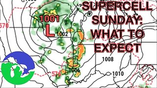
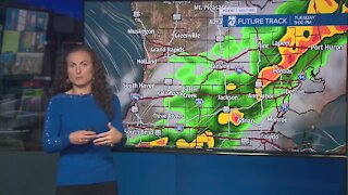
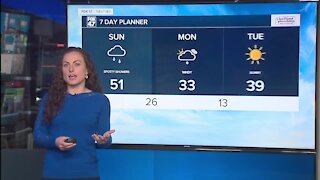
A rather slow-moving low pressure system will settle over the Great Lakes Region over the next two days, bringing showers and thunderstorms on Saturday and Sunday. Some supercell development appears probable across Indiana and Ohio with a cluster of thunderstorms potentially impacting @Cedarville University getting started activities Saturday afternoon. Any severe weather developing from this activity will be low in strength, but will potentially chase activity developing Saturday evening on the Michigan- Indiana line.
LIKE and SUBSCRIBE for more weather-related content like this!
Loading comments...
-
 15:40
15:40
Great Lakes Weather
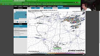
11 months agoSupercell Sunday: Severe Weather Potential for Michigan and Indiana -Great Lakes Weather
14 -
 29:49
29:49
Great Lakes Weather
1 year agoLive Update on Supercell Sunday Severe Weather Potential in Indiana and Ohio
1 -
 1:00
1:00
WSYM
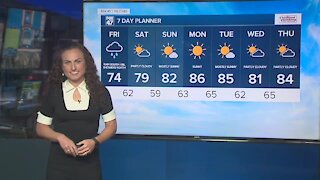
2 years agoForecast - Cloudy with rain likely. Highs in the mid-70's
12 -
 0:49
0:49
WSYM
3 years agoMorning showers could produce heavy downpours, gusty winds, small hail, and cloud to ground lightning. These will likely exit the area by around Noon Wednesday. After that, I anticipate much of the afternoon will be dry with highs near 70.
2 -
 0:53
0:53
KMGH
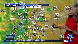
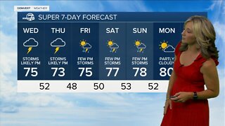
5 years agoMonday Super 7-Day forecast
17 -
 3:25
3:25
WSYM
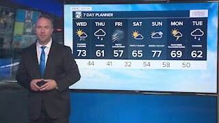
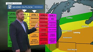
11 months agoSevere storms likely Wednesday afternoon
-
 2:42
2:42
KMGH
1 year agoHazy skies overnight, thunderstorms likely Wednesday afternoon
2 -
 1:32
1:32
WSYM
2 years agoToday's Forecast: Strong storms are possible this afternoon and evening
2 -
 1:05
1:05
WSYM
3 years agoToday's Forecast: Cloudy, windy & mild with a few showers
7 -
 3:08
3:08
KIVI
5 years agoStorms possible Monday evening, then get ready for blistering heat mid-week