Grizzly Flat Trail, North/South Trail Junction, Closer Look Pt. 2
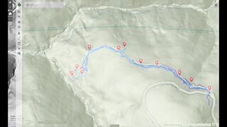
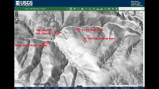
A return visit to the middle junction of the Grizzly Flat North and South trails. There's a short spur called the Grizzly Flat Cutoff Trail that joins the 2 trails here. Had more time to spend exploring this area and testing out the DIY hill shade map.
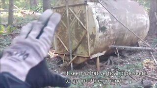
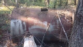
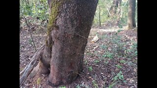
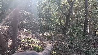
This is the only large, relatively flat area on this entire ridge. There's a large steel tank here. I found no signs of fence or pipe on the south end of the clearing.
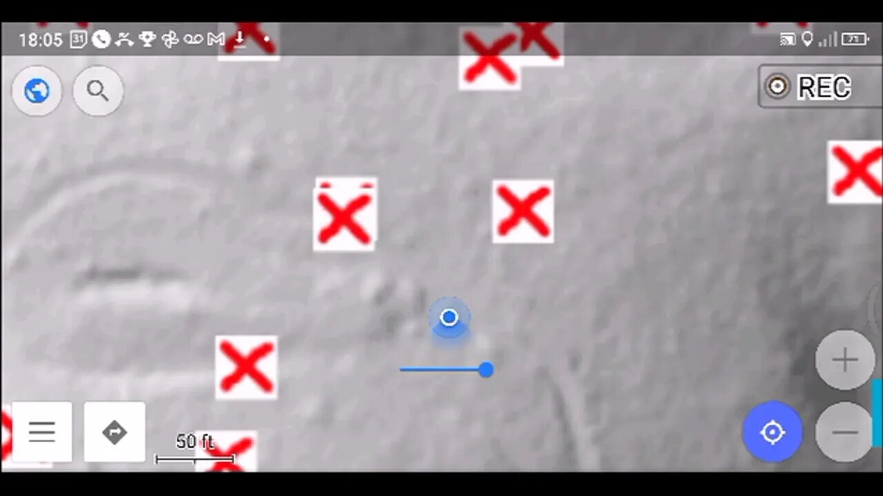
Looks like I've finally dialed in the DIY hill shade map calibration. So nice to be able to navigate to a feature on the map, then look around and find the feature on the ground. Some of these features are invisible at first glance, but knowing there's something there, you move a bit, look from a different angle and there it is!
Followed several traces on the map to find signs of faint trails that may need further exploration. The one to the SW might lead to a water source as it seems to head uphill a ways. Then there's a trail running NE down the crest of the ridge.
What do you think this area was used for?
About the USGS hill shade maps:
https://apps.nationalmap.gov/viewer/
Subscribe for more content like this
Comment, rate, share & click the bell icon
And as always, thanks for watching
#USGS #HillShade
-
 5:30
5:30
4Crawler
3 years agoGrizzly Flat Trail, North/South Trail Junction, Closer Look
5 -
 6:39
6:39
4Crawler
3 years agoGrizzly Flat Trail, North/South Trail Junction
6 -
 8:46
8:46
4Crawler
3 years agoGrizzly Flat North Trail / Middle Road: 2nd Visit
5 -
 7:31
7:31
4Crawler
3 years agoGrizzly Flat North Trail / Middle Road: 3rd Visit
22 -
 6:59
6:59
4Crawler
3 years agoGrizzly Flat North Trail / What was this Middle Road built for?
59 -
 9:54
9:54
4Crawler
3 years agoGrizzly Flat North Trail / What's at the Bottom of the Middle Road?
11 -
 6:08
6:08
4Crawler
3 years agoChecking out the Middle Road on the Grizzly Flat North Trail
12 -
 5:15
5:15
4Crawler
3 years agoExploring the Upper Road on the Grizzly Flat / North Trail
3 -
 0:13
0:13
DVW Experiences
3 years agoRampart Reservoir Trail North 3
-
 0:23
0:23
DVW Experiences
3 years agoRampart North trail fountain head
6