Old 1895 Stevens Canyon Road: Beyond Grizzly Flat Trail
The 1895 topo map shows the old Stevens Canyon Road continuing beyond the location of the modern Grizzly Flat Trail.
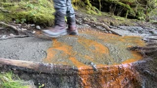
I had always seen what looked like an old road on the far side of the canyon when dropping down the stream crossing on the Grizzly Flat Trail. This is the first time I finally took the plunge and ventured up onto the old road shelf. There are a lot of fallen trees across the old road and with the steep slopes, a lot of debris has fallen down from above and covered much of the old road bed.
I think this road continues up at least a ways past where I got to in this video. Two plans of attack are to side hill down from the portion of Grizzly Flat trail where it runs up the ridge above this point. Then there are also 1 or 2 old roads I've seen dropping down off Grizzly Flat Trail (south) that seem to be heading into the same canyon as this portion of the road is heading up.
It's hard to be certain of any of this as the old and new maps seem to be very inaccurate in this area. They show the Branch D canyon starting about 0.1 miles further upstream from this location. I think the modern maps make use of much of the topographic information on the older maps and thus if the old map was off, then new map is off as well. This area is not amenable to aerial surveys as the tree cover is so heavy. In order to see where all these old roads actually go, the only way is to hike them, recording a GPS track then upload them and view the tracks on a larger map.
About the USGS HTMC:
https://www.usgs.gov/programs/national-geospatial-program/historical-topographic-maps-preserving-past
View/download maps on the TopoView site:
https://ngmdb.usgs.gov/topoview/
I used the 1895 Palo Alto quadrangle or the 1900 historical topo as listed in GaiaGPS:
https://www.gaiagps.com/
More to come...
Subscribe for more content like this
Comment, rate, share & click the bell icon
And as always, thanks for watching
-
 4:27
4:27
4Crawler
2 years agoOld 1895 Stevens Canyon Road - Along the Grizzly Flat Trail
2 -
 7:24
7:24
4Crawler
2 years agoScouting Access to the Old 1897 Stevens Canyon Road: Beyond Grizzly Flat Trail
64 -
 9:19
9:19
RottenDawgEntertainment
3 years agoOld Robe Canyon Trail Hike-Granite Falls, WA
158 -
 0:38
0:38
HikingViking
11 months agoArriving @ GORGEOUS McNeil Point Trail Junction! | Timberline Mount Hood Wilderness | 4K | Oregon
332 -
 11:36
11:36
Cactus Hill
1 year agoTemple Mountain Road Outbound from Reds Canyon Loop - Lower San Rafael Swell
4 -
 29:46
29:46
NotARubicon Productions
4 years agoEasy Off Roading in Southern California: Old Dale Road - Full Trail Review
14 -
 0:39
0:39
HikingViking
2 years agoOld Growth Rainforest Trail Overlooking Salmon River – Mount Hood – 4K
4 -
 16:03
16:03
Backpacking Adventures
2 years ago $0.01 earnedGrand Canyon of Pennsylvania Backpacking - The West Rim Trail 2022 Part 1
333 -
 8:01
8:01
Backpacking Adventures
2 years agoGrand Canyon of Pennsylvania Backpacking - The West Rim Trail 2022 Part 2
231 -
 1:02
1:02
Bexar0718
1 year agoOregon Trail near Casper
11