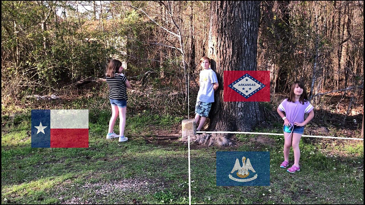
The tristate monument of "LouTexArk"
Between Atlanta, TX and Rodessa, LA, this monument is just on the east side of the highway embedded in the root of a giant tree. The three states of Louisiana, Texas, and Arkansas meet at this monument. The north/south line at this spot was determined by the Onís-Adams Treaty of 1819. A line would be drawn due north to the Red River from the spot where the Sabine River crossed the 32nd parallel North latitude. This was to create a land buffer between the predominantly French settled areas of the southward flowing section of the Red River from the border of Spanish Texas. 32N is a significant line to Texas which determined the shape of Texas in the west and in the east. The north/south line was an international border between Spain and the United States; then Mexico and the United States; then the Republic of Texas and the US, before it finally became the state boundary between Texas/Louisiana, and Texas/Arkansas.
-
 2:25:01
FreshandFit
4 hours agoTyreek Hill Pays Ex Wife $1 Million in Ongoing Fees From Divorce?!
22K3 -
 2:03:46
Inverted World Live
6 hours agoHaunted Dolls Hack Amazon Alexa | Ep. 98
91.3K2 -
 3:09:53
Laura Loomer
6 hours agoEP140: Loomer EXPOSES Islamification At US State Department
25.7K12 -
 3:05:00
TimcastIRL
6 hours agoTrump Floats Accepting 600,000 Chinese Student Visas, MAGA Uproar | Timcast IRL
194K129 -
 8:44:47
SpartakusLIVE
11 hours ago$20,000 Hide and Seek Tourney w/ Stonemountain64 || #1 Rat wins the BIG CHEESE
62.3K -
 2:34:02
Barry Cunningham
7 hours agoLISA COOK | ADAM SCHIFF | LETITIA JAMES | ARE THEY BEING SACRIFICED BY THE DEEP STATE?
89.4K53 -
 1:36:19
Flyover Conservatives
15 hours agoOnly 17% of Millennials Hit These 5 Adult Milestones—Why?; What If Childhood Trauma Is Behind Your Health Problems? - Dr. Troy Spurrill | FOC Show
32.6K4 -
 4:49:04
HogansAlleyHero
17 hours ago💥CHASING DOPAMINE💥✅TRUMP SAYS BATTLEFIELD IS THE BEST✅
41.8K3 -
 1:57:40
MattMorseTV
7 hours ago $10.90 earned🔴Trump just SHATTERED the PROJECTIONS.🔴
54.3K50 -
 2:32:19
megimu32
6 hours agoOTS: From Star Search to Superstardom
38.7K4