1 year agoSatellite Imagery Exposes Potential Russian Nuclear Storage Site in BelarusFrom the Desk of Gav
1 year agoSudan Civil War | Before & After - New Satellite Imagery Reveals Level Destruction Of DarfurGlobalDispatch
11 months agoPentagon Pressed On Satellite Imagery Showing Four 'Likely' Chinese Listening Posts In CubaForbes Breaking News
3 years agoLost American Viking Settlement Discovered By Space Archaeologists Using Satellite ImagerySeeker Land
3 years agoSatellite imagery shows new deployments in Southern Belarus and Western RussiaNews Of World
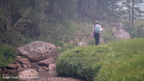
5 months agoForecasting the Future: How NASA Satellite Data Helps Trout PopulationsSpaceFrontiersNASA
1 year agoLas Vegas & Lake Mead 1972-2021 Satellite Timelapse NASA Imagery #lasvegas #lakemead #water #droughtMOJO ADVENTURES
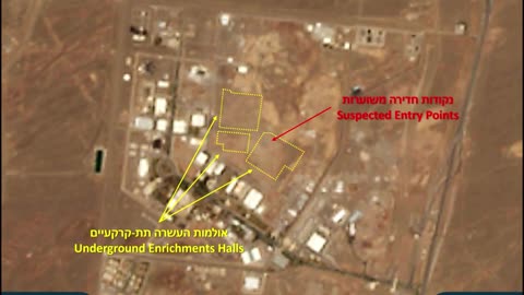
1 day ago🛰️🚨 Israel Iran War | Satellite Reveals Natanz Enrichment Facility Under Threat | RCFRCF - Real Combat Footage: Unfiltered Perspectives on War Military Actions and Conflicts
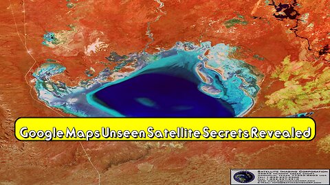
23 days agoGoogle Maps: Unseen Satellite Secrets Revealed! #GoogleMaps #SatelliteView #HiddenFeaturesoddityworldtube
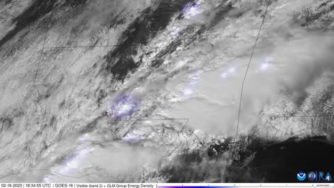
2 years agoSatellite imagery captures lightning as severe storms move across southern statesJTN2020Verified
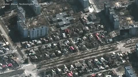
3 years agoSatellite imagery shows damage to civilian areas in Mariupol, Kyiv, ChernihivEnjoy with Dharam
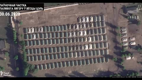
1 year agoSatellite imagery from June 30 (today), presumably one of the three Wagner Group bases in Belarus.Rumor has itVerified
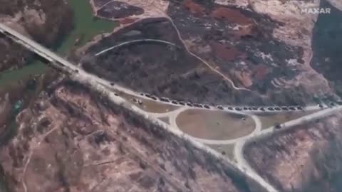
3 years agoSatellite imagery company Maxar publishes footage of a 64 kilometer-long Russian military convoyKevkonk
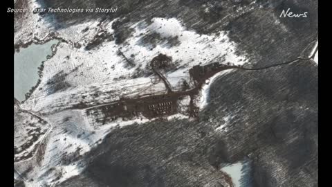
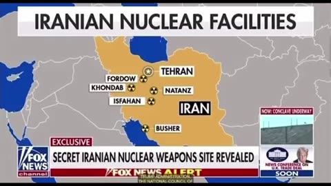
6 days agoSatellite imagery reveals a previously UNKOWN nuclear facility in Iran that spans 2500 acres.drrichswiee