Google Maps: Unseen Satellite Secrets Revealed! #GoogleMaps #SatelliteView #HiddenFeatures
Discover the hidden power of Google Maps Satellite! Uncover secret Google Maps features and satellite imagery tricks most users miss. Learn advanced map skills now!
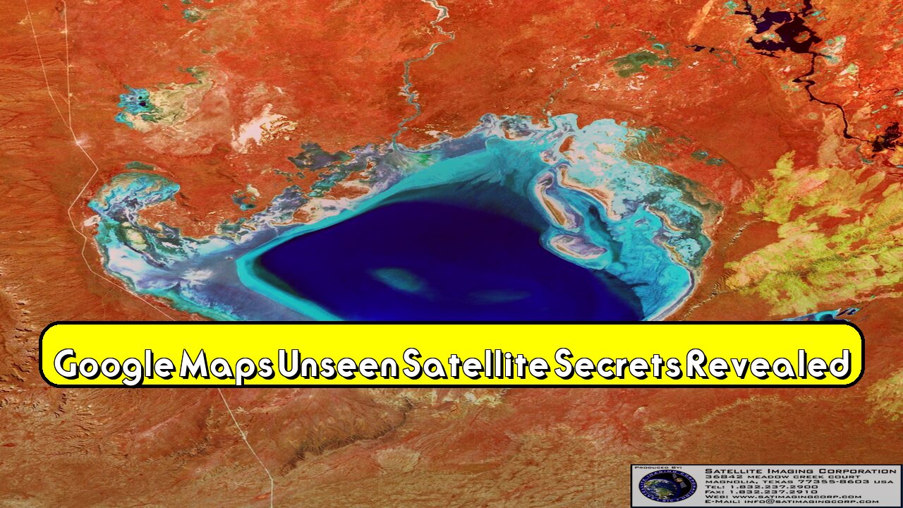
Explore Google Maps' satellite view for historical insights and landscape changes. Analyze detailed Earth observation data from Landsat satellites. Did you know Google Maps offers offline maps? Oddity world brings you these hidden gems.
Unlock elevation profiles for hiking and accurate distance measurements. Examine immersive 3D city models. Oddity world reveals more Google Maps secrets.
[00:00:10] Access historical satellite imagery.
[00:00:35] Use offline maps without internet.
[00:01:15] Measure distances with scale tool.
[00:01:40] View 3D city models in detail.
Like this video, subscribe to Oddity world, and hit the notification bell for more amazing discoveries! Visit our website and social media for exclusive content. What is the most surprising application of Google Maps satellite imagery you've encountered?
#GoogleMaps #SatelliteImagery #HiddenFeatures #GoogleMapsTricks #MapSecrets #Landsat #EarthObservation #3DModels #OfflineMaps #DistanceMeasurement #ElevationProfiles #Mapping #TechTips #TravelHacks #GoogleEarth
Visit our official site:
https://cargo-isf.com/
Follow us on social media :
Facebook : https://www.facebook.com/oddityworldtubee/
X : https://x.com/oddityworldx
Rumble : https://rumble.com/c/c-2333140
-
 19:52
19:52
oddityworldtube
23 days agoقادة مجانين دمّروا شعوبهم: وهم العظمة والسلطة المطلقة
32 -
 LIVE
LIVE
Rallied
40 minutes agoWarzone Challenges All Night
150 watching -
 LIVE
LIVE
DLDAfterDark
1 hour agoWhat Are We Missing From The Charlie Kirk Incident? Feat. TN Tactical - After Hours Armory Live!
115 watching -
 16:23
16:23
True Crime | Unsolved Cases | Mysterious Stories
1 month ago $0.07 earnedThe Strange Disappearance of Mekayla Bali | (Mini-Documentary)
2321 -
 10:03
10:03
nospeedlimitgermany
12 days agoVW Golf 5 R32 | 250 PS | Top Speed Drive German Autobahn No Speed Limit POV
312 -
 1:35
1:35
Memology 101
1 day ago $0.11 earnedChicago Mayor Johnson calls LAW ENFORCEMENT a "SICKNESS" he will "ERADICATE"
2.86K12 -
 10:17
10:17
Advanced Level Diagnostics
13 days ago2007 Chevy Express - Replaced Everything But The Code Remains!
19 -
 1:01:11
The Mel K Show
2 hours agoMel K & Harley Schlanger | History Repeats: A Wake-Up Call for Humanity | 9-20-25
71.2K13 -
 2:13:52
Mally_Mouse
10 hours ago🌶️ 🥵Spicy BITE Saturday!! 🥵🌶️- Let's Play: Lockdown Protocol (New Updates!)
79.7K5 -
 12:57
12:57
Culture Apothecary with Alex Clark
1 day agoMy Last 6 Years With Charlie Kirk | In Memoriam with Alex Clark
30.4K6