
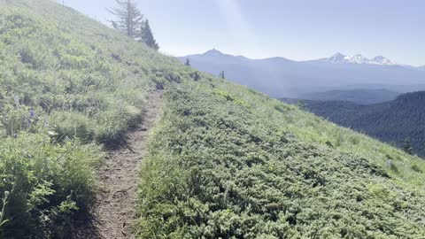
Descending Purple Flower Laden Mountainside with Alpine Views – Crescent Mountain – 4K
My goal of these wilderness trail videos is to 1) show reverence for the beauty of the land, and 2) give YOU actionable trail information that can assist you in planning your own hike here.
This was a day-hike in Central Oregon, Willamette National Forest, Summiting Crescent Mountain, approximately 10 mile Out and Back and 2400 FEET Elevation Gain to the Summit where you can see 9 mountains! You start in the Old Growth Forest, cross a Creek, and ultimately ascend to the Alpine Zone above the tree line all the way to the Summit. Just before the Summit there is a fork, go right which takes you to the Summit Zone. The temperature was classic Summer weather, low of 51 officially but in the low 40's in the shade of the forest canopy, with a high in the high 70's to low 80's. This was hiked on 7/16/2022 and there were of a handful of mosquitoes at a few spots on the trail that were strategically waiting to attack, I got 4 bites overall which wasn't bad all things considered, they were NOT throughout the trail it was 90%+ clear. As far as road conditions, it's highway and then a well paved forest road, and then a few tenths of a mile down a pretty bumpy forest road that is narrow, so drive that section very slowly and carefully. In my opinion, the road does not require 4-Wheel Drive despite the short bumpy section, however do watch for road conditions, particularly snow/ice depending on the time of year.
20
views
2
comments
Get Addicted to Nature – Crescent Mountain Trail – Willamette National Forest – Central Oregon – 4K
My goal of these wilderness trail videos is to 1) show reverence for the beauty of the land, and 2) give YOU actionable trail information that can assist you in planning your own hike here.
This was a day-hike in Central Oregon, Willamette National Forest, Summiting Crescent Mountain, approximately 10 mile Out and Back and 2400 FEET Elevation Gain to the Summit where you can see 9 mountains! You start in the Old Growth Forest, cross a Creek, and ultimately ascend to the Alpine Zone above the tree line all the way to the Summit. Just before the Summit there is a fork, go right which takes you to the Summit Zone. The temperature was classic Summer weather, low of 51 officially but in the low 40's in the shade of the forest canopy, with a high in the high 70's to low 80's. This was hiked on 7/16/2022 and there were of a handful of mosquitoes at a few spots on the trail that were strategically waiting to attack, I got 4 bites overall which wasn't bad all things considered, they were NOT throughout the trail it was 90%+ clear. As far as road conditions, it's highway and then a well paved forest road, and then a few tenths of a mile down a pretty bumpy forest road that is narrow, so drive that section very slowly and carefully. In my opinion, the road does not require 4-Wheel Drive despite the short bumpy section, however do watch for road conditions, particularly snow/ice depending on the time of year.
12
views
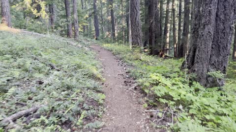
Hiking the Classic Old Growth Willamette National Forest Ascending Crescent Mountain – 4K
My goal of these wilderness trail videos is to 1) show reverence for the beauty of the land, and 2) give YOU actionable trail information that can assist you in planning your own hike here.
This was a day-hike in Central Oregon, Willamette National Forest, Summiting Crescent Mountain, approximately 10 mile Out and Back and 2400 FEET Elevation Gain to the Summit where you can see 9 mountains! You start in the Old Growth Forest, cross a Creek, and ultimately ascend to the Alpine Zone above the tree line all the way to the Summit. Just before the Summit there is a fork, go right which takes you to the Summit Zone. The temperature was classic Summer weather, low of 51 officially but in the low 40's in the shade of the forest canopy, with a high in the high 70's to low 80's. This was hiked on 7/16/2022 and there were of a handful of mosquitoes at a few spots on the trail that were strategically waiting to attack, I got 4 bites overall which wasn't bad all things considered, they were NOT throughout the trail it was 90%+ clear. As far as road conditions, it's highway and then a well paved forest road, and then a few tenths of a mile down a pretty bumpy forest road that is narrow, so drive that section very slowly and carefully. In my opinion, the road does not require 4-Wheel Drive despite the short bumpy section, however do watch for road conditions, particularly snow/ice depending on the time of year.
22
views
4
comments
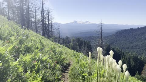
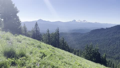
Entering the GORGEOUS "The Sound of Music" Style Wildflower Hillside of Crescent Mountain – 4K
My goal of these wilderness trail videos is to 1) show reverence for the beauty of the land, and 2) give YOU actionable trail information that can assist you in planning your own hike here.
This was a day-hike in Central Oregon, Willamette National Forest, Summiting Crescent Mountain, approximately 10 mile Out and Back and 2400 FEET Elevation Gain to the Summit where you can see 9 mountains! You start in the Old Growth Forest, cross a Creek, and ultimately ascend to the Alpine Zone above the tree line all the way to the Summit. Just before the Summit there is a fork, go right which takes you to the Summit Zone. The temperature was classic Summer weather, low of 51 officially but in the low 40's in the shade of the forest canopy, with a high in the high 70's to low 80's. This was hiked on 7/16/2022 and there were of a handful of mosquitoes at a few spots on the trail that were strategically waiting to attack, I got 4 bites overall which wasn't bad all things considered, they were NOT throughout the trail it was 90%+ clear. As far as road conditions, it's highway and then a well paved forest road, and then a few tenths of a mile down a pretty bumpy forest road that is narrow, so drive that section very slowly and carefully. In my opinion, the road does not require 4-Wheel Drive despite the short bumpy section, however do watch for road conditions, particularly snow/ice depending on the time of year.
10
views
2
comments
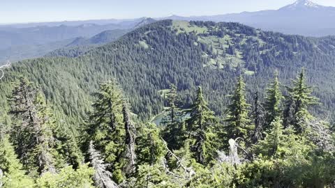
Looking Down on the Expansive Forest We Just Climbed Up From – Crescent Mountain Summit – 4K
My goal of these wilderness trail videos is to 1) show reverence for the beauty of the land, and 2) give YOU actionable trail information that can assist you in planning your own hike here.
This was a day-hike in Central Oregon, Willamette National Forest, Summiting Crescent Mountain, approximately 10 mile Out and Back and 2400 FEET Elevation Gain to the Summit where you can see 9 mountains! You start in the Old Growth Forest, cross a Creek, and ultimately ascend to the Alpine Zone above the tree line all the way to the Summit. Just before the Summit there is a fork, go right which takes you to the Summit Zone. The temperature was classic Summer weather, low of 51 officially but in the low 40's in the shade of the forest canopy, with a high in the high 70's to low 80's. This was hiked on 7/16/2022 and there were of a handful of mosquitoes at a few spots on the trail that were strategically waiting to attack, I got 4 bites overall which wasn't bad all things considered, they were NOT throughout the trail it was 90%+ clear. As far as road conditions, it's highway and then a well paved forest road, and then a few tenths of a mile down a pretty bumpy forest road that is narrow, so drive that section very slowly and carefully. In my opinion, the road does not require 4-Wheel Drive despite the short bumpy section, however do watch for road conditions, particularly snow/ice depending on the time of year.
12
views
6
comments
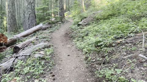
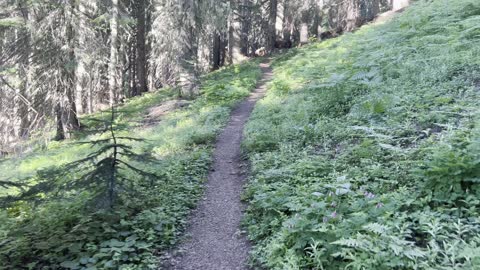
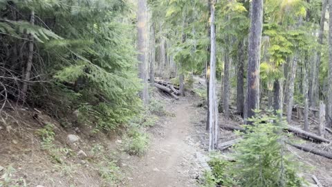
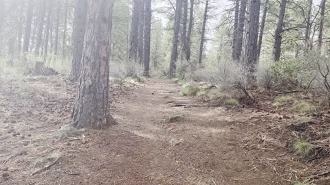
Ascending the Lower Forest of Crescent Mountain Trail – Central Oregon – 4K
My goal of these wilderness trail videos is to 1) show reverence for the beauty of the land, and 2) give YOU actionable trail information that can assist you in planning your own hike here.
This was a day-hike in Central Oregon, Willamette National Forest, Summiting Crescent Mountain, approximately 10 mile Out and Back and 2400 FEET Elevation Gain to the Summit where you can see 9 mountains! You start in the Old Growth Forest, cross a Creek, and ultimately ascend to the Alpine Zone above the tree line all the way to the Summit. Just before the Summit there is a fork, go right which takes you to the Summit Zone. The temperature was classic Summer weather, low of 51 officially but in the low 40's in the shade of the forest canopy, with a high in the high 70's to low 80's. This was hiked on 7/16/2022 and there were of a handful of mosquitoes at a few spots on the trail that were strategically waiting to attack, I got 4 bites overall which wasn't bad all things considered, they were NOT throughout the trail it was 90%+ clear. As far as road conditions, it's highway and then a well paved forest road, and then a few tenths of a mile down a pretty bumpy forest road that is narrow, so drive that section very slowly and carefully. In my opinion, the road does not require 4-Wheel Drive despite the short bumpy section, however do watch for road conditions, particularly snow/ice depending on the time of year.
6
views
2
comments
Hiking "The Sound of Music" Style Wildflower Hillside Descending Crescent Mountain – 4K
My goal of these wilderness trail videos is to 1) show reverence for the beauty of the land, and 2) give YOU actionable trail information that can assist you in planning your own hike here.
This was a day-hike in Central Oregon, Willamette National Forest, Summiting Crescent Mountain, approximately 10 mile Out and Back and 2400 FEET Elevation Gain to the Summit where you can see 9 mountains! You start in the Old Growth Forest, cross a Creek, and ultimately ascend to the Alpine Zone above the tree line all the way to the Summit. Just before the Summit there is a fork, go right which takes you to the Summit Zone. The temperature was classic Summer weather, low of 51 officially but in the low 40's in the shade of the forest canopy, with a high in the high 70's to low 80's. This was hiked on 7/16/2022 and there were of a handful of mosquitoes at a few spots on the trail that were strategically waiting to attack, I got 4 bites overall which wasn't bad all things considered, they were NOT throughout the trail it was 90%+ clear. As far as road conditions, it's highway and then a well paved forest road, and then a few tenths of a mile down a pretty bumpy forest road that is narrow, so drive that section very slowly and carefully. In my opinion, the road does not require 4-Wheel Drive despite the short bumpy section, however do watch for road conditions, particularly snow/ice depending on the time of year.
27
views
4
comments
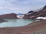
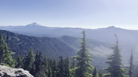
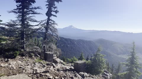
Nine Mountain Panorama from the Summit of Crescent Mountain – Central Oregon – 4K
My goal of these wilderness trail videos is to 1) show reverence for the beauty of the land, and 2) give YOU actionable trail information that can assist you in planning your own hike here.
This was a day-hike in Central Oregon, Willamette National Forest, Summiting Crescent Mountain, approximately 10 mile Out and Back and 2400 FEET Elevation Gain to the Summit where you can see 9 mountains! You start in the Old Growth Forest, cross a Creek, and ultimately ascend to the Alpine Zone above the tree line all the way to the Summit. Just before the Summit there is a fork, go right which takes you to the Summit Zone. The temperature was classic Summer weather, low of 51 officially but in the low 40's in the shade of the forest canopy, with a high in the high 70's to low 80's. This was hiked on 7/16/2022 and there were of a handful of mosquitoes at a few spots on the trail that were strategically waiting to attack, I got 4 bites overall which wasn't bad all things considered, they were NOT throughout the trail it was 90%+ clear. As far as road conditions, it's highway and then a well paved forest road, and then a few tenths of a mile down a pretty bumpy forest road that is narrow, so drive that section very slowly and carefully. In my opinion, the road does not require 4-Wheel Drive despite the short bumpy section, however do watch for road conditions, particularly snow/ice depending on the time of year.
21
views
3
comments
Arriving at the Summit of Crescent Mountain – Willamette National Forest – Central Oregon – 4K
My goal of these wilderness trail videos is to 1) show reverence for the beauty of the land, and 2) give YOU actionable trail information that can assist you in planning your own hike here.
This was a day-hike in Central Oregon, Willamette National Forest, Summiting Crescent Mountain, approximately 10 mile Out and Back and 2400 FEET Elevation Gain to the Summit where you can see 9 mountains! You start in the Old Growth Forest, cross a Creek, and ultimately ascend to the Alpine Zone above the tree line all the way to the Summit. Just before the Summit there is a fork, go right which takes you to the Summit Zone. The temperature was classic Summer weather, low of 51 officially but in the low 40's in the shade of the forest canopy, with a high in the high 70's to low 80's. This was hiked on 7/16/2022 and there were of a handful of mosquitoes at a few spots on the trail that were strategically waiting to attack, I got 4 bites overall which wasn't bad all things considered, they were NOT throughout the trail it was 90%+ clear. As far as road conditions, it's highway and then a well paved forest road, and then a few tenths of a mile down a pretty bumpy forest road that is narrow, so drive that section very slowly and carefully. In my opinion, the road does not require 4-Wheel Drive despite the short bumpy section, however do watch for road conditions, particularly snow/ice depending on the time of year.
5
views
Crescent Mountain Trailhead – Willamette National Forest – Central Oregon – 4K
My goal of these wilderness trail videos is to 1) show reverence for the beauty of the land, and 2) give YOU actionable trail information that can assist you in planning your own hike here.
This was a day-hike in Central Oregon, Willamette National Forest, Summiting Crescent Mountain, approximately 10 mile Out and Back and 2400 FEET Elevation Gain to the Summit where you can see 9 mountains! You start in the Old Growth Forest, cross a Creek, and ultimately ascend to the Alpine Zone above the tree line all the way to the Summit. Just before the Summit there is a fork, go right which takes you to the Summit Zone. The temperature was classic Summer weather, low of 51 officially but in the low 40's in the shade of the forest canopy, with a high in the high 70's to low 80's. This was hiked on 7/16/2022 and there were of a handful of mosquitoes at a few spots on the trail that were strategically waiting to attack, I got 4 bites overall which wasn't bad all things considered, they were NOT throughout the trail it was 90%+ clear. As far as road conditions, it's highway and then a well paved forest road, and then a few tenths of a mile down a pretty bumpy forest road that is narrow, so drive that section very slowly and carefully. In my opinion, the road does not require 4-Wheel Drive despite the short bumpy section, however do watch for road conditions, particularly snow/ice depending on the time of year.
7
views
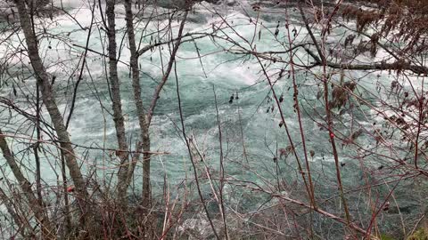
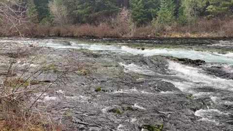
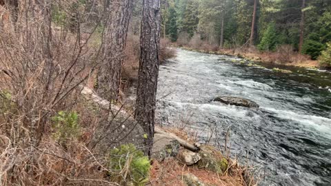
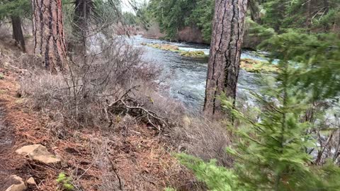
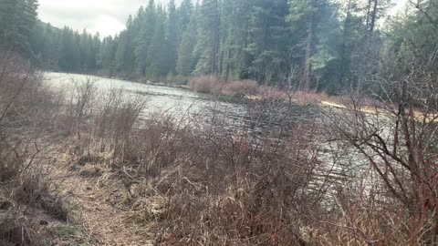
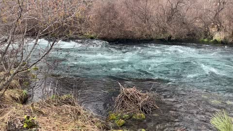
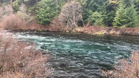
The Turquoise Beauty of Raging Metolius River – Central Oregon
My goal of these wilderness trail videos is to 1) show reverence for the beauty of the land, and 2) give YOU actionable trail information that can assist you in planning your own hike here.
This was a day-hike in Central Oregon, Deschutes National Forest, Metolius River National Recreation Area, starting at Allen Springs Campground on East Metolius River Trail exploring the East side of Metolius River with miles of epic shoreline hiking and only a few hundred feet elevation gain over a long distance making it mostly a flat hike. The elevation starts around 2800 ft and stays in a range of up to 3000 ft, at such low elevation it allows this hike to be done in the end of Winter as far as snow melt and road access. The temperature was below freezing and the ground was frozen for the majority of the hike, the sun came out and the ground finally started to melt near the end of the hike. The sky was overcast and it sprinkled on and off for the majority of the day. This was hiked on 3/4/2022 and there were of course NO Mosquitoes. As far as road conditions, it's highway to the turn off for the Camp Sherman area which is a well paved road until the turn off to Allen Springs Campground which is also paved, so it was a very easy and safe driving route. In my opinion, the road most definitely DOES NOT require 4-Wheel Drive, however do watch for road conditions, particularly snow/ice depending on the time of year.
13
views
4
comments
The Waterfall Convergence of Metolius River – Central Oregon
My goal of these wilderness trail videos is to 1) show reverence for the beauty of the land, and 2) give YOU actionable trail information that can assist you in planning your own hike here.
This was a day-hike in Central Oregon, Deschutes National Forest, Metolius River National Recreation Area, starting at Allen Springs Campground on East Metolius River Trail exploring the East side of Metolius River with miles of epic shoreline hiking and only a few hundred feet elevation gain over a long distance making it mostly a flat hike. The elevation starts around 2800 ft and stays in a range of up to 3000 ft, at such low elevation it allows this hike to be done in the end of Winter as far as snow melt and road access. The temperature was below freezing and the ground was frozen for the majority of the hike, the sun came out and the ground finally started to melt near the end of the hike. The sky was overcast and it sprinkled on and off for the majority of the day. This was hiked on 3/4/2022 and there were of course NO Mosquitoes. As far as road conditions, it's highway to the turn off for the Camp Sherman area which is a well paved road until the turn off to Allen Springs Campground which is also paved, so it was a very easy and safe driving route. In my opinion, the road most definitely DOES NOT require 4-Wheel Drive, however do watch for road conditions, particularly snow/ice depending on the time of year.
11
views
4
comments
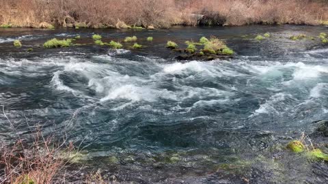
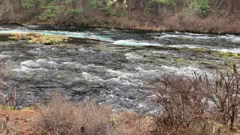
The Roaring & Raging Metolius River – Central Oregon
My goal of these wilderness trail videos is to 1) show reverence for the beauty of the land, and 2) give YOU actionable trail information that can assist you in planning your own hike here.
This was a day-hike in Central Oregon, Deschutes National Forest, Metolius River National Recreation Area, starting at Allen Springs Campground on East Metolius River Trail exploring the East side of Metolius River with miles of epic shoreline hiking and only a few hundred feet elevation gain over a long distance making it mostly a flat hike. The elevation starts around 2800 ft and stays in a range of up to 3000 ft, at such low elevation it allows this hike to be done in the end of Winter as far as snow melt and road access. The temperature was below freezing and the ground was frozen for the majority of the hike, the sun came out and the ground finally started to melt near the end of the hike. The sky was overcast and it sprinkled on and off for the majority of the day. This was hiked on 3/4/2022 and there were of course NO Mosquitoes. As far as road conditions, it's highway to the turn off for the Camp Sherman area which is a well paved road until the turn off to Allen Springs Campground which is also paved, so it was a very easy and safe driving route. In my opinion, the road most definitely DOES NOT require 4-Wheel Drive, however do watch for road conditions, particularly snow/ice depending on the time of year.
14
views
2
comments
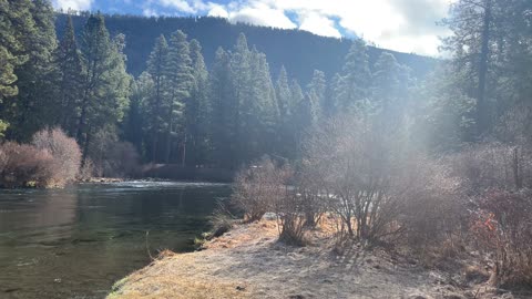
Exploring the Mighty Deschutes River Trail – Central Oregon – 4K
My goal of these wilderness trail videos is to 1) show reverence for the beauty of the land, and 2) give YOU actionable trail information that can assist you in planning your own hike here.
This was a day-hike in Central Oregon, Deschutes National Forest, starting at Meadow Day Use Area Trailhead and hiking to Lava Island, Big Eddy, Aspen, and then Dillon Falls along the Shoreline of Deschutes River as an Out and Back hiking approximately 8 miles with only a couple hundred feet elevation gain. I call this the "Northern Half" of Deschutes River Hiking (the "Southern Half" starts at Sun Lava Path Trailhead and goes to Benham Falls and then also Dillon Falls, approximately 8 miles). The temperature was in the upper 30's when I started and it rained heavily intermittently with occasional sunbreaks and a rainbow. This was hiked on 5/6/2022 and there were of course NO Mosquitoes. As far as road conditions, it's highway and then a relatively well maintained road to the parking lot. In my opinion, the road most definitely DOES NOT require 4-Wheel Drive, however do watch for road conditions, particularly snow/ice depending on the time of year.
10
views
2
comments
Chinook Salmon Fishing for Fly Fisherman – Metolius River – Central Oregon – 4K
My goal of these wilderness trail videos is to 1) show reverence for the beauty of the land, and 2) give YOU actionable trail information that can assist you in planning your own hike here.
This was a day-hike in Central Oregon, Deschutes National Forest, Metolius River National Recreation Area, starting at Allen Springs Campground on East Metolius River Trail exploring the East side of Metolius River with miles of epic shoreline hiking and only a few hundred feet elevation gain over a long distance making it mostly a flat hike. The elevation starts around 2800 ft and stays in a range of up to 3000 ft, at such low elevation it allows this hike to be done in the end of Winter as far as snow melt and road access. The temperature was below freezing and the ground was frozen for the majority of the hike, the sun came out and the ground finally started to melt near the end of the hike. The sky was overcast and it sprinkled on and off for the majority of the day. This was hiked on 3/4/2022 and there were of course NO Mosquitoes. As far as road conditions, it's highway to the turn off for the Camp Sherman area which is a well paved road until the turn off to Allen Springs Campground which is also paved, so it was a very easy and safe driving route. In my opinion, the road most definitely DOES NOT require 4-Wheel Drive, however do watch for road conditions, particularly snow/ice depending on the time of year.
11
views

The Sun Shining on the Cascading Metolius River – Central Oregon
My goal of these wilderness trail videos is to 1) show reverence for the beauty of the land, and 2) give YOU actionable trail information that can assist you in planning your own hike here.
This was a day-hike in Central Oregon, Deschutes National Forest, Metolius River National Recreation Area, starting at Allen Springs Campground on East Metolius River Trail exploring the East side of Metolius River with miles of epic shoreline hiking and only a few hundred feet elevation gain over a long distance making it mostly a flat hike. The elevation starts around 2800 ft and stays in a range of up to 3000 ft, at such low elevation it allows this hike to be done in the end of Winter as far as snow melt and road access. The temperature was below freezing and the ground was frozen for the majority of the hike, the sun came out and the ground finally started to melt near the end of the hike. The sky was overcast and it sprinkled on and off for the majority of the day. This was hiked on 3/4/2022 and there were of course NO Mosquitoes. As far as road conditions, it's highway to the turn off for the Camp Sherman area which is a well paved road until the turn off to Allen Springs Campground which is also paved, so it was a very easy and safe driving route. In my opinion, the road most definitely DOES NOT require 4-Wheel Drive, however do watch for road conditions, particularly snow/ice depending on the time of year.
8
views

Hiking Along the Scenic Deschutes River Trail – Central Oregon – 4K
My goal of these wilderness trail videos is to 1) show reverence for the beauty of the land, and 2) give YOU actionable trail information that can assist you in planning your own hike here.
This was a day-hike in Central Oregon, Deschutes National Forest, starting at Meadow Day Use Area Trailhead and hiking to Lava Island, Big Eddy, Aspen, and then Dillon Falls along the Shoreline of Deschutes River as an Out and Back hiking approximately 8 miles with only a couple hundred feet elevation gain. I call this the "Northern Half" of Deschutes River Hiking (the "Southern Half" starts at Sun Lava Path Trailhead and goes to Benham Falls and then also Dillon Falls, approximately 8 miles). The temperature was in the upper 30's when I started and it rained heavily intermittently with occasional sunbreaks and a rainbow. This was hiked on 5/6/2022 and there were of course NO Mosquitoes. As far as road conditions, it's highway and then a relatively well maintained road to the parking lot. In my opinion, the road most definitely DOES NOT require 4-Wheel Drive, however do watch for road conditions, particularly snow/ice depending on the time of year.
3
views
Winter Shoreline of Metolius River – Central Oregon – 4K
My goal of these wilderness trail videos is to 1) show reverence for the beauty of the land, and 2) give YOU actionable trail information that can assist you in planning your own hike here.
This was a day-hike in Central Oregon, Deschutes National Forest, Metolius River National Recreation Area, starting at Allen Springs Campground on East Metolius River Trail exploring the East side of Metolius River with miles of epic shoreline hiking and only a few hundred feet elevation gain over a long distance making it mostly a flat hike. The elevation starts around 2800 ft and stays in a range of up to 3000 ft, at such low elevation it allows this hike to be done in the end of Winter as far as snow melt and road access. The temperature was below freezing and the ground was frozen for the majority of the hike, the sun came out and the ground finally started to melt near the end of the hike. The sky was overcast and it sprinkled on and off for the majority of the day. This was hiked on 3/4/2022 and there were of course NO Mosquitoes. As far as road conditions, it's highway to the turn off for the Camp Sherman area which is a well paved road until the turn off to Allen Springs Campground which is also paved, so it was a very easy and safe driving route. In my opinion, the road most definitely DOES NOT require 4-Wheel Drive, however do watch for road conditions, particularly snow/ice depending on the time of year.
6
views
Hiking Through the Forest Beside Metolius River – Central Oregon
My goal of these wilderness trail videos is to 1) show reverence for the beauty of the land, and 2) give YOU actionable trail information that can assist you in planning your own hike here.
This was a day-hike in Central Oregon, Deschutes National Forest, Metolius River National Recreation Area, starting at Allen Springs Campground on East Metolius River Trail exploring the East side of Metolius River with miles of epic shoreline hiking and only a few hundred feet elevation gain over a long distance making it mostly a flat hike. The elevation starts around 2800 ft and stays in a range of up to 3000 ft, at such low elevation it allows this hike to be done in the end of Winter as far as snow melt and road access. The temperature was below freezing and the ground was frozen for the majority of the hike, the sun came out and the ground finally started to melt near the end of the hike. The sky was overcast and it sprinkled on and off for the majority of the day. This was hiked on 3/4/2022 and there were of course NO Mosquitoes. As far as road conditions, it's highway to the turn off for the Camp Sherman area which is a well paved road until the turn off to Allen Springs Campground which is also paved, so it was a very easy and safe driving route. In my opinion, the road most definitely DOES NOT require 4-Wheel Drive, however do watch for road conditions, particularly snow/ice depending on the time of year.
4
views
Hiking to East Shoreline of Metolius River – Central Oregon – 4K
My goal of these wilderness trail videos is to 1) show reverence for the beauty of the land, and 2) give YOU actionable trail information that can assist you in planning your own hike here.
This was a day-hike in Central Oregon, Deschutes National Forest, Metolius River National Recreation Area, starting at Allen Springs Campground on East Metolius River Trail exploring the East side of Metolius River with miles of epic shoreline hiking and only a few hundred feet elevation gain over a long distance making it mostly a flat hike. The elevation starts around 2800 ft and stays in a range of up to 3000 ft, at such low elevation it allows this hike to be done in the end of Winter as far as snow melt and road access. The temperature was below freezing and the ground was frozen for the majority of the hike, the sun came out and the ground finally started to melt near the end of the hike. The sky was overcast and it sprinkled on and off for the majority of the day. This was hiked on 3/4/2022 and there were of course NO Mosquitoes. As far as road conditions, it's highway to the turn off for the Camp Sherman area which is a well paved road until the turn off to Allen Springs Campground which is also paved, so it was a very easy and safe driving route. In my opinion, the road most definitely DOES NOT require 4-Wheel Drive, however do watch for road conditions, particularly snow/ice depending on the time of year.
1
view
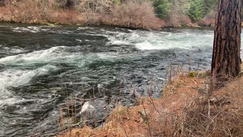
Very Wild Section of Metolius River – Central Oregon
My goal of these wilderness trail videos is to 1) show reverence for the beauty of the land, and 2) give YOU actionable trail information that can assist you in planning your own hike here.
This was a day-hike in Central Oregon, Deschutes National Forest, Metolius River National Recreation Area, starting at Allen Springs Campground on East Metolius River Trail exploring the East side of Metolius River with miles of epic shoreline hiking and only a few hundred feet elevation gain over a long distance making it mostly a flat hike. The elevation starts around 2800 ft and stays in a range of up to 3000 ft, at such low elevation it allows this hike to be done in the end of Winter as far as snow melt and road access. The temperature was below freezing and the ground was frozen for the majority of the hike, the sun came out and the ground finally started to melt near the end of the hike. The sky was overcast and it sprinkled on and off for the majority of the day. This was hiked on 3/4/2022 and there were of course NO Mosquitoes. As far as road conditions, it's highway to the turn off for the Camp Sherman area which is a well paved road until the turn off to Allen Springs Campground which is also paved, so it was a very easy and safe driving route. In my opinion, the road most definitely DOES NOT require 4-Wheel Drive, however do watch for road conditions, particularly snow/ice depending on the time of year.
8
views
2
comments
Forest Exploring Along the Shoreline of Metolius River – Central Oregon – 4K
My goal of these wilderness trail videos is to 1) show reverence for the beauty of the land, and 2) give YOU actionable trail information that can assist you in planning your own hike here.
This was a day-hike in Central Oregon, Deschutes National Forest, Metolius River National Recreation Area, starting at Allen Springs Campground on East Metolius River Trail exploring the East side of Metolius River with miles of epic shoreline hiking and only a few hundred feet elevation gain over a long distance making it mostly a flat hike. The elevation starts around 2800 ft and stays in a range of up to 3000 ft, at such low elevation it allows this hike to be done in the end of Winter as far as snow melt and road access. The temperature was below freezing and the ground was frozen for the majority of the hike, the sun came out and the ground finally started to melt near the end of the hike. The sky was overcast and it sprinkled on and off for the majority of the day. This was hiked on 3/4/2022 and there were of course NO Mosquitoes. As far as road conditions, it's highway to the turn off for the Camp Sherman area which is a well paved road until the turn off to Allen Springs Campground which is also paved, so it was a very easy and safe driving route. In my opinion, the road most definitely DOES NOT require 4-Wheel Drive, however do watch for road conditions, particularly snow/ice depending on the time of year.
6
views

Hiking on the Very Wet Deschutes River Trail – Central Oregon – 4K
My goal of these wilderness trail videos is to 1) show reverence for the beauty of the land, and 2) give YOU actionable trail information that can assist you in planning your own hike here.
This was a day-hike in Central Oregon, Deschutes National Forest, starting at Meadow Day Use Area Trailhead and hiking to Lava Island, Big Eddy, Aspen, and then Dillon Falls along the Shoreline of Deschutes River as an Out and Back hiking approximately 8 miles with only a couple hundred feet elevation gain. I call this the "Northern Half" of Deschutes River Hiking (the "Southern Half" starts at Sun Lava Path Trailhead and goes to Benham Falls and then also Dillon Falls, approximately 8 miles). The temperature was in the upper 30's when I started and it rained heavily intermittently with occasional sunbreaks and a rainbow. This was hiked on 5/6/2022 and there were of course NO Mosquitoes. As far as road conditions, it's highway and then a relatively well maintained road to the parking lot. In my opinion, the road most definitely DOES NOT require 4-Wheel Drive, however do watch for road conditions, particularly snow/ice depending on the time of year.
3
views
Cascading Waterfall Section – Metolius River – Central Oregon
My goal of these wilderness trail videos is to 1) show reverence for the beauty of the land, and 2) give YOU actionable trail information that can assist you in planning your own hike here.
This was a day-hike in Central Oregon, Deschutes National Forest, Metolius River National Recreation Area, starting at Allen Springs Campground on East Metolius River Trail exploring the East side of Metolius River with miles of epic shoreline hiking and only a few hundred feet elevation gain over a long distance making it mostly a flat hike. The elevation starts around 2800 ft and stays in a range of up to 3000 ft, at such low elevation it allows this hike to be done in the end of Winter as far as snow melt and road access. The temperature was below freezing and the ground was frozen for the majority of the hike, the sun came out and the ground finally started to melt near the end of the hike. The sky was overcast and it sprinkled on and off for the majority of the day. This was hiked on 3/4/2022 and there were of course NO Mosquitoes. As far as road conditions, it's highway to the turn off for the Camp Sherman area which is a well paved road until the turn off to Allen Springs Campground which is also paved, so it was a very easy and safe driving route. In my opinion, the road most definitely DOES NOT require 4-Wheel Drive, however do watch for road conditions, particularly snow/ice depending on the time of year.
5
views
Forest-River Wonderland Area – Metolius River – Central Oregon – 4K
My goal of these wilderness trail videos is to 1) show reverence for the beauty of the land, and 2) give YOU actionable trail information that can assist you in planning your own hike here.
This was a day-hike in Central Oregon, Deschutes National Forest, Metolius River National Recreation Area, starting at Allen Springs Campground on East Metolius River Trail exploring the East side of Metolius River with miles of epic shoreline hiking and only a few hundred feet elevation gain over a long distance making it mostly a flat hike. The elevation starts around 2800 ft and stays in a range of up to 3000 ft, at such low elevation it allows this hike to be done in the end of Winter as far as snow melt and road access. The temperature was below freezing and the ground was frozen for the majority of the hike, the sun came out and the ground finally started to melt near the end of the hike. The sky was overcast and it sprinkled on and off for the majority of the day. This was hiked on 3/4/2022 and there were of course NO Mosquitoes. As far as road conditions, it's highway to the turn off for the Camp Sherman area which is a well paved road until the turn off to Allen Springs Campground which is also paved, so it was a very easy and safe driving route. In my opinion, the road most definitely DOES NOT require 4-Wheel Drive, however do watch for road conditions, particularly snow/ice depending on the time of year.
10
views