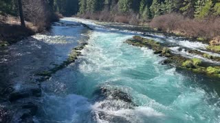
White Water Rapids of Metolius River National Recreation Area – Central Oregon
My goal of these wilderness trail videos is to 1) show reverence for the beauty of the land, and 2) give YOU actionable trail information that can assist you in planning your own hike here.
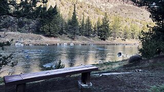
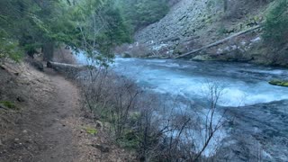
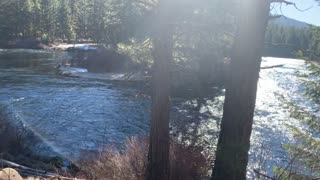
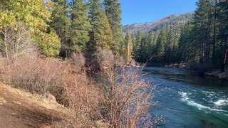
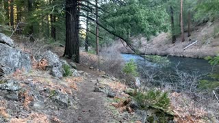
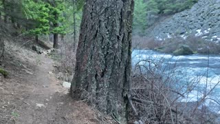
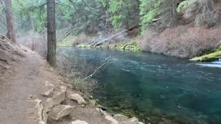
This was a day-hike in Central Oregon, Deschutes National Forest, Metolius River National Recreation Area, starting at Allen Springs Campground on East Metolius River Trail exploring the East side of Metolius River with miles of epic shoreline hiking and only a few hundred feet elevation gain over a long distance making it mostly a flat hike. The elevation starts around 2800 ft and stays in a range of up to 3000 ft, at such low elevation it allows this hike to be done in the end of Winter as far as snow melt and road access. The temperature was below freezing and the ground was frozen for the majority of the hike, the sun came out and the ground finally started to melt near the end of the hike. The sky was overcast and it sprinkled on and off for the majority of the day. This was hiked on 3/4/2022 and there were of course NO Mosquitoes. As far as road conditions, it's highway to the turn off for the Camp Sherman area which is a well paved road until the turn off to Allen Springs Campground which is also paved, so it was a very easy and safe driving route. In my opinion, the road most definitely DOES NOT require 4-Wheel Drive, however do watch for road conditions, particularly snow/ice depending on the time of year.
-
 9:45
9:45
HikingViking
13 days agoGreenwood Day Use Area @ Lower Crooked National Wild & Scenic River! | BLM | Prineville Oregon | 4K
36 -
 0:42
0:42
HikingViking
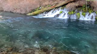
2 years agoWhite Water Rapids – Metolius River – Central Oregon – 4K
746 -
 1:02
1:02
HikingViking
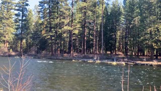
2 years agoShoreline Exploration – Metolius River National Recreation Area – Central Oregon
106 -
 1:20
1:20
HikingViking
2 years agoHiking Shoreline – Metolius River National Recreation Area – Central Oregon
642 -
 0:23
0:23
HikingViking
2 years agoAquamarine Splendor – Metolius River National Recreation Area – Central Oregon
55 -
 2:53
2:53
HikingViking
2 years agoExploring the Shoreline – Metolius River National Recreation Area – Central Oregon
43 -
 2:08
2:08
HikingViking
2 years agoExploring the Shoreline of Metolius River National Recreation Area – Central Oregon
18 -
 0:54
0:54
HikingViking
2 years agoThe World Famous Metolius River National Recreation Area – Central Oregon – 4K
14 -
 0:40
0:40
HikingViking
2 years agoA Myriad of Glacial Waterfalls – Metolius River National Recreation Area – Central Oregon
424 -
 0:43
0:43
HikingViking
2 years agoGorgeous River Hiking – Metolius River National Recreation Area – Central Oregon – 4K
13