Gino Recchia NBC26 Weather Forecast
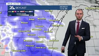
A quick burst of snow and a wintry mix caused some slippery stretches for the first half of the day. Most snowfall accumulations remained north of Highway 29 with 1-3 inches being reports from Shawano to Stiles. Freezing rain and sleet mixed in with snow elsewhere. Tonight will remain partly to mostly cloudy with temperatures falling into the lower 20s under calm winds. Christmas Eve will bring in some rainfall, but in the early morning, with temperatures below freezing, there may be a period of freezing rain or freezing drizzle, so take it slow. Temperatures will climb to 40 which will melt any ice covered surfaces. Patchy dense fog is possible Christmas Eve evening with lows around 30. The first half of Christmas Day will be a dry one. We will have temperatures in the mid 30s with mostly cloudy skies. Later at night, there is a chance of a wintry mix carrying over into the overnight. We will keep the chance of snow or wintry mix through early next week before an arctic high pressure works in and drops our temperatures down while pushing away any chance of precipitation.
-
 3:36
3:36
WGBA
7 months agoWill it be necessary to have both the AC & the heat on during the same day??
991 -
 3:20
3:20
WGBA
2 years agoGino Recchia NBC26 Weather Forecast
11 -
 5:05
5:05
WGBA
2 years agoGino Recchia NBC26 Weather Forecast
1 -
 4:01
4:01
WGBA
2 years agoGino Recchia NBC26 Weather Forecast
2 -
 4:10
4:10
WGBA
2 years agoGino Recchia NBC26 Weather Forecast
2 -
 3:34
3:34
WGBA
2 years agoGino Recchia NBC26 Weather Forecast
-
 2:51
2:51
WGBA
2 years agoGino Recchia NBC26 Weather Forecast
-
 3:52
3:52
WGBA
2 years agoGino Recchia NBC26 Weather Forecast
-
 1:41
1:41
WGBA
2 years agoGino Recchia NBC26 Weather Forecast
7 -
 3:29
3:29
WGBA
2 years agoGino Recchia NBC26 Weather Forecast