Premium Only Content

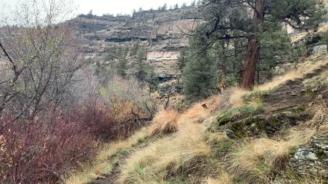
Central Oregon – Steelhead Falls – Hiking Shoreline of Crooked River – 4K
My goal of these wilderness trail videos is to 1) show reverence for the beauty of the land, and 2) give YOU actionable trail information that can assist you in planning your own hike here.
This was a day-hike in Central Oregon, Steelhead Falls Wilderness Study Area, starting at Steelhead Falls Trailhead and hiking a 2-mile out and back, approximately 226 feet elevation gain (mostly on the way back up). If you just want to go to the Steelhead Falls lookout area and back it is only half of that, 1-mile roundtrip. Weather was a low of 40, high of 56, overcast cloudy day and mildly windy. This was hiked on 11/2/2021 with fall colors in transition or full bloom, trail was completely clear of snow, and there were NO Mosquitoes! On Alltrails this hike is called "Steelhead Falls". As far as road conditions, it's highway and paved side streets until the last few tenths of a mile or so which is gravel, you want to take this part a little cautiously but it's fairly easy. In my opinion, the road most definitely DOES NOT require 4-Wheel Drive. As far as permits, the Steelhead Falls Trailhead DOES NOT require a Recreation.gov permit.
-
 3:23
3:23
HikingViking
2 months ago(4K UHD) HIKING HIGHLIGHTS - West on Salmon River Trail | Salmon-Huckleberry Wilderness | Mount Hood
1081 -
 8:38
8:38
WhaddoYouMeme
4 hours agoChristians in Iran Are Being Hunted—Here’s Why
1431 -
 LIVE
LIVE
VapinGamers
2 hours agoCOD Black Ops 6 with Abnerdagreat, Gunnin and Runnin! - !rumbot
90 watching -
 1:53:32
Glenn Greenwald
3 hours agoWhy Did Zohran Win in NYC? Plus: Gazan Pulitzer Prize Winner Mosab Abu Toha on the Latest Atrocities | SYSTEM UPDATE SHOW #476
145K40 -
 DVR
DVR
RiftTV/Slightly Offensive
6 hours agoCrowder Takes SHOT at Candace, “Panicans” OBLITERATED? | The Rift | Guests: Hodge Twins
20.9K7 -
 LIVE
LIVE
Spartan
2 hours agoPro Halo Player | Sens Crisis Grind | Ranked Arena, Probably SWTOR at some point
52 watching -

EnDuEnDo
2 hours ago🚨Variety Stream 🎮 Push to 600 Followers 🚀 Chill Vibes 😎 Content Creator for @SelfMadeGGs & @SMKAcademy
62 -
 LIVE
LIVE
Playback Request Live
3 hours agoMillennial Meltdown: 2000s Pop Hits & Tabloid Twists
66 watching -
 LIVE
LIVE
Melonie Mac
2 hours agoGo Boom Live Ep 52!
159 watching -
 1:04:22
BonginoReport
4 hours agoNYC Chooses Socialist Mayoral Candidate - Nightly Scroll w/ Hayley Caronia (Ep.77) - 06/25/2025
130K59