Weird State Borders - El Paso Area
The Boundary Act of 1850 finalized the shape of Texas as we know it today.
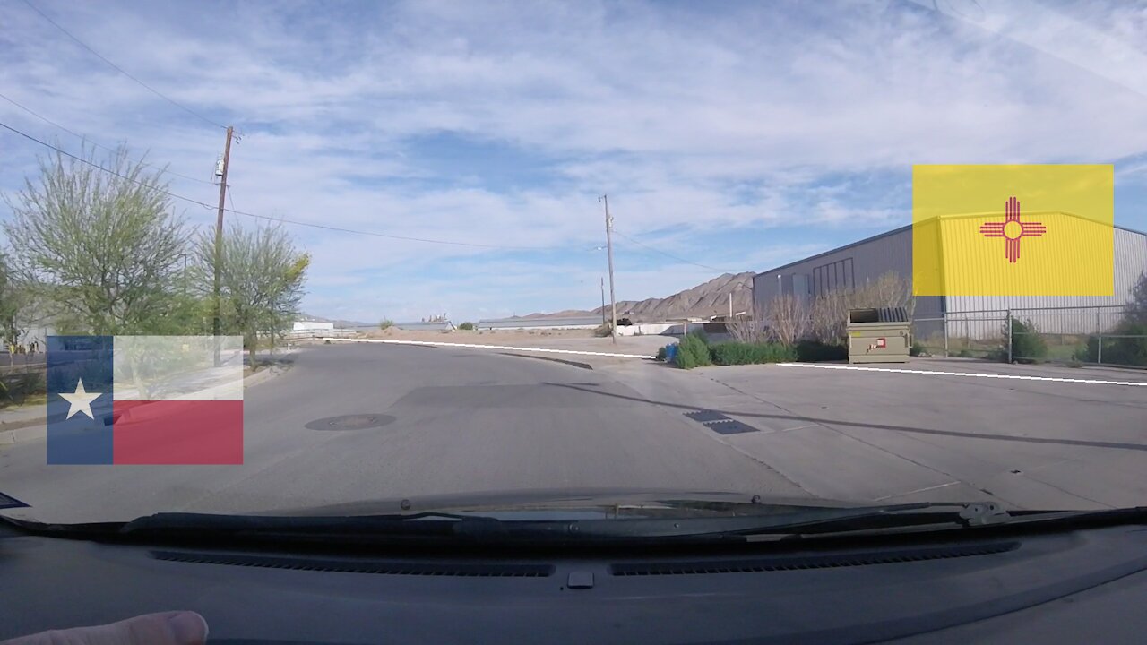
The area of interest in this video is the 25 miles of Texas/New Mexico line traced down the channel of the Rio Grande River, from 32 degrees north southward to the place where the Mexican Border intersects the river today.
This small section of stream, which forms the extreme western tip of Texas, changed course over many decades. By the 20th Century, the people of the area had forgotten where the river had been, which led to a major dispute between the two states.
The Supreme Court decided a surveyor would calculate where the 1850 channel of the river had been. The surveyor completed his work in 1930, setting 105 concrete monuments to mark this unusual state line in the El Paso area.
The state line winds through fields and buildings with no clear pattern.
In May 2021, my children and I stopped to take a look.
In 65 minutes, we explored the area, crossing the line 7 times.
This included a small detour to see the Mexican Border.
See references below: https://amerisurv.com/2019/02/10/unsung-hero-the-texas-new-mexico-border/
https://www.tsl.texas.gov/treasures/earlystate/boundary.html
https://www.tsl.texas.gov/treasures/earlystate/boundary-01.html
https://www.drtinfo.org/education/republic-of-texas-2/boundaries-of-the-republic-of-texas
-
 5:37
5:37
Weekly Videos
3 years agoFriendship Boundaries
27 -
 0:37
0:37
jim04092
4 years agoLost Maples State Natural Area
2331 -
 9:49
9:49
Global Bob’s Adventures
4 years agoRichloam Area Jeep Adventure in the Withlacoochee State Forest
26 -
 6:25
6:25
Jerika316
4 years agoUNUSUAL Foods
20 -
 1:46
1:46
Camera Drone videos from my personal Breeze drone
4 years agoSnow-filled State Lakes Area Feb. 2021
18 -
 6:57
6:57
GeologyForestryEngineering
4 years agoMoraine State Park 528 Bridge Area
19 -
 41:26
41:26
Kimberly Guilfoyle
2 hours agoMaking DC Safe Again, Live with Daily Signal's Tyler O'Neil | Ep249
59.6K16 -
 LIVE
LIVE
Dr Disrespect
6 hours ago🔴LIVE - DR DISRESPECT VS. JEAN-CLAUDE VAN DAMME - HITMAN
1,329 watching -
 32:43
32:43
Uncommon Sense In Current Times
4 days agoAre Women’s Sports Under Attack? | Penny Nance on Protecting Title IX & Biblical Truth
9.57K -
 LIVE
LIVE
LFA TV
22 hours agoLFA TV ALL DAY STREAM - MONDAY 8/25/25
1,150 watching