Brittney's NBC 26 weather forecast
3 years ago
7
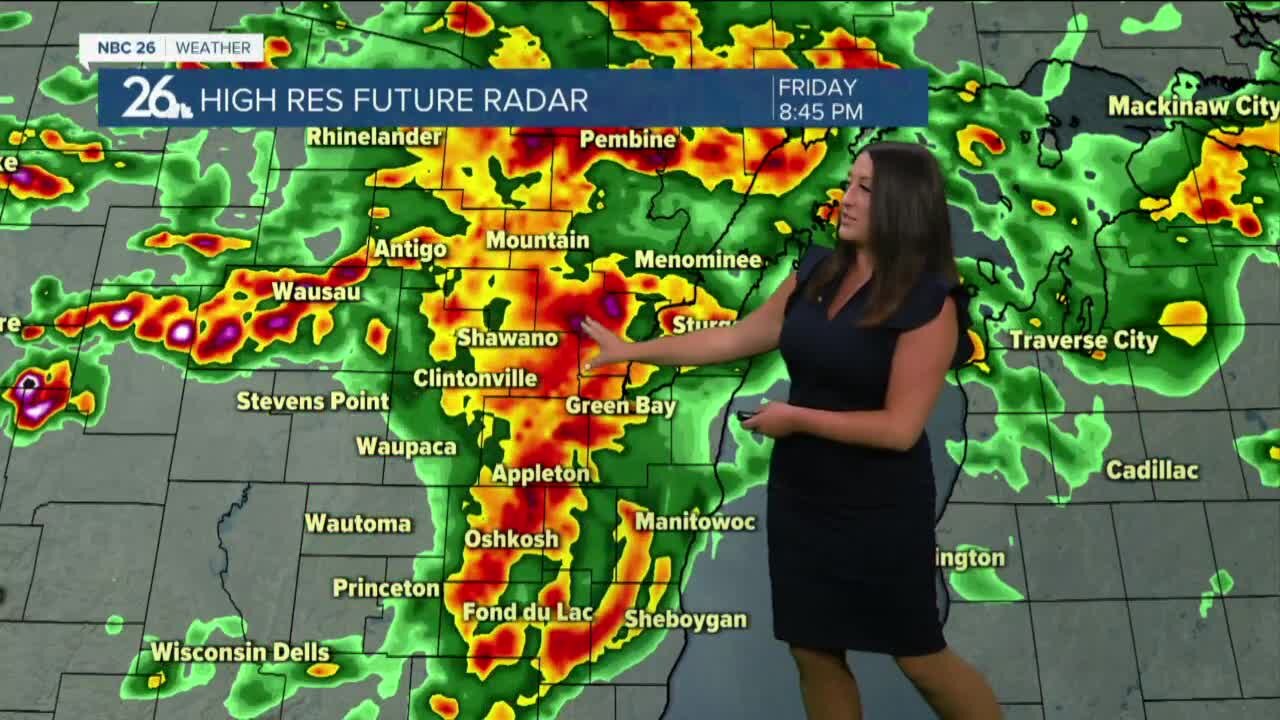
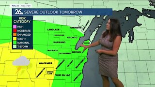
Showers and storms are moving through this morning as a warm front stalls across central to northern Wisconsin. Localized flooding and some gusty winds are possible. Temperatures remain mild in the upper 70s to low 80s today. Additional showers and thunderstorms capable of severe weather are once again expected Friday afternoon and into the evening. Hail, gusty winds, and localized flooding will be a problem once again. Saturday morning storms wind down and high temperatures will soar to the upper 80s and even some low 90s are possible. Under partly sunny skies for the afternoon, more showers and storms return at night along a cold front, into Sunday morning. Cooler weather returns next week, in the 70s with abundant sunshine.
Loading comments...
-
 1:57
1:57
WGBA
1 year agoHow the City of Green Bay is hoping a $1.6M investment will make the community safer for pedestrians
4442 -
 3:10
3:10
WGBA
3 years agoBrittney's NBC 26 weather forecast
8 -
 3:01
3:01
WGBA
3 years agoBrittney's NBC 26 weather forecast
12 -
 11:22
11:22
WGBA
4 years agoBrittney's NBC 26 weather forecast
11 -
 3:06
3:06
WGBA
4 years agoBrittney's NBC 26 weather forecast
6 -
 3:28
3:28
WGBA
3 years agoNBC 26 Weather Forecast
5 -
 3:25
3:25
WGBA
3 years agoNBC 26 Weather Forecast
2 -
 3:30
3:30
WGBA
3 years agoNBC 26 Weather Forecast
2 -
 3:16
3:16
WGBA
3 years agoNBC 26 Weather Forecast
6 -
 2:59
2:59
WGBA
3 years agoNBC 26 Weather Forecast
9