Gino Recchia NBC26 Weather Forecast
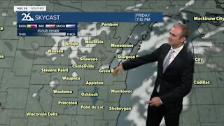
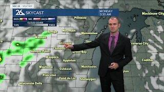
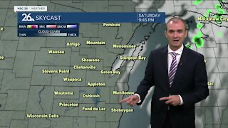
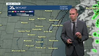
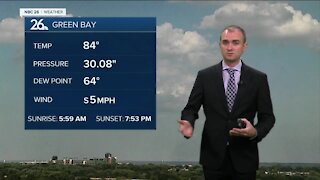
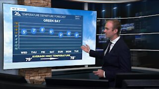
Showers and storms are expected to develop and move through overnight into tomorrow morning as a warm front stalls across central to northern Wisconsin. Localized flooding, some gusty winds, and hail are all possible. Temperatures remain mild in the upper 60s. Additional showers and thunderstorms capable of severe weather are once again expected Friday afternoon and evening. Hail, gusty winds, and localized flooding will be a problem once again. High temperatures will range vastly depending on when the morning storms break down and the sun returns. We may have highs as cool as the upper 70s to as warm to near 90. More storms will move through Friday night into Saturday morning as this warm front lifts northward. We should have a dry period during the day before a few isolated showers and storms develop in the afternoon and evening. Highs Saturday will get into the mid to upper 80s. A cold front moves in Sunday with a few additional showers and storms. Cooler weather returns next week.
-
 1:45
1:45
WGBA
7 months agoFond du Lac Cardinals start the football season with a new $5.3 million nest
65 -
 2:54
2:54
WGBA
2 years agoGino Recchia NBC26 Weather Forecast
3 -
 2:41
2:41
WGBA
2 years agoGino Recchia NBC26 Weather Forecast
2 -
 3:33
3:33
WGBA
2 years agoGino Recchia NBC26 Weather Forecast
6 -
 3:58
3:58
WGBA
2 years agoGino Recchia NBC26 Weather Forecast
5 -
 2:56
2:56
WGBA
2 years agoGino Recchia NBC26 Weather Forecast
5 -
 3:07
3:07
WGBA
2 years agoGino Recchia NBC26 Weather Forecast
3 -
 2:53
2:53
WGBA
2 years agoGino Recchia NBC26 Weather Forecast
2 -
 0:58
0:58
WGBA
2 years agoGino Recchia NBC26 Weather Forecast
9 -
 3:37
3:37
WGBA
2 years agoGino Recchia NBC26 Weather Forecast
1