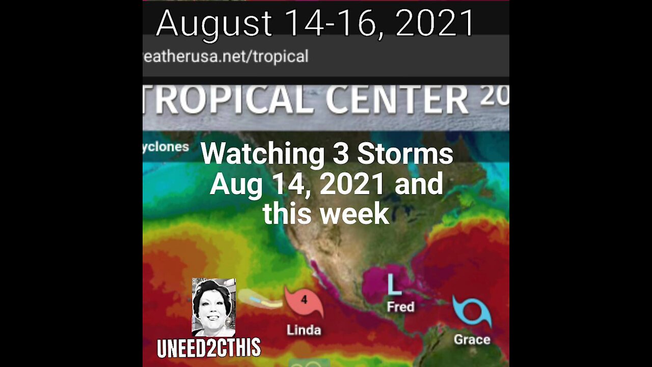
TROPICAL STORMS FRED, GRACE, & LINDA Raging Aug 14-18, 2021
TROPICAL STORM FRED
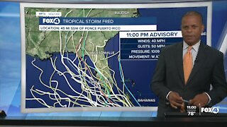
8-14-21 5pm with 35 mph winds, moving WNW at 11 mph.
²"Fred is likely to re-form
a well-defined closed circulation over the eastern Gulf of Mexico
Sunday morning. "
¹"Through today...sat
Portions of Cuba...2 to 5 inches with isolated maximum totals of 8
inches. This rainfall may lead to scattered flash flooding.
Across the Bahamas...1 to 3 inches, with isolated maximum totals of
5 inches.
Through Monday...
Keys and southern Florida...3 to 5 inches.
From Sunday night into Tuesday...
The Florida Big Bend and Panhandle...3 to 7 inches with isolated
maximum totals of 10 inches.
Southern Alabama...2 to 4 inches with isolated maximum totals of 6
inches.
Heavy rainfall across portions of Florida and southern Alabama could
lead to areal, urban, small stream and river flooding impacts.
From Tuesday onward...
Heavy rain and flood impacts could extend into inland portions of
the Southeast and into the southern and central Appalachians and
Piedmont as Fred interacts with a front in the area.
SURF: Swells generated by Fred or its remnants are expected to
spread across the Florida Keys later this morning and reach the
coast of Mississippi, Alabama and the Florida Panhandle on Monday.
Please consult products from your local weather office for more
details.
TORNADOES: A tornado or two are possible through Sunday over parts
of the western Florida peninsula."¹
² https://www.weatherusa.net/tropical
UNEED2CTHIS © 2021
Reporter: Dawn Pearce
-
 1:49
1:49
WPTV
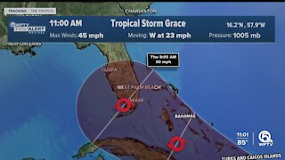
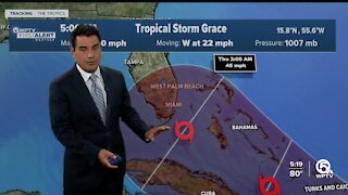
3 years agoTropical Storm Grace forms as Fred weakens to tropical wave
122 -
 1:01
1:01
WFTX
3 years agoTracking Tropical Storm Grace
198 -
 0:40
0:40
WFTX
3 years agoTracking Tropical Depression Grace
15 -
 4:01
4:01
WPTV
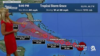
3 years agoTropical Storm Grace weakens, remnants of Fred bringing rain to South Florida
339 -
 3:12
3:12
WPTV
3 years agoTropical Storm Grace forms; Tropical Depression Fred to remain on westerly track in Gulf
118 -
 1:28
1:28
WFTX
3 years agoTropical Storm Fred forms
230 -
 2:47
2:47
WPTV
3 years agoTropical Depression Fred, Potential Tropical Cyclone Seven
131 -
 0:46
0:46
WFTX
3 years agoTracking Tropical Storm Fred
41 -
 1:11
1:11
WPTV
3 years agoTracking Tropical Storm Fred: Wednesday 5 a.m.
142 -
 1:13
1:13
WFTX
3 years agoTropical Storm Fred 5AM Advisory
118