NBC 26 Weather Forecast
2 years ago
9
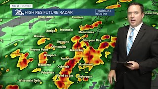
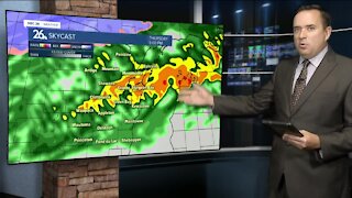
The severe storm risk returns today, with highs in the mid to upper 80s. Factoring in the high humidity, it will feel more like the mid 90s to near 100° in the southern Fox Valley towns. This afternoon strong to severe storms fire up and the main threats will be damaging winds, large hail and heavy rain that could cause flash flooding again. We also can't rule out a possible tornado/waterspout. 90s could surge in if we get enough sunshine at peak heating this week. Dew points will all be rising into the upper 60s & lower 70s too, making for some uncomfortable and oppressive. Dry & less humid weather returns by Friday!
Loading comments...
-
 3:51
3:51
WGBA
3 years agoNBC 26 weather forecast
9 -
 3:50
3:50
WGBA
3 years agoNBC 26 weather forecast
7 -
 1:51
1:51
RedWeatherman
3 years ago5/27/21 Local Weather Forecast
5 -
 1:00
1:00
RedWeatherman
3 years ago5/24/21 Local Weather Forecast
3 -
 1:35
1:35
RedWeatherman
3 years ago6/18/21 Local Weather Forecast
11 -
 9:45
9:45
Great Lakes Weather
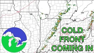
10 months agoIsolated Severe Storms Possible Tomorrow, Cooler Weather Ahead -Great Lakes Weather
4 -
 13:14
13:14
YaddaNews
1 year agoOh no... BIG TIME Severe Weather Starting Tomorrow!
22 -
 5:28
5:28
NCTV45
1 year agoNCTV45’S LAWRENCE COUNTY 45 WEATHER FRIDAY SEPT 23 2022 PLEASE SHARE
-
 28:33
28:33
Aaron Tuttle Meteorologist
2 years agoWATCH: Monday Night Live Weather Update
31 -
 59:04
59:04
Aaron Tuttle Meteorologist
1 year agoWATCH: Sunday Night Live Weather Update
201