Brittney's NBC 26 weather forecast
Severe thunderstorms tore through the area overnight, knocking out power to 45,000+ customers in NE WI. In Brown county alone, near 1,000 customers are waking up to no power. Trees are down, branches were ripped off and heavy downpours continue this morning. Be careful on your morning commute! The severe risk this morning is diminishing and some sun will actually be out by the afternoon hours, with high temperatures rising into the mid and upper 80s. There is a marginal risk for strong to severe storms tonight, mainly after 6pm. Right now it is a low risk and where exactly the thunderstorms will develop remain a question as well. Another day near 90 is likely Wednesday with more chance of showers and storms before cooling down into the upper 70s and lower 80s to close out the week. The chances of severe weather is highest on Wednesday night, as we are in an enhanced risk.
-
 3:36
3:36
WGBA
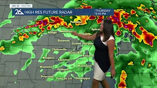
2 years agoBrittney's NBC 26 weather forecast
8 -
 3:49
3:49
WGBA
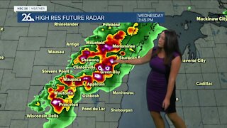
2 years agoBrittney's NBC 26 weather forecast
6 -
 16:26
16:26
ScottyRay
3 years agoScotty Ray's Weather 12-30-20
480 -
 9:09
9:09
ScottyRay
3 years agoScotty Ray's Weather 11-29-20
3 -
 9:45
9:45
Great Lakes Weather
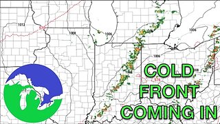
8 months agoIsolated Severe Storms Possible Tomorrow, Cooler Weather Ahead -Great Lakes Weather
4 -
 1:25:10
Off-Grid Backcountry Adventures
2 years agoLarge Hail, High Winds Forecasted - Let's Livestream! (check out forecast in description below)
36 -
 9:30
9:30
ScottyRay
3 years agoScotty Ray's Weather 12-28-20
31 -
 1:35
1:35
RedWeatherman
2 years ago6/18/21 Local Weather Forecast
11 -
 1:51
1:51
RedWeatherman
2 years ago5/27/21 Local Weather Forecast
5 -
 10:34
10:34
Great Lakes Weather
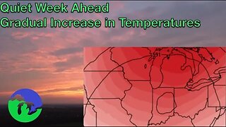
8 months agoThunderstorms Tuesday; Quiet Pattern Ahead with Gradual Warming Trend -Great Lakes Weather
4