Satellite Navigation Accuracy
The Prague-based European Global Navigation Satellite System Agency (GSA) has commissioned RUAG Space to conduct a study to increase real-time satellite navigation accuracy.
“The more accurately the satellite’s position can be determined, the more precise the environmental data it collects and provides. With the more accurate data, for example, the danger to coastal cities such as Venice can be predicted more effectively.”
Fiammetta Diani, Head of Market Development at GSA.
For climate and environmental research, satellites provide extremely important data every day, such as how high sea levels are rising or what effects global warming is having on glacier ice shrinkage in the Alps.
The new study, funded by a one-million Euro ($1.2 million) GSA contract, aims to further increase the accuracy of this space data from climate and environmental satellites.
To provide precise Earth observation data from space, the satellite’s position in space must be known as accurately as possible.
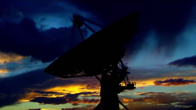
To determine the exact position of satellites, RUAG Space’s satellite navigation receivers today use the signals from the 22 European Galileo navigation satellites.
“Currently, there is still untapped potential in the Galileo satellites.
They transmit several signals.
On one of these signals, a new service, the High Accuracy Service (HAS), will support significantly improved positioning from 2022,” said Martin Auer, who is leading the study at RUAG Space.
“When this new service goes into operational use, it will need equipment that can do something with it.
That’s what we’re working on.”
By the end of 2022, RUAG Space will develop a new product in Vienna that will be able to use the new Galileo HAS service.
However, navigation receivers from RUAG Space that process Galileo signals already ensure precise positioning.
These include the Sentinel-6 environmental satellite, which has been in space since November 2020.
It measures the amount of sea level change and provides crucial data on coastal areas at risk from sea level rise.
“The more accurately the satellite’s position can be determined, the more precise the environmental data it collects and provides.
With the more accurate data, for example, the danger to coastal cities such as Venice can be predicted more effectively,” said Fiammetta Diani, Head of Market Development at GSA.
RUAG Space is developing a software update for satellite navigation receivers of the current PODRIX receiver generation already in space, such as those used for Sentinel-6.
This will enable these receivers to increase the satellite navigation accuracy from the current level of about one meter (3.2 feet) to 20 centimeters (8 inches).
“This is a dramatic improvement – a quantum leap – in accurate satellite positioning that will contribute to much better climate and environmental data,” said Heinz Reichinger, the product manager responsible at RUAG Space.
-
 9:10
9:10
BlackDiamondGunsandGear
7 hours agoI Finally Got it! / Now i need to BUILD IT!
3.31K1 -
 9:44
9:44
Millionaire Mentor
3 days agoCharlie Kirk Brings Woke Student To STUTTERING Over White Privilege Lies
1535 -
 24:12
24:12
MudandMunitions
8 hours agoOff-Roading with NYPrepper Wild Elk & PA’s Most Remote Backroads
2.71K -
 LIVE
LIVE
Bannons War Room
7 months agoWarRoom Live
4,334 watching -
 LIVE
LIVE
IsaiahLCarter
7 hours agoAPOSTATE RADIO 029: Leftist Violence, & NYC's Mayor's Race (Guests: Lattina Brown and David Sivella)
64 watching -
 10:03:41
LFA TV
14 hours agoLIVE: CHARLIE KIRK VIGIL SERVICE!
171K60 -
 6:59:16
BaldBrad
9 hours agoCharlie Kirk Memorial LIVESTREAM
42.3K4 -
 5:13:13
Professor Nez
1 day ago🚨Charlie Kirk Funeral LIVE: Trump Honors Kirk in Arizona 🇺🇸
34.1K14 -
 22:13
22:13
iCkEdMeL
10 hours ago $12.98 earnedMass Shooting at Wedding Reception — Witnesses Say Shooter Yelled “Free Palestine”
135K43 -
 0:36
0:36
Danny Rayes
3 days ago $5.28 earnedFacebook Needs To Be Stopped...
103K21