Satellite Navigation Accuracy
The Prague-based European Global Navigation Satellite System Agency (GSA) has commissioned RUAG Space to conduct a study to increase real-time satellite navigation accuracy.
“The more accurately the satellite’s position can be determined, the more precise the environmental data it collects and provides. With the more accurate data, for example, the danger to coastal cities such as Venice can be predicted more effectively.”
Fiammetta Diani, Head of Market Development at GSA.
For climate and environmental research, satellites provide extremely important data every day, such as how high sea levels are rising or what effects global warming is having on glacier ice shrinkage in the Alps.
The new study, funded by a one-million Euro ($1.2 million) GSA contract, aims to further increase the accuracy of this space data from climate and environmental satellites.
To provide precise Earth observation data from space, the satellite’s position in space must be known as accurately as possible.
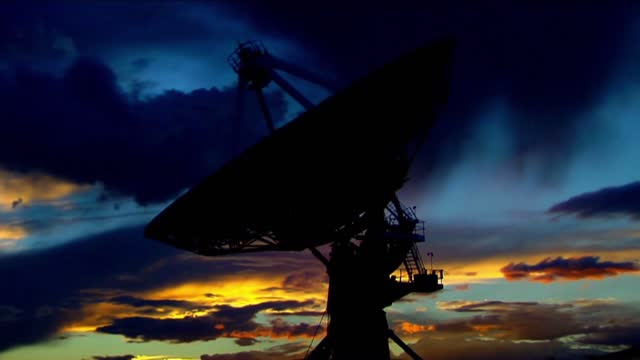
To determine the exact position of satellites, RUAG Space’s satellite navigation receivers today use the signals from the 22 European Galileo navigation satellites.
“Currently, there is still untapped potential in the Galileo satellites.
They transmit several signals.
On one of these signals, a new service, the High Accuracy Service (HAS), will support significantly improved positioning from 2022,” said Martin Auer, who is leading the study at RUAG Space.
“When this new service goes into operational use, it will need equipment that can do something with it.
That’s what we’re working on.”
By the end of 2022, RUAG Space will develop a new product in Vienna that will be able to use the new Galileo HAS service.
However, navigation receivers from RUAG Space that process Galileo signals already ensure precise positioning.
These include the Sentinel-6 environmental satellite, which has been in space since November 2020.
It measures the amount of sea level change and provides crucial data on coastal areas at risk from sea level rise.
“The more accurately the satellite’s position can be determined, the more precise the environmental data it collects and provides.
With the more accurate data, for example, the danger to coastal cities such as Venice can be predicted more effectively,” said Fiammetta Diani, Head of Market Development at GSA.
RUAG Space is developing a software update for satellite navigation receivers of the current PODRIX receiver generation already in space, such as those used for Sentinel-6.
This will enable these receivers to increase the satellite navigation accuracy from the current level of about one meter (3.2 feet) to 20 centimeters (8 inches).
“This is a dramatic improvement – a quantum leap – in accurate satellite positioning that will contribute to much better climate and environmental data,” said Heinz Reichinger, the product manager responsible at RUAG Space.
-
 1:01:12
Donald Trump Jr.
6 hours agoThe China Matrix with Journalist Lee Smith | TRIGGERED Ep.288
105K71 -
 LIVE
LIVE
Dr Disrespect
11 hours ago🔴LIVE - DR DISRESPECT - ARC RAIDERS - FULL SEND INTO THE RED
1,078 watching -
 LIVE
LIVE
JdaDelete
2 hours agoFinally playing Eldin Ring | First Playthrough Episode 2
14 watching -
 1:02:08
BonginoReport
4 hours agoNicki Minaj Speaks Out Against Christian Persecution - Nightly Scroll w/ Hayley Caronia (Ep.169)
37.7K25 -
 LIVE
LIVE
HomieQuest
4 hours agoLive Streaming! Pokemon Legends Z-A
6 watching -
 LIVE
LIVE
FusedAegisTV
7 hours agoFUSEDAEGIS PLAYS THE GREATEST JRPG EVER MADE ⌛► CHRONO TRIGGER (1995) Part 3
30 watching -
 DVR
DVR
Nerdrotic
3 hours ago $2.05 earnedNerdrotic At Night 531
18.7K3 -
 1:43:27
Glenn Greenwald
4 hours agoThe Right's Crusade to Cancel Tucker | SYSTEM UPDATE #542
56.9K54 -
 2:10:04
Conductor_Jackson
23 hours agoLet's Play Unrailed 2 Solo! 🚂🚂🚂🚂🚂🚂
5.01K1 -
 1:25:38
Kim Iversen
5 hours agoTrump’s Nigeria Threat Isn’t About Christians — It’s About China
81.7K88