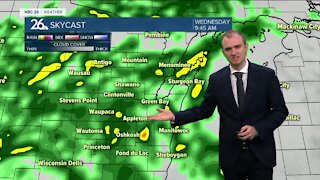
Gino Recchia NBC26 Weather Forecast
Temperatures will cool off tonight with overnight lows in the mid to upper 40s thanks to steady southwest winds around 10-15 mph. Chances of rain return for the first few days of the new week starting as early as Monday. Highs will be in the mid to upper 50s away from the lake on Monday. Winds will start out of the southwest but tilt to the southeast in the evening around 5-15 mph. More chances of rain will move in on Tuesday through Wednesday with temperatures in the mid to upper 50s. We do cool off a bit back into the mid to upper 40s for Thursday and Friday. There is a chance of rain or a wintry mix. One model even shows some accumulating snow. This will be a storm for us to watch and how it evolves over the coming days. A weak disturbance may scrape us on Saturday with more quiet weather on Sunday. Highs are expected to be in the mid to upper 40s both days. Long range temperature forecasts are keeping highs closer to average by the end of March. The average high temperature by the end of the month is 46.
-
 1:57
1:57
WGBA
1 year agoHow the City of Green Bay is hoping a $1.6M investment will make the community safer for pedestrians
2411 -
 3:26
3:26
WGBA
3 years agoGino Recchia NBC26 Weather Forecast
6 -
 3:19
3:19
WGBA
3 years agoGino Recchia NBC26 Weather Forecast
4 -
 3:42
3:42
WGBA
3 years agoGino Recchia NBC26 Weather Forecast
5 -
 3:35
3:35
WGBA
3 years agoGino Recchia NBC26 Weather Forecast
4 -
 3:23
3:23
WGBA
3 years agoGino Recchia NBC26 Weather Forecast
7 -
 3:13
3:13
WGBA
3 years agoGino Recchia NBC26 Weather Forecast
7 -
 3:25
3:25
WGBA
3 years agoGino Recchia NBC26 Weather Forecast
13 -
 3:14
3:14
WGBA
3 years agoGino Recchia NBC26 Weather Forecast
3 -
 3:22
3:22
WGBA
3 years agoGino Recchia NBC26 Weather Forecast
11