NBC 26 weather forecast
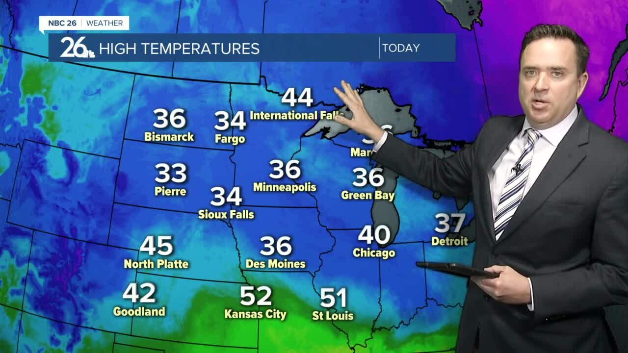
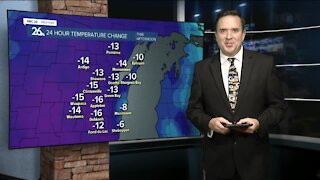
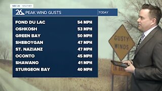
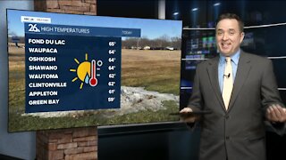
Light snow will pass through our area tonight. There could be a little minor accumulation mainly under an inch, though possibly 1-2" toward HWY 23 and south of there. Temperatures will fall into the upper 20s. Cloudy to mostly cloudy skies will stick around Tuesday with highs in the upper 30s to the lower 40s. We may see a "little" more sunshine on Wednesday with highs in the lower 40s. Some light snow or a wintry mix is possible as a storm system will pass mainly south of Wisconsin Thursday AM but winds will pick up out of the east because of it. We'll be in the 40s, though it will be cooler by the lake. High pressure moves in on Friday from Canada dropping our highs into the low to mid 40s with mostly sunny skies. We rise up into the lower to mid/upper 50s during the weekend with more sunshine as the high pressure shifts east and we get in the warmer air return flow. Long range temperature forecasts are keeping highs general slightly above average through the end of March. The average high temperature by the end of the month is 46.
-
 1:45
1:45
WGBA
1 year agoStudents excited to start at "huge and beautiful" Vel Phillips Middle School
292 -
 4:06
4:06
WGBA
4 years agoNBC 26 weather forecast
17 -
 0:38
0:38
WGBA
4 years agoNBC 26 weather forecast
13 -
 3:42
3:42
WGBA
4 years agoNBC 26 weather forecast
2 -
 4:03
4:03
WGBA
4 years agoNBC 26 weather forecast
2 -
 3:37
3:37
WGBA
4 years agoNBC 26 weather forecast
7 -
 3:35
3:35
WGBA
4 years agoNBC 26 weather forecast
4 -
 3:27
3:27
WGBA
4 years agoNBC 26 weather forecast
6 -
 3:01
3:01
WGBA
4 years agoNBC 26 weather forecast
6 -
 3:29
3:29
WGBA
4 years agoNBC 26 weather forecast
7