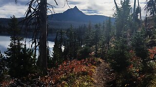
Panorama Dome Trail Mammoth Lakes
3 years ago
51
From the top of Panorama Dome, you’ll see views of the Mammoth Crest and Mammoth Mountain to the west, the Long Valley Caldera and White Mountains to the east, and the town of Mammoth Lakes below.
Coordinates 37°37′05″N 119°00′28″W
© Mike Barkley Photo
MikeBarkleyPhoto.PhotoShelter.com
Filmed 11 Sept 2017 with Yuneec Typhoon H in 4K video.
Loading comments...
-
 3:30
3:30
Mike Barkley Photo Aerial
3 years agoLake Tahoe Before A Storm
19 -
 11:12
11:12
HikingViking
8 months agoHiking the Big Lake Overlook Shoreline Trail! | Mount Washington | Patjens Lake Trail | Oregon | 4K
67 -
 0:26
0:26
HikingViking
2 years agoOregon – Mount Hood National Forest – Panoramic Views of Lower Twin Lake – 4K
47 -
 2:47
2:47
HikingViking
2 years agoAlpine Lakes > Waterfalls – Tamanawas Falls – Mount Hood – Oregon – 4K
44 -
 7:46
7:46
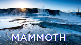
Robert Anthony Photography
2 years agoMammoth Hot Springs Yellowstone Sunrise Photography | Landscape Photography In Yellowstone Park
3082 -
 0:21
0:21
HikingViking
2 years agoOregon – Mount Hood – Panoramic Views from Alpine Trail
251 -
 0:29
0:29
HikingViking
2 years agoOregon – Mount Hood – Awesome Alpine Waterfall – 4K
353 -
 0:48
0:48
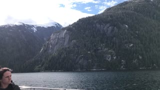
Schism12
2 years agoSnow Melt Waterfalls north of Punchbowl Cove Misty Fjords National Monument, Alaska
5 -
 0:51
0:51
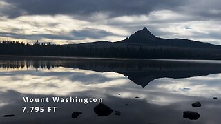
HikingViking
8 months agoHiking the Shoreline of Beautiful Big Lake Framed By Mighty Mount Washington! | Central Oregon | 4K
652 -
 0:25
0:25
HikingViking
2 years agoOregon – Mount Hood – Gorgeous Alpine Waterfall
42