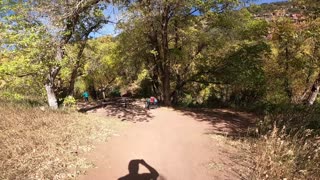
Rimrocker Trail - Part 3 - Highway 141 to the Colorado-Utah State Line
My Dad and I try to find, and stay on, the new Rimrocker Trail that goes from Montrose, CO to Moab, UT. In this video, we’ll cover part three of the trail from Highway 141 to the Colorado-Utah state line.
Official Website for the Rimrocker Trail:
http://rimrockertrail.org/
Local news story on the new Rimrocker Trail:
https://www.nbc11news.com/content/news/Connecting-Montrose-to-Moab-with-a-160-mile-long-off-roading-trail-482880991.html
Part 3 Directions - Highway 141 to the Colorado-Utah state line
From Part 2 turn left onto Highway 141 and proceed South for 1.4 miles to continue on the Rimrocker Trail.
Turn right on R13 Road, zero your trip meter, and cross the bridge over the Dolores River (N38 25.573 W108 49.39).
As you proceed down The R13 Road you'll Soon come to a fork on the R13 Road where the Q13 road splits off to the right.
Take the Q13 Road and it should begin a steep uphill climb up to Carpenter Flats.
Ignore the lesser roads on both the left and right and continue straight ahead.
When traveling along the mesa top, pay particular attention to your map because the trail wanders a bit.
Sometimes you will be on Q13 Road, but at other times the trail will take a different road to provide scenic views from roads less traveled. These include S12 Road, S10 Road, T10 Road, and R3 Road. See Inset 1 on the Rimrocker Trail map for a closer look at most of these roads.
Don’t worry if you happen to miss a turn for one of them, as they all rejoin Q13 Road.
At approximately 4.5 miles from Highway 141, the Q13 Road bears left and then right around a steeper climb (N38 24.18, W108 52.23). Continuing straight up the climb will get you to the same point, but with a little bit of a challenge.
At approximately 10.5 miles from the highway (N38 24.61 W108 56.52) you’ll be atop Carpenter Ridge.
After you pass the intersection with S8 Road, the Rimrocker Trail uses the same route as the Old Paradox Trail.
Eventually, 600 Road (aka Carpenter Ridge Road) will be on your left (N38 25.335 W108 57.89).
Beyond the intersection with 600 Road, the Rimrocker Trail continues on Q13 Road and then turns left on R3 Road.
The trail then rejoins Q13 Road and continues to the Manti La Sal National Forest, where the road also known as FSR 0378.
After entering the national forest, the Rimrocker Trail signs are brown instead of fluorescent green.
On the east side of Buckeye Reservoir is a left turn (N38 26.53 W109 02.10) to a group picnic area with toilets and a wonderful view of the reservoir.
Continuing on FSR 0378 (aka Q13 Road) past Buckeye Reservoir to an intersection, turn right and head northwest on FSR 0208 (aka U5 Road).
At approximately 19.4 miles from Highway 141 (N38 27.33 W109 03.60) you will cross into Utah.
-
 5:51
5:51
Coyote Overland
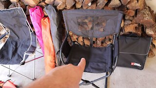
3 years agoIs this the Ultimate Overlanding Camp Chair?
1371 -
 17:35
17:35
Coyote Overland
3 years ago $0.01 earnedRimrocker Trail - Part 4 - Colorado-Utah State Line to Moab
146 -
 17:11
17:11
Coyote Overland
3 years agoRimrocker Trail - Part 2 - Nucla, CO to Highway 141
127 -
 12:59
12:59
Coyote Overland
3 years ago $0.02 earnedRimrocker Trail - Part 1 - Montrose, CO to Nucla, CO
120 -
 0:22
0:22
KTNV
3 years agoNew recreation trail near Nevada-Arizona state line
22 -
 17:41
17:41
Todd and Sheila's Outdoor Adventures
3 years ago $0.03 earnedRapids Trail Hike at Hillsborough River State Park
722 -
 1:40
1:40
Go West
3 years agoRifle State Park Colorado Part 2
33 -
 1:09
1:09
Trikke rides and stuff
3 years ago $0.01 earnedHigh Line Canal Trail
78 -
 2:44
2:44
Go West
3 years agoRifle State Park Colorado Part 1
63 -
 1:01
1:01
BlackHillsATV
3 years agoNeedles Highway Custer State Park Black Hills National Forest South Dakota
85