
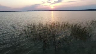
Drone Flight Over Medina Lake At Sunset - January 2nd 2021
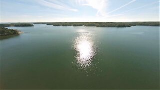
The last time we went flying out near Medina Lake was at least 6 months ago. We had been told the water levels were way down from normal, so we decided to make the drive out west to see for ourselves. We chose to fly the Autel Evo 2 Pro in 4K 60fps, but we wish we had changed that down to 30fps. Unless you are recording fast moving objects, it seems 60fps doesn't record quite the same clarity as 30fps does.
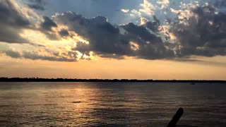
We got there just in time for sunset, so we grabbed some scenery shots that included the sunset. We flew out onto the lake to look at the shorelines which were very exposed due to the low water conditions. There is an animated chart at the very end of the video showing the decline in water levels over the past 2 years. It was about 30ft below normal today.
Medina Lake was created to provide steady water flow to farmers downstream so they could irrigate their crops. This means that a certain amount of water needs to be let out each month, regardless of the rainfall amounts (or lack thereof).
Please feel free to hit the RUMBLE button if you liked this, SUBSCRIBE if you want to see more, and leave a comment with your suggestions or observations. We always read and respond to comments. We do take requests from folks that want to see different types of aerial photography / videos from areas they might not be able to access from the ground. We are a certified Part 107 commercial drone pilot. Flight plans were filed prior to all flights.
We flew the Autel Evo 2 Pro drone, recording in 4K / 60fps. Video Editing software was Wondershare Filmora X. Music was from Epidemic Sound. Get your free 30 day trial from Epidemic Sound by clicking on this free referral link: https://www.epidemicsound.com/referral/d2jne3/
-
 3:16
3:16
Yellow Rose Drone Videos
1 year agoAerial View of the Ohio River at Evansville Indiana 4 Freedom Monuments #LST325 Vietnam War Memorial
121 -
 2:38
2:38
ChuckVanVleck
4 years ago $0.01 earned9 January 2021 Sunset
264 -
 4:21
4:21
goofynoodle
4 years agoDrone flight over cherry valley
28 -
 0:48
0:48
TMac FPV
4 years ago $0.01 earnedFirst-Person View (FPV) Drone Flight Over Lake with GPS Telemetry
72 -
 1:14
1:14
Viper2020
4 years ago $0.01 earnedDrone flight Video: Lake Minnetonka - Minnesota
6.36K -
 0:40
0:40
Davidtheexplorer
4 years ago $0.02 earnedDrone flight over field
271 -
 0:35
0:35
White Lake Vacations
4 years agoTime-lapse Sunset over White Lake
65 -
 4:41
4:41
Discovering Land
4 years agoValley Drone Flight
833 -
 0:38
0:38
Nature
4 years agoflight over the lake sundown 9
177 -
 1:00
1:00
tima102
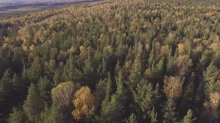
4 years ago $0.01 earneddrone flight over the forest
4903