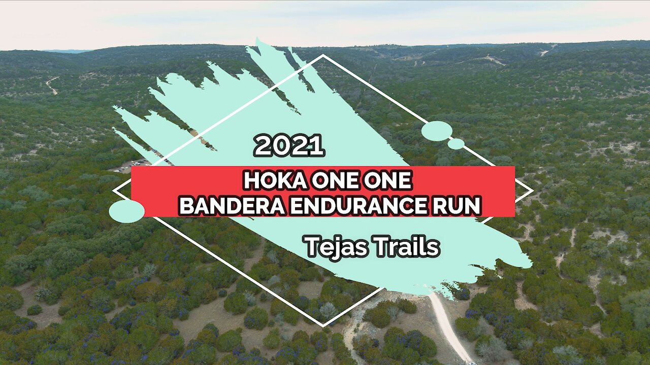
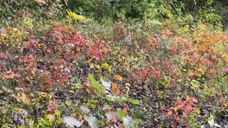
2021 Hoka One One Bandera 100k Endurance Run at Hill Country State Natural Area (Texas State Park)
This was the annual Hoka One One Bandera 100k event, held January 9-10th, 2021 and sponsored by https://www.TejasTrails.com in the Hill Country State Natural Area. HCSNA is a Texas State Park and requires written permission in advance from the Park Ranger before flying any drones from inside the park. Permission was obtained, thanks to the help of the event sponsor, and this video resulted from only about an hour's worth of flying.
Our primary purpose for being there during the Bandera 100k event out at Hill Country State Natural Area, wasn't to fly drones. It was to help with the Ham Radio communications between the YaYa Aid Station and Net Control at the Finish Line, not to fly drones. Flying drones was an optional task. We took advantage of a brief free time (less urgent) to fly around the YaYa and Equestrian Aid Stations, plus the "Lodge" at the Start / Finish area.
We tracked all of the runners by recording their bib number and time they passed thru the Aid station, then relayed it to our Net Control station. When it got down to the end of the cut-off times, we used that data to locate any runners still out on the course and know if it was safe to shut down an Aid Station, or whether we needed to send someone to sweep the course backwards (another runner) to find the "missing runner."
We were somewhat restricted in how much driving around we could accomplish, due to the runners out on the course, plus a shortage of Ham Radio volunteers whose presence we had counted upon to help free up our schedule on Saturday. They gave excuses about being exposed to Covid-19 the week before and not wanting to share it with the rest of us over the weekend. So therefore, our flying time was more limited than originally planned.
On Sunday morning, a storm front moved thru the area around 4:30am and kept raining for the next 12 hours, so I did not stick around to fly again on Sunday morning. Rain and drones don't mix well. Something about electronics and water.
There were 3 other Aid Stations, "Chapas," "Nachos" and "Boyles," where we had other Ham Radio crews monitoring the runners and relaying the runner bib numbers over the Ham radio using a computer program called WinLink. We didn't have any Hams at the Aid Station called "Last Chance" and we're not sure if they even used that location this year.
Please feel free to hit the LIKE button if you liked this, SUBSCRIBE if you want to see more, and leave a comment with your suggestions or observations. We always read and respond to comments. We do take requests from folks that want to see different types of aerial photography / videos from areas they might not be able to access from the ground. We are a certified Part 107 commercial drone pilot. Flight plans were filed prior to all flights.
We flew the Autel Evo 2 Pro drone, recording in 4K / 30fps. Video Editing software was Wondershare Filmora X. Music was from Epidemic Sound. Get your free 30 day trial from Epidemic Sound by clicking on this free referral link: https://www.epidemicsound.com/referral/d2jne3/
-
 4:59
4:59
Yellow Rose Drone Videos
1 year agoWedding of Lee Besing & Avril Rollison at Canyon Lake TX on December 2, 2023 #wedding #marriage
127 -
 3:14
3:14
Adventure_With_the_Dickasons
4 years agoBandera 100K 2021
72 -
 6:11
6:11
LoneStarNature
4 years ago $0.02 earnedColorado Bend State Park Texas Hill Country
118 -
 10:33
10:33
ThomasFugate
4 years ago $0.02 earnedNatural Tunnel State Park
139 -
 1:24
1:24
xfire524
4 years agoNatural beauty at Brown County State Park
22 -
 2:52
2:52
WKBW
4 years agoGovernor Cuomo delivers 2021 State of the State Address
2081 -
 12:51
12:51
DeLoEnterprises
4 years ago2021 Chevy Tahoe High Country
60 -
 16:09
16:09
DeLoEnterprises
4 years ago2021 Chevy Colorado High Country 4x4
17 -
 2:27
2:27
KIVI
4 years agoState of 208: BoiseDev looks 2021
711 -
 1:03:32
KERO
4 years agoState of California Update: January 4, 2021
5701