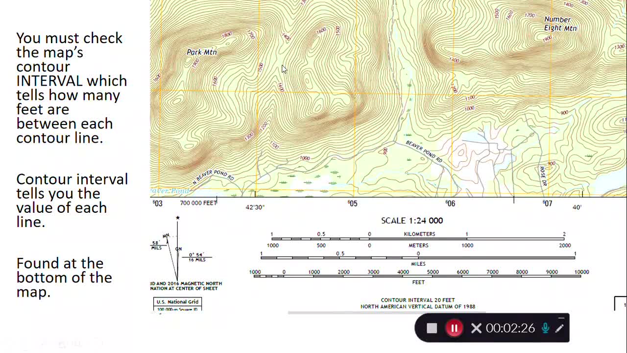
Topographic Maps: Contours and Elevation
Loading comments...
-
 13:10
13:10
DeLoEnterprises
4 years ago2021 GMC Sierra 1500 Elevation
64 -
 14:04
14:04
DeLoEnterprises
4 years ago $0.03 earned2021 GMC Sierra 1500 Elevation Duramax Diesel
135 -
 1:02
1:02
SPMP TV
4 years ago $0.06 earnedBreaking News - Elevation Business Magazine | Launch 2021
310 -
 10:21
10:21
mxhernandez21
4 years agoRumble Book Club : Elevation by Stephen King
74 -
 16:29
16:29
EricRock
4 years ago $0.05 earnedRattle by Elevation Worship - Is it Biblical? | WSLA Ep. 4
4453 -
 43:11
43:11
Revman
4 years ago $0.11 earnedBattle of Brooklyn with maps
2004 -
 11:49
11:49
Revman
4 years agoRev War NYC environs maps introduction
67 -
 1:43
1:43
Chutzpah
4 years ago $0.02 earnedLive Streaming Maps US 2020 Election
199 -
 2:55
2:55
OffroadTracks
4 years agoOffroad Tracks Importing with US Topo Maps
76 -
 8:55
8:55
Jamin13
4 years agoGolf, Maps and politicts
20