Gino Recchia NBC26 Weather Forecast
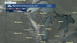
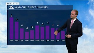
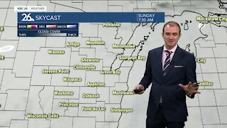
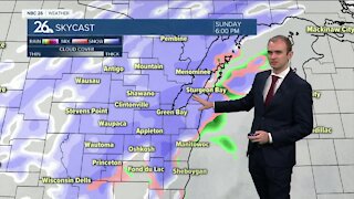
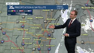
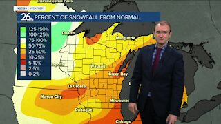
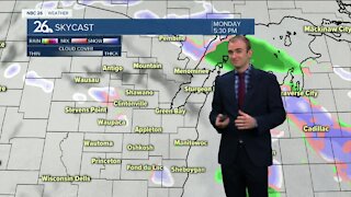
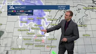
Tonight will be clear and chilly with lows in the single digits. Clouds will be increasing on Tuesday with highs in the mid- to upper-20s. Snow is on the way for Tuesday night. It will be kind of a quick-hitter as it develops through the evening, then starts to taper off into early Wednesday morning. It's looking likely that higher snowfall totals over a half foot will occur over the southern part of the state with lesser totals further north. 3-6 inches will be likely for areas along and south of Highway 29. Near and south of Highway 23, totals will be close to or exceed 6 inches. North of Highway 29, It's mainly 1-3 inches. There's still some uncertainty regarding the intensity of the snowfall and if the stronger snowfall over the southern part of the state cuts down on the amount of moisture we see further north. Either way we all should be seeing snow adding on top of the current snow pack that was laid down last night. Most of the snow should be moving out Wednesday morning. It could even mix in with some drizzle or freezing drizzle. Salt should work fine though with highs in the lower 30s. There will be another chance of snow on Friday, but with the low pressure developing in Texas, the track may shift very easily putting us out of any additional accumulation.
-
 1:45
1:45
WGBA
10 months agoStudents excited to start at "huge and beautiful" Vel Phillips Middle School
167 -
 3:25
3:25
WGBA
3 years agoGino Recchia NBC26 Weather Forecast
7 -
 3:21
3:21
WGBA
3 years agoGino Recchia NBC26 Weather Forecast
3 -
 3:11
3:11
WGBA
3 years agoGino Recchia NBC26 Weather Forecast
10 -
 3:28
3:28
WGBA
3 years agoGino Recchia NBC26 Weather Forecast
13 -
 3:15
3:15
WGBA
3 years agoGino Recchia NBC26 Weather Forecast
4 -
 3:22
3:22
WGBA
3 years agoGino Recchia NBC26 Weather Forecast
12 -
 2:44
2:44
WGBA
3 years agoGino Recchia NBC26 Weather Forecast
2 -
 5:56
5:56
WGBA
3 years agoGino Recchia NBC26 Weather Forecast
4 -
 3:21
3:21
WGBA
3 years agoGino Recchia NBC26 Weather Forecast
4