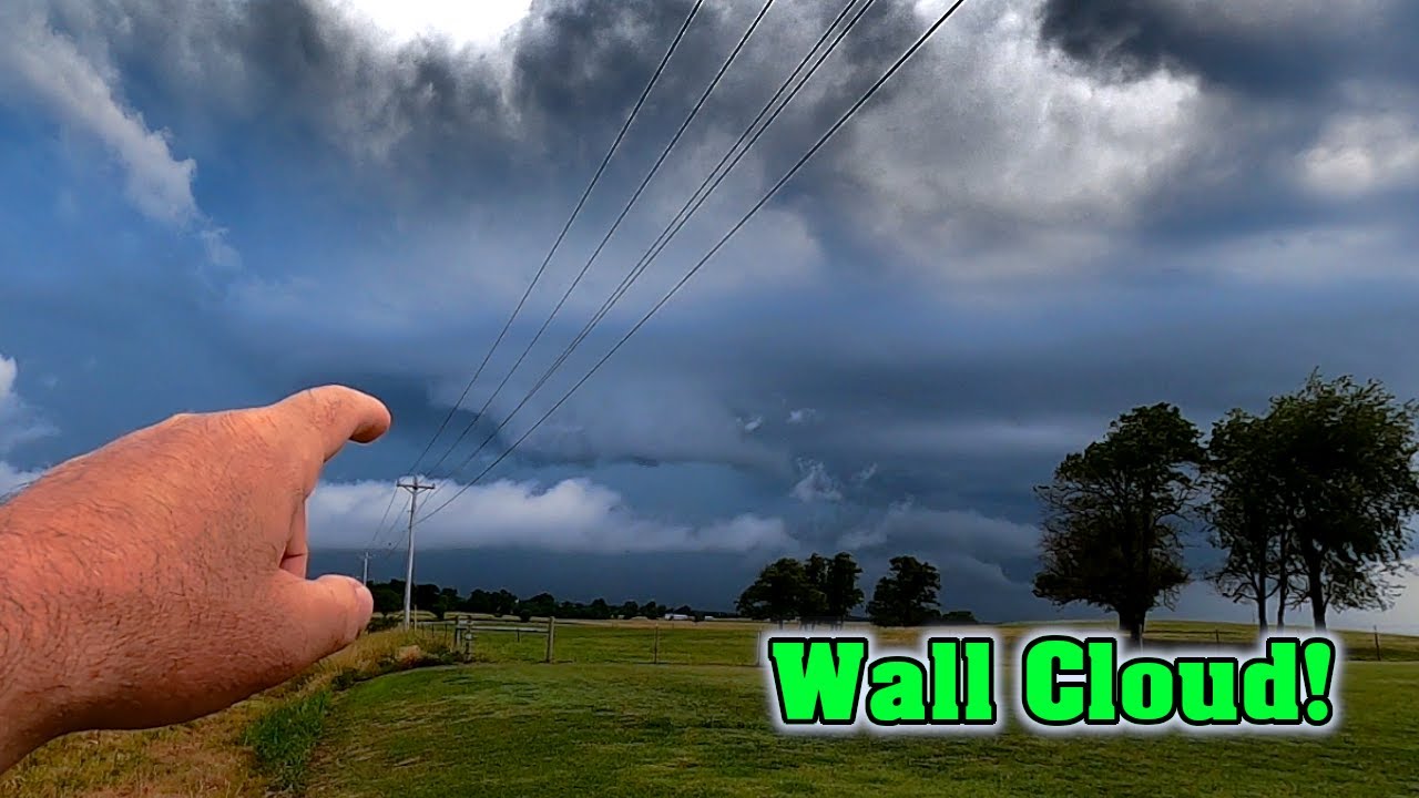
July Wall Cloud ~ Amateur Storm Chasing ~ Severe Weather 2020
As an Amazon Associate I earn from qualifying purchases.
👍 Hand Held Weather Station: https://amzn.to/36zZ5y3
👍 GoPro Action Camera: https://amzn.to/2TJ1Tnv
👍 Storm Lightning Detector: https://amzn.to/2OPRlzv
👍 Storm Chasing Handbook: https://amzn.to/2OnPyCQ
👍 Storm Chaser TShirt: https://amzn.to/2rxclTG
👍 Glass Mount Antenna: https://amzn.to/2RJzDBu
👍 Rain-X Windshield Rain Protection: https://amzn.to/2W7ENbB
👍 Rain-X Wiper Blades: https://amzn.to/2yxLqv0
A wall cloud is a large, localized, persistent, and often abrupt lowering of cloud that develops beneath the surrounding base of a cumulonimbus cloud and from which tornadoes sometimes form. It is typically beneath the rain-free base portion of a thunderstorm, and indicates the area of the strongest updraft within a storm. Rotating wall clouds are an indication of a mesocyclone in a thunderstorm; most strong tornadoes form from these. Many wall clouds do rotate; however, some do not.
Genesis
Wall clouds are formed by a process known as entrained, when an inflow of warm, moist air rises and converges, overpowering wet, rain-cooled air from the normally downwind downdraft. As the warm air continues to en train the cooler air, the air temperature drops and the dew point increases (thus the dew point depression decreases). As this air continues to rise, it becomes more saturated with moisture, which results in additional cloud condensation, sometimes in the form of a wall cloud. Wall clouds may form as a descending of the cloud base or may form as rising scud comes together and connects to the storm's cloud base.
-
 15:57
15:57
Amateur Storm Chasing
4 years ago $0.02 earnedExtreme Storms Chaser | Purple Mammatus
2691 -
 3:06
3:06
WXYZ
4 years agoSevere storm threat
738 -
 3:18
3:18
WTMJMilwaukee
4 years agoWet weather before severe storm potential
39 -
 3:09
3:09
WXYZ
4 years agoSevere weather
33 -
 21:36
21:36
KSHB
4 years ago2020 Spring Severe Weather Special
10 -
 0:10
0:10
slavatsarev
4 years ago $0.02 earnedBloody weather, storm, red skies
100 -
 2:06
2:06
WXYZ
4 years agoSevere storm chance overnight
428 -
 3:32
3:32
KGUN
4 years agoSevere storm Sunday
291 -
 1:53
1:53
KERO
4 years ago23ABC weather for July 29, 2020
7 -
 1:56
1:56
KERO
4 years ago23ABC Weather for July 28, 2020
11